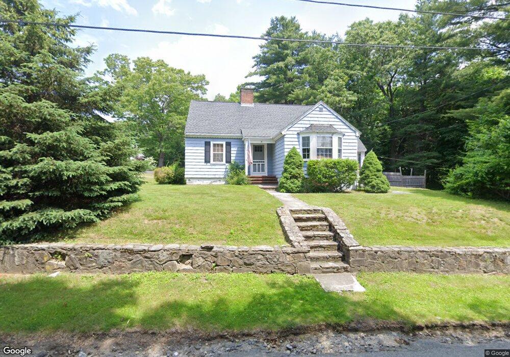
4 Dewey Ave Boylston, MA 01505
Estimated Value: $470,000 - $539,000
3
Beds
1
Bath
1,584
Sq Ft
$321/Sq Ft
Est. Value
About This Home
This home is located at 4 Dewey Ave, Boylston, MA 01505 and is currently estimated at $508,031, approximately $320 per square foot. 4 Dewey Ave is a home located in Worcester County with nearby schools including Tahanto Regional High School, Central New England Christian Academy, and St John's High School.
Ownership History
Date
Name
Owned For
Owner Type
Purchase Details
Closed on
May 26, 2022
Sold by
Crowton Jonathan and Crowton Jill
Bought by
T J
Current Estimated Value
Purchase Details
Closed on
Nov 21, 2008
Sold by
Hager Margaret and Mildish Marilyn E
Bought by
Bryant Jill and Crowton Jonathan
Home Financials for this Owner
Home Financials are based on the most recent Mortgage that was taken out on this home.
Original Mortgage
$201,058
Interest Rate
6.03%
Mortgage Type
Purchase Money Mortgage
Create a Home Valuation Report for This Property
The Home Valuation Report is an in-depth analysis detailing your home's value as well as a comparison with similar homes in the area
Home Values in the Area
Average Home Value in this Area
Purchase History
| Date | Buyer | Sale Price | Title Company |
|---|---|---|---|
| T J | -- | None Available | |
| Bryant Jill | $208,000 | -- |
Source: Public Records
Mortgage History
| Date | Status | Borrower | Loan Amount |
|---|---|---|---|
| Previous Owner | Bryant Jill | $201,058 |
Source: Public Records
Tax History
| Year | Tax Paid | Tax Assessment Tax Assessment Total Assessment is a certain percentage of the fair market value that is determined by local assessors to be the total taxable value of land and additions on the property. | Land | Improvement |
|---|---|---|---|---|
| 2025 | $6,051 | $437,500 | $138,700 | $298,800 |
| 2024 | $5,124 | $371,000 | $138,700 | $232,300 |
| 2023 | $5,508 | $382,500 | $147,500 | $235,000 |
| 2022 | $4,885 | $308,400 | $147,500 | $160,900 |
| 2021 | $5,038 | $296,700 | $147,500 | $149,200 |
| 2020 | $4,264 | $257,800 | $122,700 | $135,100 |
| 2019 | $3,999 | $249,300 | $120,200 | $129,100 |
| 2018 | $4,079 | $243,800 | $120,200 | $123,600 |
| 2017 | $3,930 | $243,800 | $120,200 | $123,600 |
| 2016 | $3,886 | $237,400 | $114,300 | $123,100 |
| 2015 | $4,133 | $237,400 | $114,300 | $123,100 |
| 2014 | $3,829 | $220,200 | $102,200 | $118,000 |
Source: Public Records
Map
Nearby Homes
- 2 Poe Ave Unit 1
- 4 Poe Ave Unit 1
- 5 Ridge Rd
- 5 Barnard Hill Rd
- 12 Erie Ave
- 22 Huron Ave
- 13 Fatima Ln
- 7 Conifer Cir Unit 7
- 655 Plantation St Unit 20B
- 3205 Halcyon Dr Unit 3205
- 291 Sewall St Unit 291
- 289 Sewall St Unit 289
- 58 Osceola Ave
- 281 Sewall St Unit 281
- 230A Gulf St
- 279 Sewall St Unit 279
- 66 Eunice Ave
- 2 Clover Glen Cir
- 331 Burncoat St
- 323 Burncoat St
- 1 Main St
- 12 Dewey Ave
- 7 Hobson Ave
- 13 Dewey Ave
- 12 Main St
- 149 Clinton St
- 6 Glendale Ave Unit A
- 4 Main St
- 18 Dewey Ave
- 16 Main St
- 11 Hobson Ave
- 18 Glendale Ave
- 16 Glendale Ave
- 10 Miles Ave
- 23 Glendale Ave
- 1 7 Glendale Ave Unit B
- Lot 5 Glendale Ave
- Lot 6 Glendale Ave
- Lot 2 Glendale Ave
- Lot 3 Glendale Ave
Your Personal Tour Guide
Ask me questions while you tour the home.