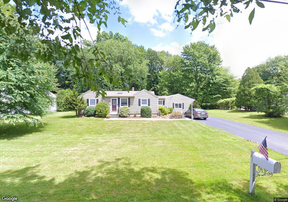
4 Donahue Ln North Grafton, MA 01536
Estimated Value: $482,646 - $518,000
3
Beds
2
Baths
1,921
Sq Ft
$259/Sq Ft
Est. Value
About This Home
This home is located at 4 Donahue Ln, North Grafton, MA 01536 and is currently estimated at $496,912, approximately $258 per square foot. 4 Donahue Ln is a home located in Worcester County with nearby schools including Grafton High School and Silver Spruce Montessori School.
Ownership History
Date
Name
Owned For
Owner Type
Purchase Details
Closed on
May 18, 2022
Sold by
Fairbanks Wilfred A and Fairbanks Helen F
Bought by
Fairbanks Michael D and Wilhelmi Crinstine B
Current Estimated Value
Purchase Details
Closed on
Oct 19, 1971
Bought by
Fairbanks Wilfred A and Fairbanks Helen F
Create a Home Valuation Report for This Property
The Home Valuation Report is an in-depth analysis detailing your home's value as well as a comparison with similar homes in the area
Home Values in the Area
Average Home Value in this Area
Purchase History
| Date | Buyer | Sale Price | Title Company |
|---|---|---|---|
| Fairbanks Michael D | -- | None Available | |
| Fairbanks Michael D | -- | None Available | |
| Fairbanks Michael D | -- | None Available | |
| Fairbanks Wilfred A | -- | -- |
Source: Public Records
Mortgage History
| Date | Status | Borrower | Loan Amount |
|---|---|---|---|
| Previous Owner | Fairbanks Wilfred A | $188,000 | |
| Previous Owner | Fairbanks Wilfred A | $76,000 | |
| Previous Owner | Fairbanks Wilfred A | $30,000 |
Source: Public Records
Tax History Compared to Growth
Tax History
| Year | Tax Paid | Tax Assessment Tax Assessment Total Assessment is a certain percentage of the fair market value that is determined by local assessors to be the total taxable value of land and additions on the property. | Land | Improvement |
|---|---|---|---|---|
| 2025 | $5,911 | $424,000 | $153,700 | $270,300 |
| 2024 | $5,771 | $403,300 | $146,400 | $256,900 |
| 2023 | $5,508 | $350,600 | $146,400 | $204,200 |
| 2022 | $5,172 | $306,400 | $125,700 | $180,700 |
| 2021 | $6,990 | $292,000 | $114,200 | $177,800 |
| 2020 | $4,663 | $282,600 | $114,200 | $168,400 |
| 2019 | $5,231 | $240,800 | $99,300 | $141,500 |
| 2018 | $3,763 | $226,800 | $98,000 | $128,800 |
| 2017 | $6,298 | $213,300 | $84,500 | $128,800 |
| 2016 | $3,635 | $217,000 | $91,700 | $125,300 |
| 2015 | $3,561 | $215,800 | $89,000 | $126,800 |
| 2014 | $3,694 | $242,100 | $125,800 | $116,300 |
Source: Public Records
Map
Nearby Homes
- 194 Worcester St
- 14 Northgate Ct Unit 14
- 11 Hovey Pond Dr Unit 11
- 17 Hingham Rd
- 167 Worcester St
- 30 Falmouth Dr
- 21 Lordvale Blvd Unit 406
- 76 Samuel Dr
- 5 Lincoln Ln Unit 5
- 4 Westboro Rd
- 46 John Dr Unit 46
- 28 Lincoln Ln
- 44 Meadow Ln
- 5 Edward Dr
- 39 Pointe Rok Dr Unit 39
- 95 Pineland Ave
- 156 Brigham Hill Rd
- 69 Cortland Grove Dr Unit 69
- 0 East St
- 51 Cortland Grove Dr Unit 51
- 6 Donahue Ln
- 2 Donahue Ln
- 5 Hollywood Dr
- Lot 4A Donahue Ln
- 8 Donahue Ln
- 7 Hollywood Dr
- 214 Worcester St
- 10 Donahue Ln
- 210 Worcester St Unit 2L
- 210 Worcester St Unit 2R
- 210 Worcester St Unit 1R
- 210 Worcester St Unit D
- 210 Worcester St
- 1 Hollywood Dr
- 7 Donahue Ln
- 9 Hollywood Dr
- 212 Worcester St
- 212 Worcester St Unit 2L
- 212 Worcester St Unit 2R
- 2 Beverly Rd