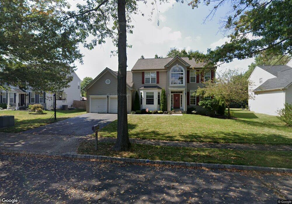
4 Durham Way East Windsor, NJ 08520
Estimated Value: $839,000 - $947,000
--
Bed
--
Bath
2,702
Sq Ft
$329/Sq Ft
Est. Value
About This Home
This home is located at 4 Durham Way, East Windsor, NJ 08520 and is currently estimated at $888,858, approximately $328 per square foot. 4 Durham Way is a home located in Mercer County with nearby schools including Melvin H. Kreps Middle School, Hightstown High School, and SciCore Academy.
Ownership History
Date
Name
Owned For
Owner Type
Purchase Details
Closed on
Jun 27, 2003
Sold by
Grogan Thomas
Bought by
Brophy Darryl and Brophy Tracy
Current Estimated Value
Home Financials for this Owner
Home Financials are based on the most recent Mortgage that was taken out on this home.
Original Mortgage
$322,700
Outstanding Balance
$137,299
Interest Rate
5.27%
Estimated Equity
$751,559
Purchase Details
Closed on
May 28, 1999
Sold by
Rose Bruce
Bought by
Grogan Ii Thomas and Grogan Amy Carnall
Home Financials for this Owner
Home Financials are based on the most recent Mortgage that was taken out on this home.
Original Mortgage
$205,600
Interest Rate
6.99%
Purchase Details
Closed on
Aug 21, 1995
Sold by
Centex Real Estate
Bought by
Rose Bruce and Rose Marcie
Home Financials for this Owner
Home Financials are based on the most recent Mortgage that was taken out on this home.
Original Mortgage
$185,000
Interest Rate
7.32%
Create a Home Valuation Report for This Property
The Home Valuation Report is an in-depth analysis detailing your home's value as well as a comparison with similar homes in the area
Home Values in the Area
Average Home Value in this Area
Purchase History
| Date | Buyer | Sale Price | Title Company |
|---|---|---|---|
| Brophy Darryl | $433,000 | -- | |
| Grogan Ii Thomas | $257,000 | -- | |
| Rose Bruce | $233,400 | -- |
Source: Public Records
Mortgage History
| Date | Status | Borrower | Loan Amount |
|---|---|---|---|
| Open | Brophy Darryl | $322,700 | |
| Previous Owner | Grogan Ii Thomas | $205,600 | |
| Previous Owner | Rose Bruce | $185,000 |
Source: Public Records
Tax History Compared to Growth
Tax History
| Year | Tax Paid | Tax Assessment Tax Assessment Total Assessment is a certain percentage of the fair market value that is determined by local assessors to be the total taxable value of land and additions on the property. | Land | Improvement |
|---|---|---|---|---|
| 2025 | $17,261 | $464,000 | $146,000 | $318,000 |
| 2024 | $16,342 | $464,000 | $146,000 | $318,000 |
| 2023 | $16,342 | $464,000 | $146,000 | $318,000 |
| 2022 | $15,920 | $464,000 | $146,000 | $318,000 |
| 2021 | $15,804 | $464,000 | $146,000 | $318,000 |
| 2020 | $15,822 | $464,000 | $146,000 | $318,000 |
| 2019 | $15,679 | $464,000 | $146,000 | $318,000 |
| 2018 | $15,474 | $464,000 | $146,000 | $318,000 |
| 2017 | $15,460 | $464,000 | $182,800 | $281,200 |
| 2016 | $15,242 | $464,000 | $182,800 | $281,200 |
| 2015 | $14,945 | $464,000 | $182,800 | $281,200 |
| 2014 | $14,769 | $464,000 | $182,800 | $281,200 |
Source: Public Records
Map
Nearby Homes
- 24 Stonehedge Dr
- 20 Stonehedge Dr
- 4 Wendover Rd
- 59 Moorsgate Cir
- 2 Carriage Ct
- 785 Old York Rd
- 23 Fulham Way
- 648 Old York Rd
- 28 Columbia Ave
- 89 Hickory Corner Rd
- 740 Windsor Perrineville
- 108 Orchard Ave
- 102 Teal Ct
- 58 Teal Ct
- 17 Winchester Dr
- 569 Route 130
- 302 S Main St
- 865 Windsor Perrineville Rd
- 107 Hausser Ave
- 201 Morrison Ave
- 6 Durham Way
- 7 New Castle Ct
- 25 Stonehedge Dr
- 3 New Castle Ct
- 3 Durham Way
- 5 Durham Way
- 1 Durham Way
- 29 Stonehedge Dr
- 1 New Castle Ct
- 9 New Castle Ct
- 31 Stonehedge Dr
- 6 Lexington Ct
- 313 Conover Rd
- 8 Lexington Ct
- 4 New Castle Ct
- 6 New Castle Ct
- 8 New Castle Ct
- 4 Lexington Ct
- 26 Stonehedge Dr
- 22 Stonehedge Dr