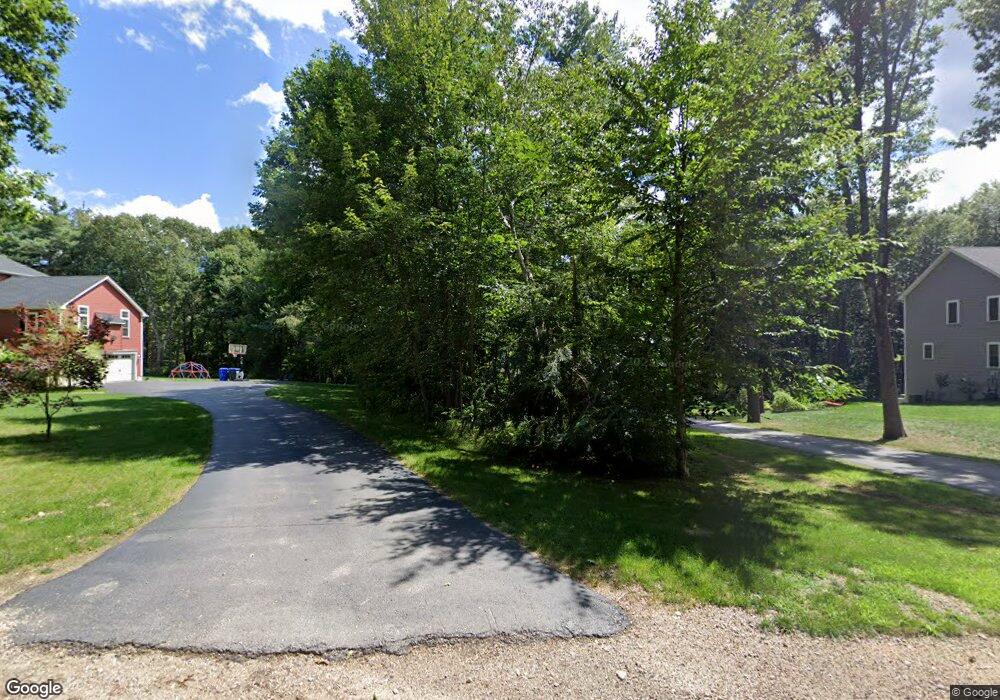
4 Emerald Rd Rutland, MA 01543
Estimated Value: $671,000 - $941,000
3
Beds
2
Baths
1,536
Sq Ft
$487/Sq Ft
Est. Value
About This Home
This home is located at 4 Emerald Rd, Rutland, MA 01543 and is currently estimated at $747,298, approximately $486 per square foot. 4 Emerald Rd is a home located in Worcester County with nearby schools including Wachusett Regional High School.
Ownership History
Date
Name
Owned For
Owner Type
Purchase Details
Closed on
Aug 19, 2016
Sold by
J M Soucy Contracting
Bought by
Grensavitch David P and Grensavitch Bridget M
Current Estimated Value
Home Financials for this Owner
Home Financials are based on the most recent Mortgage that was taken out on this home.
Original Mortgage
$417,000
Outstanding Balance
$331,964
Interest Rate
3.41%
Mortgage Type
Unknown
Estimated Equity
$415,334
Create a Home Valuation Report for This Property
The Home Valuation Report is an in-depth analysis detailing your home's value as well as a comparison with similar homes in the area
Home Values in the Area
Average Home Value in this Area
Purchase History
| Date | Buyer | Sale Price | Title Company |
|---|---|---|---|
| Grensavitch David P | $439,000 | -- |
Source: Public Records
Mortgage History
| Date | Status | Borrower | Loan Amount |
|---|---|---|---|
| Open | Grensavitch David P | $417,000 |
Source: Public Records
Tax History
| Year | Tax Paid | Tax Assessment Tax Assessment Total Assessment is a certain percentage of the fair market value that is determined by local assessors to be the total taxable value of land and additions on the property. | Land | Improvement |
|---|---|---|---|---|
| 2025 | $8,795 | $617,600 | $109,100 | $508,500 |
| 2024 | $8,781 | $592,100 | $104,500 | $487,600 |
| 2023 | $8,091 | $589,700 | $99,200 | $490,500 |
| 2022 | $7,589 | $480,600 | $85,500 | $395,100 |
| 2021 | $7,478 | $447,800 | $85,500 | $362,300 |
| 2020 | $7,726 | $438,700 | $91,800 | $346,900 |
| 2019 | $7,711 | $431,000 | $85,000 | $346,000 |
| 2018 | $7,399 | $408,100 | $85,000 | $323,100 |
| 2017 | $6,760 | $369,000 | $78,300 | $290,700 |
Source: Public Records
Map
Nearby Homes
- 7 Emerald Rd
- 236 Turkey Hill Rd
- 14A Welch Ave Unit A
- Lot 6 Irish Ln
- 7 Victoria Ave
- 2 Kosta Ave
- 4 Wilson Way
- 189 Maple Ave
- 176 Maple Ave Unit 7-21
- 176 Maple Ave Unit 5-32
- 176 Maple Ave Unit 1-24
- LOT 8 Pierre Cir
- Lot 11 Pleasantdale Rd
- 11 Brigham Rd
- 20 Fidelity Dr Unit 10
- 18 Fidelity Dr Unit 9
- 252 Pleasantdale Rd
- 12 Fidelity Dr Unit 6
- 10 Fidelity Dr Unit 5
- 132 Fidelity Dr Unit 61
- 4 Emerald Rd Unit 71096936
- 4 Emerald Rd
- 4 Emerald Rd
- 6 Emerald Rd
- 2 Emerald Rd
- 2 Emerald Rd
- 1 Emerald Rd
- 143 Turkey Hill Rd
- 8 Emerald Rd
- 139 Turkey Hill Rd
- 145 Turkey Hill Rd
- 141 Turkey Hill Rd
- 14 Emerald Rd
- 147 Turkey Hill Rd
- 12 Emerald Rd
- 149 Turkey Hill Rd
- 144 Turkey Hill Rd
- 18 Emerald Rd
- 151 Turkey Hill Rd
- 13 Emerald Rd
