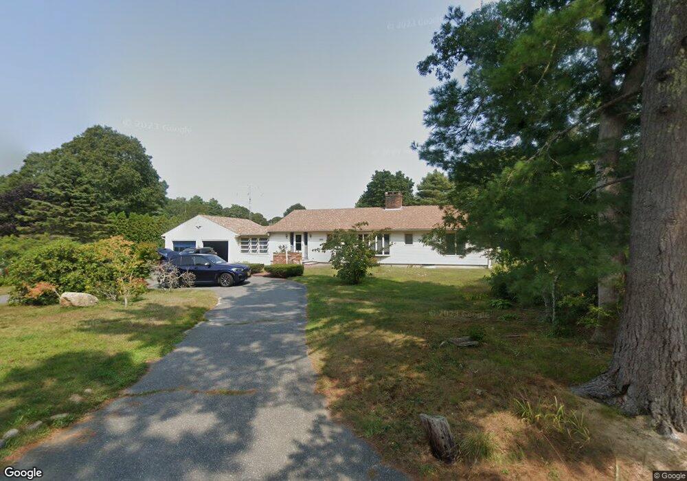
4 Erin Ln Bourne, MA 2532
Buzzards Bay NeighborhoodEstimated Value: $609,000 - $676,000
2
Beds
2
Baths
1,705
Sq Ft
$371/Sq Ft
Est. Value
About This Home
This home is located at 4 Erin Ln, Bourne, MA 2532 and is currently estimated at $632,222, approximately $370 per square foot. 4 Erin Ln is a home located in Barnstable County with nearby schools including Bourne High School and St Margaret Regional School.
Ownership History
Date
Name
Owned For
Owner Type
Purchase Details
Closed on
Oct 11, 2024
Sold by
Buczek Jayne and Lannon John
Bought by
Buczek Jayne A and Lannon John J
Current Estimated Value
Purchase Details
Closed on
Jan 25, 2024
Sold by
Marks Valerie A Est and Marks
Bought by
Buczek Jayne and Lannon John
Purchase Details
Closed on
Nov 9, 2007
Sold by
Marks Robert C and Marks Valerie A
Bought by
Marks Valerie A
Purchase Details
Closed on
Mar 31, 1997
Sold by
Kurtz Jacqueline A
Bought by
Marks Robert C and Marks Valerie A
Home Financials for this Owner
Home Financials are based on the most recent Mortgage that was taken out on this home.
Original Mortgage
$132,300
Interest Rate
7.59%
Mortgage Type
Purchase Money Mortgage
Purchase Details
Closed on
Aug 31, 1988
Sold by
Mercier Raymond A
Bought by
Kurtz Edward
Home Financials for this Owner
Home Financials are based on the most recent Mortgage that was taken out on this home.
Original Mortgage
$138,750
Interest Rate
10.38%
Mortgage Type
Purchase Money Mortgage
Create a Home Valuation Report for This Property
The Home Valuation Report is an in-depth analysis detailing your home's value as well as a comparison with similar homes in the area
Home Values in the Area
Average Home Value in this Area
Purchase History
| Date | Buyer | Sale Price | Title Company |
|---|---|---|---|
| Buczek Jayne A | -- | None Available | |
| Buczek Jayne A | -- | None Available | |
| Buczek Jayne A | -- | None Available | |
| Buczek Jayne | $495,000 | None Available | |
| Buczek Jayne | $495,000 | None Available | |
| Buczek Jayne | $495,000 | None Available | |
| Marks Valerie A | -- | -- | |
| Marks Robert C | $147,000 | -- | |
| Marks Valerie A | -- | -- | |
| Marks Robert C | $147,000 | -- | |
| Kurtz Edward | $185,000 | -- |
Source: Public Records
Mortgage History
| Date | Status | Borrower | Loan Amount |
|---|---|---|---|
| Previous Owner | Kurtz Edward | $132,300 | |
| Previous Owner | Kurtz Edward | $138,750 |
Source: Public Records
Tax History
| Year | Tax Paid | Tax Assessment Tax Assessment Total Assessment is a certain percentage of the fair market value that is determined by local assessors to be the total taxable value of land and additions on the property. | Land | Improvement |
|---|---|---|---|---|
| 2025 | $4,667 | $597,600 | $204,700 | $392,900 |
| 2024 | $4,705 | $586,700 | $194,900 | $391,800 |
| 2023 | $4,611 | $523,400 | $172,500 | $350,900 |
| 2022 | $4,160 | $412,300 | $152,700 | $259,600 |
| 2021 | $4,041 | $375,200 | $138,900 | $236,300 |
| 2020 | $3,906 | $363,700 | $137,600 | $226,100 |
| 2019 | $3,688 | $350,900 | $137,600 | $213,300 |
| 2018 | $3,202 | $303,800 | $124,500 | $179,300 |
| 2017 | $3,099 | $300,900 | $123,400 | $177,500 |
| 2016 | $2,862 | $281,700 | $110,400 | $171,300 |
| 2015 | $2,837 | $281,700 | $110,400 | $171,300 |
Source: Public Records
Map
Nearby Homes
- 40-A Lafayette Ave
- 4 Van Bummel Rd
- 23 Alderberry Rd
- 46 Holt Rd Unit B
- 46 Holt Rd
- 48 Maple St
- 58 Maple St
- 60 Bourne Neck Dr
- 9 Hideaway Rd Unit F
- 304 Main St
- 13 Hideaway Village Unit G
- 92 Choctaw Dr
- 810 Head of The Bay Rd
- 38 Old Bridge Rd
- 6 Honora Ct
- 3 Honora Ln Unit 3
- 60 Martin St
- 3 Fairway Dr Unit F
- 67 Algonquin St
- 11 Buzzards Bay Dr
Your Personal Tour Guide
Ask me questions while you tour the home.