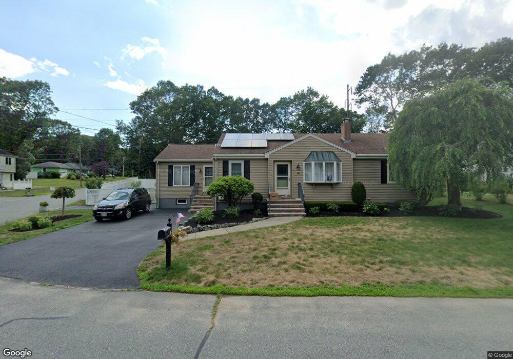
4 Farnham Rd Stoughton, MA 02072
Estimated Value: $617,000 - $687,000
3
Beds
2
Baths
2,564
Sq Ft
$255/Sq Ft
Est. Value
About This Home
This home is located at 4 Farnham Rd, Stoughton, MA 02072 and is currently estimated at $654,270, approximately $255 per square foot. 4 Farnham Rd is a home located in Norfolk County with nearby schools including South Elementary School, Dr. Robert G. O'Donnell Middle School, and Stoughton High School.
Ownership History
Date
Name
Owned For
Owner Type
Purchase Details
Closed on
Apr 5, 2019
Sold by
Murphy Ft 2001 and Murphy
Bought by
Clough Dean A and Concannon Kaitlin
Current Estimated Value
Home Financials for this Owner
Home Financials are based on the most recent Mortgage that was taken out on this home.
Original Mortgage
$319,920
Outstanding Balance
$280,693
Interest Rate
4.4%
Mortgage Type
New Conventional
Estimated Equity
$373,577
Purchase Details
Closed on
Feb 21, 2017
Sold by
Murphy William F and Murphy Laura R
Bought by
Murphy Ft 2001 and Murphy
Create a Home Valuation Report for This Property
The Home Valuation Report is an in-depth analysis detailing your home's value as well as a comparison with similar homes in the area
Home Values in the Area
Average Home Value in this Area
Purchase History
| Date | Buyer | Sale Price | Title Company |
|---|---|---|---|
| Clough Dean A | $399,900 | -- | |
| Clough Dean A | $399,900 | -- | |
| Clough Dean A | $399,900 | -- | |
| Murphy Ft 2001 | -- | -- | |
| Murphy Ft 2001 | -- | -- | |
| Murphy Ft 2001 | -- | -- |
Source: Public Records
Mortgage History
| Date | Status | Borrower | Loan Amount |
|---|---|---|---|
| Open | Clough Dean A | $319,920 | |
| Closed | Clough Dean A | $319,920 | |
| Previous Owner | Murphy Ft 2001 | $1,000,000 | |
| Previous Owner | Murphy Ft 2001 | $97,000 |
Source: Public Records
Tax History Compared to Growth
Tax History
| Year | Tax Paid | Tax Assessment Tax Assessment Total Assessment is a certain percentage of the fair market value that is determined by local assessors to be the total taxable value of land and additions on the property. | Land | Improvement |
|---|---|---|---|---|
| 2025 | $6,542 | $528,400 | $222,900 | $305,500 |
| 2024 | $6,436 | $505,600 | $203,600 | $302,000 |
| 2023 | $6,187 | $456,600 | $186,000 | $270,600 |
| 2022 | $6,032 | $418,600 | $179,000 | $239,600 |
| 2021 | $5,601 | $370,900 | $158,000 | $212,900 |
| 2020 | $5,523 | $370,900 | $158,000 | $212,900 |
| 2019 | $5,390 | $351,400 | $158,000 | $193,400 |
| 2018 | $4,831 | $326,200 | $150,900 | $175,300 |
| 2017 | $4,631 | $319,600 | $149,200 | $170,400 |
| 2016 | $4,304 | $287,500 | $135,100 | $152,400 |
| 2015 | $4,244 | $280,500 | $128,100 | $152,400 |
| 2014 | $3,985 | $253,200 | $117,600 | $135,600 |
Source: Public Records
Map
Nearby Homes
- 93 McEachron Dr
- 0 Atkinson Ave
- 48 Sofia Rd
- 79 Lucas Dr
- 59 Lucas Dr
- 511 Sumner St
- 434 Sumner St
- 21 Cathy Ln
- 14 Marshall Rd
- 86 Union St
- 110 Union St
- 51 Rangeley Ave
- Lot 1 Winterberry Ln
- LOT 4 Winterberry Ln
- Lot 2 Winterberry Ln
- Lot 8 Lawler Ln
- 38 Brickel Rd
- 95 Union St
- 96 Winterberry Ln
- 10 Felton St Unit 208
- 14 Farnham Rd
- 24 Daly Drive Extension
- 34 Daly Drive Extension
- 21 Lelland Rd
- 11 Farnham Rd
- 22 Farnham Rd
- 11 Lelland Rd
- 12 Daly Drive Extension
- 31 Lelland Rd
- 21 Farnham Rd
- 54 Daly Drive Extension
- 41 Lelland Rd
- 32 Farnham Rd
- 29 Farnham Rd
- 64 Daly Drive Extension
- 49 Lelland Rd
- 14 Lelland Rd
- 24 Lelland Rd
- 42 Farnham Rd
- 106 Daly Dr