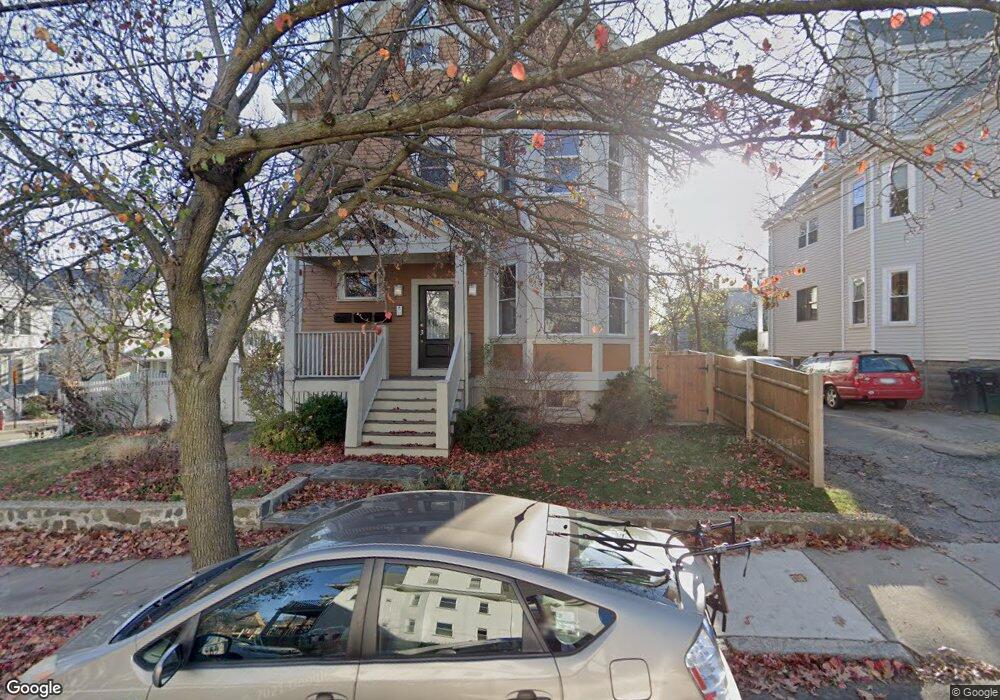
4 Foskett St Unit 1 Somerville, MA 02144
Davis Square NeighborhoodEstimated Value: $1,130,405 - $1,280,000
2
Beds
2
Baths
1,634
Sq Ft
$730/Sq Ft
Est. Value
About This Home
This home is located at 4 Foskett St Unit 1, Somerville, MA 02144 and is currently estimated at $1,193,351, approximately $730 per square foot. 4 Foskett St Unit 1 is a home located in Middlesex County with nearby schools including Somerville High School, St. Clement Elementary School, and Wild Rose Montessori School.
Ownership History
Date
Name
Owned For
Owner Type
Purchase Details
Closed on
Dec 30, 2022
Sold by
Slobod Karen S and Hoy Cindy L
Bought by
Walnut T
Current Estimated Value
Purchase Details
Closed on
Nov 20, 2007
Sold by
Trant Scott A
Bought by
Hoy Cindy L and Slobod Karen S
Home Financials for this Owner
Home Financials are based on the most recent Mortgage that was taken out on this home.
Original Mortgage
$100,000
Interest Rate
6.41%
Mortgage Type
Purchase Money Mortgage
Create a Home Valuation Report for This Property
The Home Valuation Report is an in-depth analysis detailing your home's value as well as a comparison with similar homes in the area
Home Values in the Area
Average Home Value in this Area
Purchase History
| Date | Buyer | Sale Price | Title Company |
|---|---|---|---|
| Walnut T | -- | None Available | |
| Hoy Cindy L | $640,000 | -- |
Source: Public Records
Mortgage History
| Date | Status | Borrower | Loan Amount |
|---|---|---|---|
| Previous Owner | Hoy Cindy L | $100,000 |
Source: Public Records
Tax History Compared to Growth
Tax History
| Year | Tax Paid | Tax Assessment Tax Assessment Total Assessment is a certain percentage of the fair market value that is determined by local assessors to be the total taxable value of land and additions on the property. | Land | Improvement |
|---|---|---|---|---|
| 2025 | $10,718 | $982,400 | $0 | $982,400 |
| 2024 | $9,894 | $940,500 | $0 | $940,500 |
| 2023 | $9,603 | $928,700 | $0 | $928,700 |
| 2022 | $9,181 | $901,900 | $0 | $901,900 |
| 2021 | $9,502 | $932,500 | $0 | $932,500 |
| 2020 | $9,212 | $913,000 | $0 | $913,000 |
| 2019 | $8,909 | $828,000 | $0 | $828,000 |
| 2018 | $8,809 | $778,900 | $0 | $778,900 |
| 2017 | $8,966 | $768,300 | $0 | $768,300 |
| 2016 | $8,915 | $711,500 | $0 | $711,500 |
| 2015 | $7,761 | $615,500 | $0 | $615,500 |
Source: Public Records
Map
Nearby Homes
- 31 Rogers Ave
- 39 Rogers Ave
- 23 Highland Rd
- 371 Highland Ave
- 79 Willow Ave
- 27 Boston Ave
- 12 Windsor Rd Unit 1
- 3 Fairlee St
- 69 Boston Ave
- 353 Summer St Unit 310
- 13 Warwick St
- 156 Albion St Unit A
- 156 Albion St Unit B
- 26 Warner St
- 595 Broadway Unit 302
- 595 Broadway Unit 101
- 595 Broadway Unit 202
- 561 Broadway Unit C1
- 10 Roberts St Unit 14
- 34 Day St
- 4 Foskett St Unit 3
- 4 Foskett St Unit 2
- 8 Foskett St
- 8 Foskett St Unit 2
- 166 Willow Ave Unit 2
- 166 Willow Ave Unit 1
- 166 Willow Ave
- 12 Foskett St
- 12 Foskett St Unit 2
- 5 Appleton St
- 5 Appleton St Unit 1
- 5 Appleton St Unit 3
- 173 Willow Ave
- 179 Willow Ave
- 164 Willow Ave
- 164 Willow Ave Unit 2
- 164 Willow Ave Unit 1
- 171 Willow Ave
- 181 Willow Ave
- 167 Willow Ave Unit 1