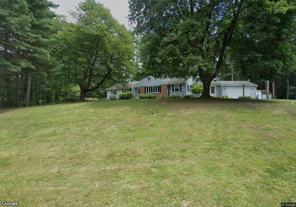
4 Fox Den Rd West Simsbury, CT 06092
Estimated Value: $590,000 - $639,000
4
Beds
3
Baths
1,965
Sq Ft
$308/Sq Ft
Est. Value
About This Home
This home is located at 4 Fox Den Rd, West Simsbury, CT 06092 and is currently estimated at $606,097, approximately $308 per square foot. 4 Fox Den Rd is a home located in Hartford County with nearby schools including Central School, Henry James Memorial School, and Simsbury High School.
Ownership History
Date
Name
Owned For
Owner Type
Purchase Details
Closed on
Mar 4, 2021
Sold by
Regier Justin
Bought by
Regier Katelyn T
Current Estimated Value
Purchase Details
Closed on
Nov 29, 2012
Sold by
Stoddard Josephine T
Bought by
Regier Justin
Home Financials for this Owner
Home Financials are based on the most recent Mortgage that was taken out on this home.
Original Mortgage
$36,000
Interest Rate
3.4%
Purchase Details
Closed on
Apr 30, 1997
Sold by
Sullivan James and Sullivan Mary
Bought by
Stoffard Ralph
Create a Home Valuation Report for This Property
The Home Valuation Report is an in-depth analysis detailing your home's value as well as a comparison with similar homes in the area
Home Values in the Area
Average Home Value in this Area
Purchase History
| Date | Buyer | Sale Price | Title Company |
|---|---|---|---|
| Regier Katelyn T | -- | None Available | |
| Regier Justin | $36,000 | -- | |
| Stoddard Josephine T | -- | -- | |
| Stoffard Ralph | $215,000 | -- |
Source: Public Records
Mortgage History
| Date | Status | Borrower | Loan Amount |
|---|---|---|---|
| Previous Owner | Stoffard Ralph | $36,000 |
Source: Public Records
Tax History Compared to Growth
Tax History
| Year | Tax Paid | Tax Assessment Tax Assessment Total Assessment is a certain percentage of the fair market value that is determined by local assessors to be the total taxable value of land and additions on the property. | Land | Improvement |
|---|---|---|---|---|
| 2025 | $9,967 | $291,760 | $101,500 | $190,260 |
| 2024 | $9,719 | $291,760 | $101,500 | $190,260 |
| 2023 | $9,284 | $291,760 | $101,500 | $190,260 |
| 2022 | $8,849 | $229,060 | $108,780 | $120,280 |
| 2021 | $8,849 | $229,060 | $108,780 | $120,280 |
| 2020 | $8,496 | $229,060 | $108,780 | $120,280 |
| 2019 | $8,549 | $229,060 | $108,780 | $120,280 |
| 2018 | $8,610 | $229,060 | $108,780 | $120,280 |
| 2017 | $8,014 | $206,760 | $97,020 | $109,740 |
| 2016 | $7,675 | $206,760 | $97,020 | $109,740 |
| 2015 | $7,675 | $206,760 | $97,020 | $109,740 |
| 2014 | $7,679 | $206,760 | $97,020 | $109,740 |
Source: Public Records
Map
Nearby Homes
- 177 Stratton Brook Rd
- 29 Fawnbrook Ln
- 37 Farms Village Rd
- 23 Stratton Forest Way
- 20 Southbridge Ct
- 2 Southbridge Ct
- 75 Stratton Forest Way
- 17 Prospect Ridge
- 113 Old Farms Rd
- 106 Hedgehog Ln
- 16 Springbrook Ln
- 72 W Mountain Rd
- 45 Westledge Rd
- 120 Plank Hill Rd
- 15 Wiggins Farm Dr Unit H
- 107 W Mountain Rd
- 35 Beldenwood Rd
- 3 Stebbins Brook Ln
- 6 Heritage Ln
- 4 Stebbins Brook Ln
- 4 Saw Mill Rd
- 158 Farms Village Rd
- 156 Farms Village Rd
- 3 Fox Den Rd
- 1 Saw Mill Rd
- 154 Farms Village Rd
- 5 Fox Den Rd
- 162 Farms Village Rd
- 162 Farms Village Rd
- 152 Farms Village Rd
- 164 Farms Village Rd
- 164 Farms Village Rd
- 6 Saw Mill Rd
- 8 Fox Den Rd
- 7 Fox Den Rd
- 148 Farms Village Rd
- 5 Saw Mill Rd
- 10 Fox Den Rd
- 168 Farms Village Rd
- 1 Whitney Ln