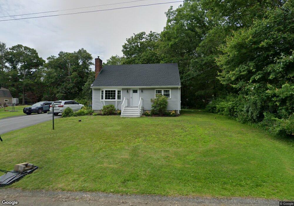
4 Francis St Westport, MA 02790
North Westport NeighborhoodEstimated Value: $436,000 - $534,000
2
Beds
--
Bath
1,344
Sq Ft
$365/Sq Ft
Est. Value
About This Home
This home is located at 4 Francis St, Westport, MA 02790 and is currently estimated at $490,786, approximately $365 per square foot. 4 Francis St is a home located in Bristol County with nearby schools including Alice A. Macomber Primary School, Westport Elementary School, and Westport Middle-High School.
Ownership History
Date
Name
Owned For
Owner Type
Purchase Details
Closed on
Dec 8, 2022
Sold by
Rose Christine E
Bought by
Rose Christine E and Rose Austin W
Current Estimated Value
Purchase Details
Closed on
Feb 6, 2020
Sold by
Rose Christine E
Bought by
Rose Christine E and Rose Kevin W
Purchase Details
Closed on
Jul 28, 1972
Bought by
Rose Arthur S and Rose Christine E
Create a Home Valuation Report for This Property
The Home Valuation Report is an in-depth analysis detailing your home's value as well as a comparison with similar homes in the area
Home Values in the Area
Average Home Value in this Area
Purchase History
| Date | Buyer | Sale Price | Title Company |
|---|---|---|---|
| Rose Christine E | -- | None Available | |
| Rose Christine E | -- | None Available | |
| Rose Arthur S | -- | -- |
Source: Public Records
Mortgage History
| Date | Status | Borrower | Loan Amount |
|---|---|---|---|
| Previous Owner | Rose Arthur S | $25,000 | |
| Previous Owner | Rose Arthur S | $28,000 |
Source: Public Records
Tax History Compared to Growth
Tax History
| Year | Tax Paid | Tax Assessment Tax Assessment Total Assessment is a certain percentage of the fair market value that is determined by local assessors to be the total taxable value of land and additions on the property. | Land | Improvement |
|---|---|---|---|---|
| 2025 | $3,159 | $424,000 | $162,000 | $262,000 |
| 2024 | $2,568 | $332,200 | $150,100 | $182,100 |
| 2023 | $2,576 | $315,700 | $136,700 | $179,000 |
| 2022 | $2,288 | $276,700 | $124,300 | $152,400 |
| 2021 | $2,288 | $265,400 | $113,000 | $152,400 |
| 2020 | $2,034 | $241,300 | $108,500 | $132,800 |
| 2019 | $1,932 | $233,600 | $108,500 | $125,100 |
| 2018 | $1,706 | $208,800 | $116,700 | $92,100 |
| 2017 | $1,674 | $210,100 | $116,700 | $93,400 |
| 2016 | $1,662 | $210,100 | $116,700 | $93,400 |
| 2015 | $1,635 | $206,200 | $116,700 | $89,500 |
Source: Public Records
Map
Nearby Homes
- 15 S Breault St
- 116 Gifford Rd
- 16 S Berryman St
- 80 Gifford Rd
- 380 Gifford Rd
- 23 Donna St
- 79 Center St
- 565 Highland Ave
- 100 D Dr
- 96 Forge Rd
- 29 Union Ave
- 3 Diane Way
- 1276 Old Fall River Rd
- 56 Lakeside Ave
- 55 Lakeside Ave
- 92 Benoit St
- 3 Roller Coaster Way Unit Lot 1
- 4 Main Rd
- 818 Reed Rd
- 2 Donna Marie Dr