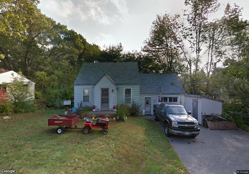
4 George St Kittery, ME 03904
Estimated Value: $419,000 - $470,000
2
Beds
1
Bath
860
Sq Ft
$529/Sq Ft
Est. Value
About This Home
This home is located at 4 George St, Kittery, ME 03904 and is currently estimated at $454,515, approximately $528 per square foot. 4 George St is a home with nearby schools including Shapleigh School, Horace Mitchell Primary School, and Robert W Traip Academy.
Ownership History
Date
Name
Owned For
Owner Type
Purchase Details
Closed on
Jun 7, 2019
Sold by
Barrett Christopher and Barrett Laurie
Bought by
Scontras Stacey C
Current Estimated Value
Home Financials for this Owner
Home Financials are based on the most recent Mortgage that was taken out on this home.
Original Mortgage
$83,000
Outstanding Balance
$73,124
Interest Rate
4.2%
Mortgage Type
New Conventional
Estimated Equity
$381,391
Purchase Details
Closed on
Oct 5, 2015
Sold by
Starkey Richard W
Bought by
Barrett Christopher and Barrett Laurie
Create a Home Valuation Report for This Property
The Home Valuation Report is an in-depth analysis detailing your home's value as well as a comparison with similar homes in the area
Home Values in the Area
Average Home Value in this Area
Purchase History
| Date | Buyer | Sale Price | Title Company |
|---|---|---|---|
| Scontras Stacey C | -- | -- | |
| Barrett Christopher | -- | -- |
Source: Public Records
Mortgage History
| Date | Status | Borrower | Loan Amount |
|---|---|---|---|
| Open | Scontras Stacey C | $83,000 |
Source: Public Records
Tax History Compared to Growth
Tax History
| Year | Tax Paid | Tax Assessment Tax Assessment Total Assessment is a certain percentage of the fair market value that is determined by local assessors to be the total taxable value of land and additions on the property. | Land | Improvement |
|---|---|---|---|---|
| 2024 | $4,067 | $286,400 | $170,200 | $116,200 |
| 2023 | $3,898 | $286,400 | $170,200 | $116,200 |
| 2022 | $3,861 | $286,400 | $170,200 | $116,200 |
| 2021 | $3,723 | $286,400 | $170,200 | $116,200 |
| 2020 | $3,695 | $286,400 | $170,200 | $116,200 |
| 2019 | $2,563 | $147,300 | $54,400 | $92,900 |
| 2018 | $2,483 | $147,800 | $54,400 | $93,400 |
| 2017 | $2,439 | $147,800 | $54,400 | $93,400 |
| 2016 | $2,372 | $147,800 | $54,400 | $93,400 |
| 2015 | $2,316 | $147,800 | $54,400 | $93,400 |
| 2014 | $2,294 | $147,800 | $54,400 | $93,400 |
| 2013 | $2,250 | $147,800 | $54,400 | $93,400 |
Source: Public Records
Map
Nearby Homes
- 10-12 Pine St
- 8 Water St Unit 2
- 8 Water St Unit 1
- 20 Mendum Ave
- 2 Wainwright Ave
- 165 Rogers Rd
- 35 Badgers Island W Unit 203
- 35 Badgers Island W Unit 301
- 35 Badgers Island W Unit 204
- 35 Badgers Island W Unit 103
- 35 Badgers Island W Unit 102
- 12 Gillis Dr Unit 3
- 27 Oak Terrace
- 25 Oak Terrace
- 1 Harbour Place Unit 4i
- 197 State Rd
- 5 Spinney Way Unit 9
- 36 State St
- 58 State St
- 137 Daniel St Unit D302