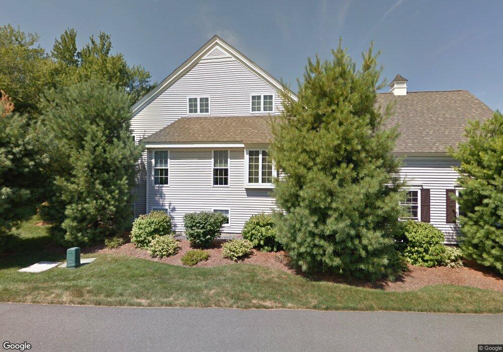
4 Gilmore Farm Rd Westborough, MA 01581
Estimated Value: $701,070 - $757,000
2
Beds
3
Baths
2,257
Sq Ft
$321/Sq Ft
Est. Value
About This Home
This home is located at 4 Gilmore Farm Rd, Westborough, MA 01581 and is currently estimated at $724,768, approximately $321 per square foot. 4 Gilmore Farm Rd is a home located in Worcester County with nearby schools including Westborough High School.
Ownership History
Date
Name
Owned For
Owner Type
Purchase Details
Closed on
Nov 19, 2018
Sold by
Bickel Donna D
Bought by
Donna D Bickel 2018 Re
Current Estimated Value
Purchase Details
Closed on
Jan 7, 2015
Sold by
4 Gilmore Farm Road Rt
Bought by
Bickel William E and Bickel Donna D
Home Financials for this Owner
Home Financials are based on the most recent Mortgage that was taken out on this home.
Original Mortgage
$348,000
Interest Rate
3.99%
Mortgage Type
New Conventional
Purchase Details
Closed on
Dec 19, 2007
Sold by
Forbush Mary Fay
Bought by
4 Gilmore Farm Road Rt
Purchase Details
Closed on
Dec 3, 2002
Sold by
Casa Bldrs & Dev Corp
Bought by
Forbush Mary Fay
Home Financials for this Owner
Home Financials are based on the most recent Mortgage that was taken out on this home.
Original Mortgage
$200,000
Interest Rate
6.16%
Mortgage Type
Purchase Money Mortgage
Create a Home Valuation Report for This Property
The Home Valuation Report is an in-depth analysis detailing your home's value as well as a comparison with similar homes in the area
Home Values in the Area
Average Home Value in this Area
Purchase History
| Date | Buyer | Sale Price | Title Company |
|---|---|---|---|
| Donna D Bickel 2018 Re | -- | -- | |
| William E Bickel 2018 | -- | -- | |
| Bickel William E | -- | -- | |
| Bickel William E | $435,000 | -- | |
| 4 Gilmore Farm Road Rt | -- | -- | |
| Forbush Mary Fay | $370,000 | -- |
Source: Public Records
Mortgage History
| Date | Status | Borrower | Loan Amount |
|---|---|---|---|
| Previous Owner | Bickel William E | $348,000 | |
| Previous Owner | Forbush Mary Fay | $200,000 |
Source: Public Records
Tax History Compared to Growth
Tax History
| Year | Tax Paid | Tax Assessment Tax Assessment Total Assessment is a certain percentage of the fair market value that is determined by local assessors to be the total taxable value of land and additions on the property. | Land | Improvement |
|---|---|---|---|---|
| 2025 | $9,504 | $583,400 | $0 | $583,400 |
| 2024 | $8,423 | $513,300 | $0 | $513,300 |
| 2023 | $7,763 | $461,000 | $0 | $461,000 |
| 2022 | $8,206 | $443,800 | $0 | $443,800 |
| 2021 | $8,017 | $432,400 | $0 | $432,400 |
| 2020 | $8,215 | $448,400 | $0 | $448,400 |
| 2019 | $8,289 | $452,200 | $0 | $452,200 |
| 2018 | $7,618 | $412,700 | $0 | $412,700 |
| 2017 | $7,346 | $412,700 | $0 | $412,700 |
| 2016 | $6,902 | $388,400 | $0 | $388,400 |
| 2015 | $6,994 | $376,200 | $0 | $376,200 |
Source: Public Records
Map
Nearby Homes
- 2 Gilmore Farm Rd
- 4 Gilmore Farm Rd Unit 4
- 12 Gilmore Farm Rd
- 10 Gilmore Farm Rd
- 8 Gilmore Farm Rd
- 6 Gilmore Farm Rd
- 6 Gilmore Farm Rd Unit 6
- 8 Gilmore Farm Rd Unit 8
- 16 Gilmore Farm Rd
- 14 Gilmore Farm Rd
- 7 Gilmore Farm Rd
- 5 Gilmore Farm Rd
- 3 Gilmore Farm Rd
- 3 Gilmore Farm Rd Unit 3
- 7 Gilmore Farm Rd Unit 7
- 17 Gilmore Farm Rd
- 15 Gilmore Farm Rd
- 11 Gilmore Farm Rd
- 9 Gilmore Farm Rd
- 4 Imperial Ct