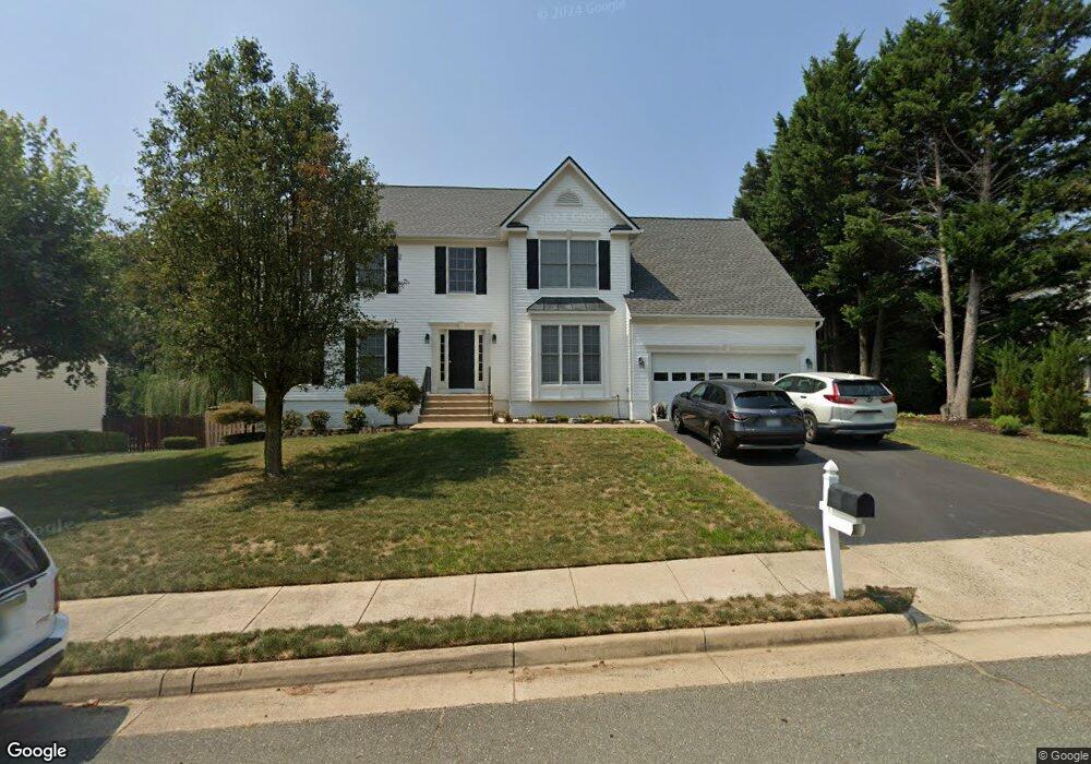
4 Gunston Rd Stafford, VA 22554
Embrey Mill NeighborhoodEstimated Value: $654,655 - $700,000
5
Beds
3
Baths
2,914
Sq Ft
$233/Sq Ft
Est. Value
About This Home
This home is located at 4 Gunston Rd, Stafford, VA 22554 and is currently estimated at $678,914, approximately $232 per square foot. 4 Gunston Rd is a home located in Stafford County with nearby schools including Anthony Burns Elementary School, Rodney E. Thompson Middle School, and Colonial Forge High School.
Ownership History
Date
Name
Owned For
Owner Type
Purchase Details
Closed on
Oct 5, 2001
Sold by
Atlantic Builders
Bought by
Lee Scott H
Current Estimated Value
Home Financials for this Owner
Home Financials are based on the most recent Mortgage that was taken out on this home.
Original Mortgage
$172,300
Outstanding Balance
$67,444
Interest Rate
6.89%
Estimated Equity
$611,470
Create a Home Valuation Report for This Property
The Home Valuation Report is an in-depth analysis detailing your home's value as well as a comparison with similar homes in the area
Home Values in the Area
Average Home Value in this Area
Purchase History
| Date | Buyer | Sale Price | Title Company |
|---|---|---|---|
| Lee Scott H | $215,450 | -- |
Source: Public Records
Mortgage History
| Date | Status | Borrower | Loan Amount |
|---|---|---|---|
| Open | Lee Scott H | $172,300 |
Source: Public Records
Tax History Compared to Growth
Tax History
| Year | Tax Paid | Tax Assessment Tax Assessment Total Assessment is a certain percentage of the fair market value that is determined by local assessors to be the total taxable value of land and additions on the property. | Land | Improvement |
|---|---|---|---|---|
| 2025 | $4,728 | $521,400 | $170,000 | $351,400 |
| 2024 | $4,728 | $521,400 | $170,000 | $351,400 |
| 2023 | $4,604 | $487,200 | $155,000 | $332,200 |
| 2022 | $4,141 | $487,200 | $155,000 | $332,200 |
| 2021 | $3,703 | $381,800 | $120,000 | $261,800 |
| 2020 | $3,703 | $381,800 | $120,000 | $261,800 |
| 2019 | $3,721 | $368,400 | $120,000 | $248,400 |
| 2018 | $3,647 | $368,400 | $120,000 | $248,400 |
| 2017 | $3,591 | $362,700 | $120,000 | $242,700 |
| 2016 | $3,591 | $362,700 | $120,000 | $242,700 |
| 2015 | -- | $357,900 | $120,000 | $237,900 |
| 2014 | -- | $357,900 | $120,000 | $237,900 |
Source: Public Records
Map
Nearby Homes
- 527 Apricot St
- 468 Coneflower Ln
- 2 Jamestown Ct
- 28 Raleigh Ln
- 16 Basket Ct
- 431 Alder Dr
- 990 Forsythia Ln
- 10 Revere Ct
- 407 Apricot St
- 3 Devonshire Ln
- 991 Coastal Ave
- 158 Bugle Way
- 241 Smokebush Dr
- 48 Brittany Ln
- 1092 Aspen Rd
- 1032 Coastal Ave
- 916 Crab Apple Dr
- 320 Pepperidge Dr
- 248 Violet Way Unit 2
- 248 Violet Way Unit 1