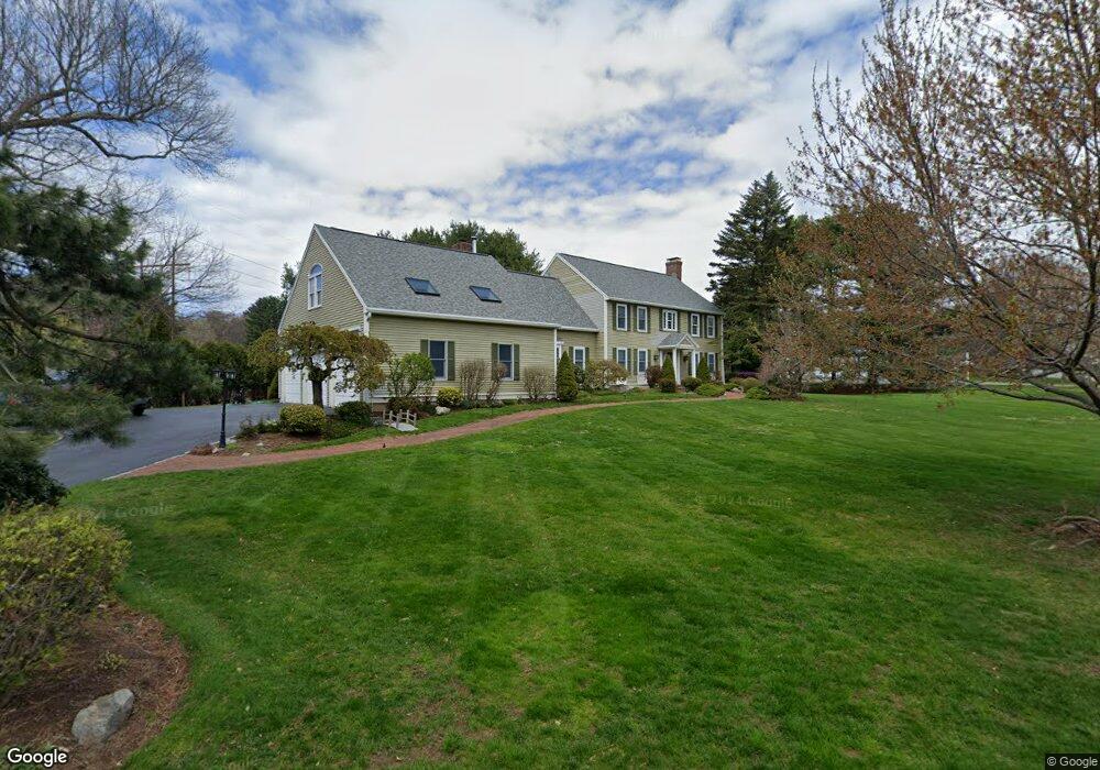
4 Guzzle Brook Dr Sudbury, MA 01776
Estimated Value: $1,292,000 - $1,584,000
4
Beds
4
Baths
3,822
Sq Ft
$380/Sq Ft
Est. Value
About This Home
This home is located at 4 Guzzle Brook Dr, Sudbury, MA 01776 and is currently estimated at $1,453,581, approximately $380 per square foot. 4 Guzzle Brook Dr is a home located in Middlesex County with nearby schools including Israel Loring Elementary School, Ephraim Curtis Middle School, and Lincoln-Sudbury Regional High School.
Ownership History
Date
Name
Owned For
Owner Type
Purchase Details
Closed on
Aug 11, 2015
Sold by
Woodward Michael D and Woodward Margaret A
Bought by
Michael D Woodward Ret
Current Estimated Value
Home Financials for this Owner
Home Financials are based on the most recent Mortgage that was taken out on this home.
Original Mortgage
$394,200
Outstanding Balance
$156,144
Interest Rate
4.03%
Mortgage Type
New Conventional
Estimated Equity
$1,297,437
Purchase Details
Closed on
Jul 21, 2014
Sold by
Woodward Michael D
Bought by
Michael D Woodward Ret and Woodward Michael D
Create a Home Valuation Report for This Property
The Home Valuation Report is an in-depth analysis detailing your home's value as well as a comparison with similar homes in the area
Home Values in the Area
Average Home Value in this Area
Purchase History
| Date | Buyer | Sale Price | Title Company |
|---|---|---|---|
| Michael D Woodward Ret | -- | -- | |
| Woodward Margaret A | -- | -- | |
| Michael D Woodward Ret | -- | -- |
Source: Public Records
Mortgage History
| Date | Status | Borrower | Loan Amount |
|---|---|---|---|
| Open | Woodward Margaret A | $394,200 | |
| Closed | Michael D Woodward Ret | $394,200 |
Source: Public Records
Tax History Compared to Growth
Tax History
| Year | Tax Paid | Tax Assessment Tax Assessment Total Assessment is a certain percentage of the fair market value that is determined by local assessors to be the total taxable value of land and additions on the property. | Land | Improvement |
|---|---|---|---|---|
| 2025 | $19,149 | $1,308,000 | $431,700 | $876,300 |
| 2024 | $18,417 | $1,260,600 | $419,400 | $841,200 |
| 2023 | $17,041 | $1,080,600 | $375,200 | $705,400 |
| 2022 | $16,624 | $921,000 | $344,600 | $576,400 |
| 2021 | $15,635 | $830,300 | $344,600 | $485,700 |
| 2020 | $15,319 | $830,300 | $344,600 | $485,700 |
| 2019 | $14,871 | $830,300 | $344,600 | $485,700 |
| 2018 | $14,538 | $810,800 | $366,400 | $444,400 |
| 2017 | $14,256 | $803,600 | $363,300 | $440,300 |
| 2016 | $13,841 | $777,600 | $349,700 | $427,900 |
| 2015 | $13,712 | $779,100 | $359,500 | $419,600 |
| 2014 | $13,712 | $760,500 | $349,100 | $411,400 |
Source: Public Records
Map
Nearby Homes
- 216 Landham Rd
- 63 Landham Rd
- 0 Wagonwheel Rd
- 6 Old County Rd Unit 16
- 84 Hopestill Brown Rd
- 94 Goodmans Hill Rd
- 23 Massasoit Ave
- 36 Concord Rd
- 353 Old Connecticut Path
- 30 Edith Rd
- 1011 Boston Post Rd
- 8 Clara Rd
- 29 Derby St
- 24 Pinewood Dr
- 454 Old Connecticut Path
- 17 Hastings Way Unit 17
- 81 Nicholas Rd Unit B
- 96 Lakeshore Dr
- 96 Lake Shore Dr
- 71 Nicholas Rd Unit H
- 5 Guzzlebrook Dr
- 11 Beckwith St
- 18 Beckwith St
- 25 Beckwith St
- 19 Guzzlebrook Dr
- 8 Beckwith St
- 20 Guzzle Brook Dr
- 49 Pelham Island Rd
- 30 Beckwith St
- 39 Pelham Island Rd
- 31 Beckwith St
- 73 Blackmer Rd
- 28 Guzzlebrook Dr
- 36 Pelham Island Rd
- 36 Beckwith St
- 65 Pelham Island Rd
- 48 Pelham Island Rd
- 24 Pelham Island Rd
- 39 Beckwith St
- 30 Pelham Island Rd