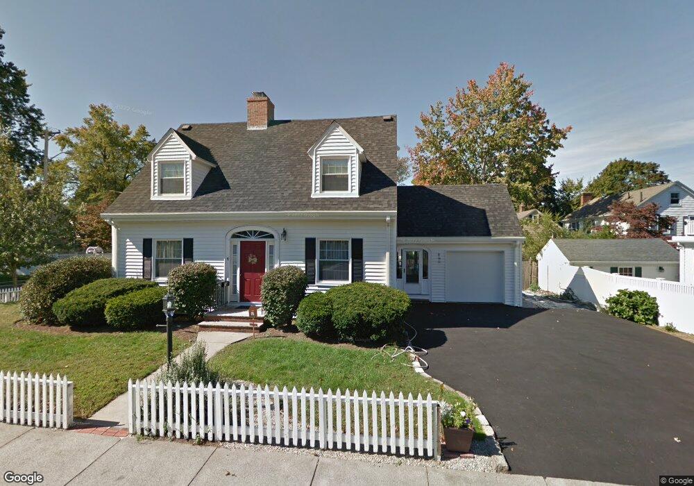
4 Harding Rd Melrose, MA 02176
Melrose East Side NeighborhoodEstimated Value: $767,000 - $938,000
3
Beds
3
Baths
1,754
Sq Ft
$484/Sq Ft
Est. Value
About This Home
This home is located at 4 Harding Rd, Melrose, MA 02176 and is currently estimated at $849,685, approximately $484 per square foot. 4 Harding Rd is a home located in Middlesex County with nearby schools including Winthrop Elementary School, Horace Mann Elementary School, and Roosevelt Elementary School.
Ownership History
Date
Name
Owned For
Owner Type
Purchase Details
Closed on
Jan 22, 2015
Sold by
Joseph Joseph C and Joseph C R
Bought by
Aurelia-Delia Therese
Current Estimated Value
Home Financials for this Owner
Home Financials are based on the most recent Mortgage that was taken out on this home.
Original Mortgage
$395,000
Outstanding Balance
$303,887
Interest Rate
3.96%
Mortgage Type
New Conventional
Estimated Equity
$545,798
Purchase Details
Closed on
Sep 1, 2011
Sold by
Riley Francis X and Langone Karen J
Bought by
T Jc and Cf T
Create a Home Valuation Report for This Property
The Home Valuation Report is an in-depth analysis detailing your home's value as well as a comparison with similar homes in the area
Home Values in the Area
Average Home Value in this Area
Purchase History
| Date | Buyer | Sale Price | Title Company |
|---|---|---|---|
| Aurelia-Delia Therese | $395,000 | -- | |
| T Jc | $360,000 | -- |
Source: Public Records
Mortgage History
| Date | Status | Borrower | Loan Amount |
|---|---|---|---|
| Open | Aurelia-Delia Therese | $395,000 |
Source: Public Records
Tax History
| Year | Tax Paid | Tax Assessment Tax Assessment Total Assessment is a certain percentage of the fair market value that is determined by local assessors to be the total taxable value of land and additions on the property. | Land | Improvement |
|---|---|---|---|---|
| 2025 | $72 | $723,900 | $476,500 | $247,400 |
| 2024 | $7,102 | $715,200 | $476,500 | $238,700 |
| 2023 | $6,763 | $649,000 | $425,000 | $224,000 |
| 2022 | $6,511 | $616,000 | $399,200 | $216,800 |
| 2021 | $6,151 | $561,700 | $360,600 | $201,100 |
| 2020 | $6,209 | $561,900 | $360,600 | $201,300 |
| 2019 | $5,461 | $505,200 | $325,800 | $179,400 |
| 2018 | $5,389 | $475,600 | $296,200 | $179,400 |
| 2017 | $5,290 | $448,300 | $283,300 | $165,000 |
| 2016 | $5,145 | $417,300 | $276,100 | $141,200 |
| 2015 | $5,088 | $392,600 | $263,000 | $129,600 |
| 2014 | $5,038 | $379,400 | $249,800 | $129,600 |
Source: Public Records
Map
Nearby Homes
- 109 Linden Rd
- 128 Green St Unit 128
- 8 Crystal St Unit 2
- 8 Crystal St Unit 3
- 9 Elmcrest Cir
- 58 Franklin St Unit 58
- 60 Franklin St Unit 60
- 51 Melrose St Unit 1C
- 51 Melrose St Unit 1A
- 187 Laurel St
- 236-238 Main St
- 71-73 Grove St
- 89 Lovell Rd
- 48 Malvern St Unit 2
- 98 Boardman Ave
- 23 Ellsworth Ave
- 24 Ellsworth Ave
- 30 Wheeler Ave
- 311 Beech Ave
- 77 Lynde St
- 134 Porter St
- 10 Harding Rd
- 8 Harding Ct
- 3 Harding Rd
- 9 Harding Rd
- 129 Porter St
- 14 Harding Ct
- 135 Porter St
- 101 Stratford Rd
- 17 Harding Rd
- 144 Porter St
- 20 Harding Rd
- 112 Porter St Unit 8
- 112 Porter St Unit 7
- 112 Porter St Unit 6
- 112 Porter St Unit 5
- 112 Porter St Unit 4
- 112 Porter St Unit 3
- 112 Porter St Unit 2
- 112 Porter St Unit 1
Your Personal Tour Guide
Ask me questions while you tour the home.