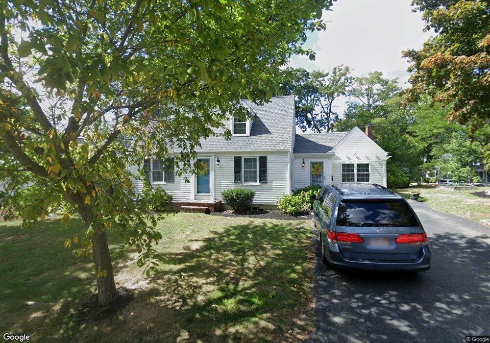
4 Hawthorne Rd Hingham, MA 02043
Crow Point NeighborhoodEstimated Value: $850,000 - $1,049,000
3
Beds
2
Baths
1,260
Sq Ft
$754/Sq Ft
Est. Value
About This Home
This home is located at 4 Hawthorne Rd, Hingham, MA 02043 and is currently estimated at $950,184, approximately $754 per square foot. 4 Hawthorne Rd is a home located in Plymouth County with nearby schools including William L. Foster Elementary School, Hingham Middle School, and Hingham High School.
Ownership History
Date
Name
Owned For
Owner Type
Purchase Details
Closed on
Jun 17, 2025
Sold by
Neal Jonathan D and Neal Tammy M
Bought by
Neal Ft and Neal
Current Estimated Value
Purchase Details
Closed on
Jun 27, 2002
Sold by
Diamond John T and Diamond Teresa A
Bought by
Feeley James J and Gerossie Diane M
Purchase Details
Closed on
Dec 9, 1996
Sold by
Malaguti Mary D
Bought by
Diamond John T and Diamond Teresa A
Purchase Details
Closed on
Sep 30, 1993
Sold by
Gillis Richard J and Gillis Carol L
Bought by
Neal Jonathan D and Graham Tammy M
Create a Home Valuation Report for This Property
The Home Valuation Report is an in-depth analysis detailing your home's value as well as a comparison with similar homes in the area
Home Values in the Area
Average Home Value in this Area
Purchase History
| Date | Buyer | Sale Price | Title Company |
|---|---|---|---|
| Neal Ft | -- | None Available | |
| Neal Ft | -- | None Available | |
| Feeley James J | $380,000 | -- | |
| Feeley James J | $380,000 | -- | |
| Diamond John T | $170,000 | -- | |
| Diamond John T | $170,000 | -- | |
| Neal Jonathan D | $128,500 | -- | |
| Neal Jonathan D | $128,500 | -- |
Source: Public Records
Mortgage History
| Date | Status | Borrower | Loan Amount |
|---|---|---|---|
| Previous Owner | Neal Jonathan D | $333,000 |
Source: Public Records
Tax History
| Year | Tax Paid | Tax Assessment Tax Assessment Total Assessment is a certain percentage of the fair market value that is determined by local assessors to be the total taxable value of land and additions on the property. | Land | Improvement |
|---|---|---|---|---|
| 2025 | $8,570 | $801,700 | $422,400 | $379,300 |
| 2024 | $8,255 | $760,800 | $422,400 | $338,400 |
| 2023 | $7,163 | $716,300 | $422,400 | $293,900 |
| 2022 | $6,881 | $595,200 | $352,000 | $243,200 |
| 2021 | $6,780 | $574,600 | $352,000 | $222,600 |
| 2020 | $6,625 | $574,600 | $352,000 | $222,600 |
| 2019 | $6,564 | $555,800 | $352,000 | $203,800 |
| 2018 | $6,549 | $509,900 | $309,800 | $200,100 |
| 2017 | $5,799 | $473,400 | $296,900 | $176,500 |
| 2016 | $5,538 | $443,400 | $282,800 | $160,600 |
| 2015 | $5,369 | $428,500 | $269,300 | $159,200 |
Source: Public Records
Map
Nearby Homes
- 2 Langlee Rd
- 151 Stayner Dr Unit 151
- 132 Hms Stayner Dr Unit 132
- 160 Hms Stayner Dr
- 160 Hms Stayner Dr Unit 160
- 43 Park View Dr
- 23 Shipyard Dr Unit 206
- 1 Squirrel Hill Ln
- 37 Foley Beach Rd
- 10 Shipyard Dr Unit 313
- 130 Broad Reach Unit 206
- 16 Foley Beach Rd
- 13 Beals Cove Rd Unit K
- 81 Kimball Beach Rd
- 51 Broad Reach Unit T23A
- 64 Broad Reach Unit 107
- 64 Broad Reach Unit 310
- 54 Broad Reach Unit 104
- 1206 Tuckers Ln Unit 1206
- 12 Daley Rd
- 12 Sycamore Ln
- 139 Hms Whitaker Ln Unit 2601
- 2 Hawthorne Rd
- 8 Sycamore Ln
- 13 Bradley Woods Dr
- 3 Hawthorne Rd
- 14 Sycamore Ln
- 13 Sycamore Ln
- 1 Hawthorne Rd
- 15 Sycamore Ln
- 11 Sycamore Ln
- 15 Bradley Woods Dr
- 17 Sycamore Ln
- 16 Sycamore Ln
- 6 Sycamore Ln
- 8 Hawthorne Rd
- 9 Bradley Woods Dr
- 9 Hawthorne Rd
- 19 Sycamore Ln
- 17 Bradley Woods Dr
Your Personal Tour Guide
Ask me questions while you tour the home.