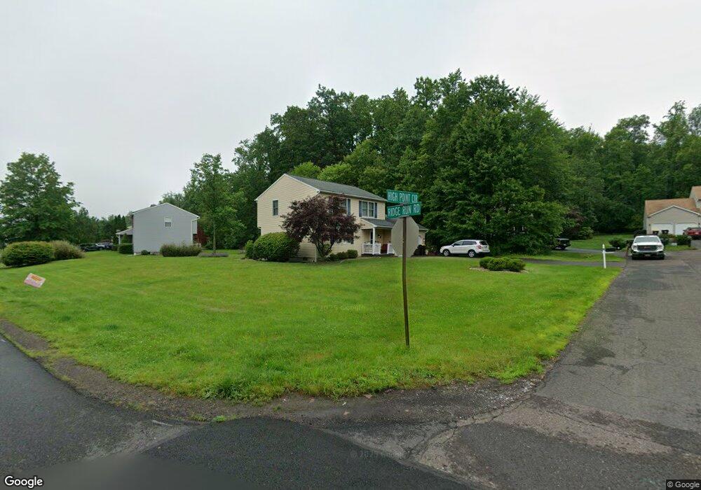
4 High Point Cir Sellersville, PA 18960
East Rockhill NeighborhoodEstimated Value: $550,000 - $609,000
3
Beds
3
Baths
2,530
Sq Ft
$234/Sq Ft
Est. Value
About This Home
This home is located at 4 High Point Cir, Sellersville, PA 18960 and is currently estimated at $592,495, approximately $234 per square foot. 4 High Point Cir is a home located in Bucks County with nearby schools including Pennridge High School, Upper Bucks Christian School, and Community Service Foundation.
Ownership History
Date
Name
Owned For
Owner Type
Purchase Details
Closed on
Dec 21, 2001
Sold by
Costella David R and Costella Cheryl L
Bought by
Costella David R and Costella Cheryl L
Current Estimated Value
Home Financials for this Owner
Home Financials are based on the most recent Mortgage that was taken out on this home.
Original Mortgage
$146,868
Outstanding Balance
$57,560
Interest Rate
6.61%
Estimated Equity
$534,935
Purchase Details
Closed on
Jan 15, 1997
Sold by
Cappello Michael J
Bought by
Costella David R and Price Cheryl L
Home Financials for this Owner
Home Financials are based on the most recent Mortgage that was taken out on this home.
Original Mortgage
$147,000
Interest Rate
7.5%
Create a Home Valuation Report for This Property
The Home Valuation Report is an in-depth analysis detailing your home's value as well as a comparison with similar homes in the area
Home Values in the Area
Average Home Value in this Area
Purchase History
| Date | Buyer | Sale Price | Title Company |
|---|---|---|---|
| Costella David R | -- | Fidelity National Title Ins | |
| Costella David R | -- | -- |
Source: Public Records
Mortgage History
| Date | Status | Borrower | Loan Amount |
|---|---|---|---|
| Open | Costella David R | $146,868 | |
| Closed | Costella David R | $147,000 |
Source: Public Records
Tax History Compared to Growth
Tax History
| Year | Tax Paid | Tax Assessment Tax Assessment Total Assessment is a certain percentage of the fair market value that is determined by local assessors to be the total taxable value of land and additions on the property. | Land | Improvement |
|---|---|---|---|---|
| 2025 | $5,932 | $33,910 | $7,960 | $25,950 |
| 2024 | $5,932 | $33,910 | $7,960 | $25,950 |
| 2023 | $5,864 | $33,910 | $7,960 | $25,950 |
| 2022 | $5,864 | $33,910 | $7,960 | $25,950 |
| 2021 | $5,864 | $33,910 | $7,960 | $25,950 |
| 2020 | $5,864 | $33,910 | $7,960 | $25,950 |
| 2019 | $4,856 | $28,240 | $7,960 | $20,280 |
| 2018 | $4,799 | $28,240 | $7,960 | $20,280 |
| 2017 | $4,764 | $28,240 | $7,960 | $20,280 |
| 2016 | $4,764 | $28,240 | $7,960 | $20,280 |
| 2015 | -- | $28,240 | $7,960 | $20,280 |
| 2014 | -- | $28,240 | $7,960 | $20,280 |
Source: Public Records
Map
Nearby Homes
- 4 Ridge Run Rd
- 2744 & 2742 Hill Roa Hill Rd
- 1000 Bluebird Ln Unit COVINGTON
- 1000 Bluebird Ln Unit WOODFORD
- 1000 Bluebird Ln Unit MAGNOLIA
- 1000 Bluebird Ln Unit DEVONSHIRE
- 431 Liberty Trail
- 439 Liberty Trail
- 441 Liberty Trail
- 443 Liberty Trail
- 434 Liberty Trail
- 451 Liberty Trail
- Woodford Plan at Everleigh Woods
- Manchester Plan at Everleigh Woods
- Arcadia Plan at Everleigh Woods
- Parker Plan at Everleigh Woods
- Sebastian Plan at Everleigh Woods
- Hawthorne Plan at Everleigh Woods
- Kipling Plan at Everleigh Woods
- Magnolia Plan at Everleigh Woods
- 3 High Point Cir
- 36 Ridge Run Rd
- 6 High Point Cir
- 39 Ridge Run Rd
- 34 Ridge Run Rd
- 41 Ridge Run Rd
- 7 High Point Cir
- 37 Ridge Run Rd
- 43 Ridge Run Rd
- 35 Ridge Run Rd
- 5 High Point Cir
- 32 Ridge Run Rd
- 33 Ridge Run Rd
- 45 Ridge Run Rd
- 30 Ridge Run Rd
- 31 Ridge Run Rd
- 46 Ridge Run Rd
- 48 Ridge Run Rd
- 71 Ridge Run Rd
- 47 Ridge Run Rd