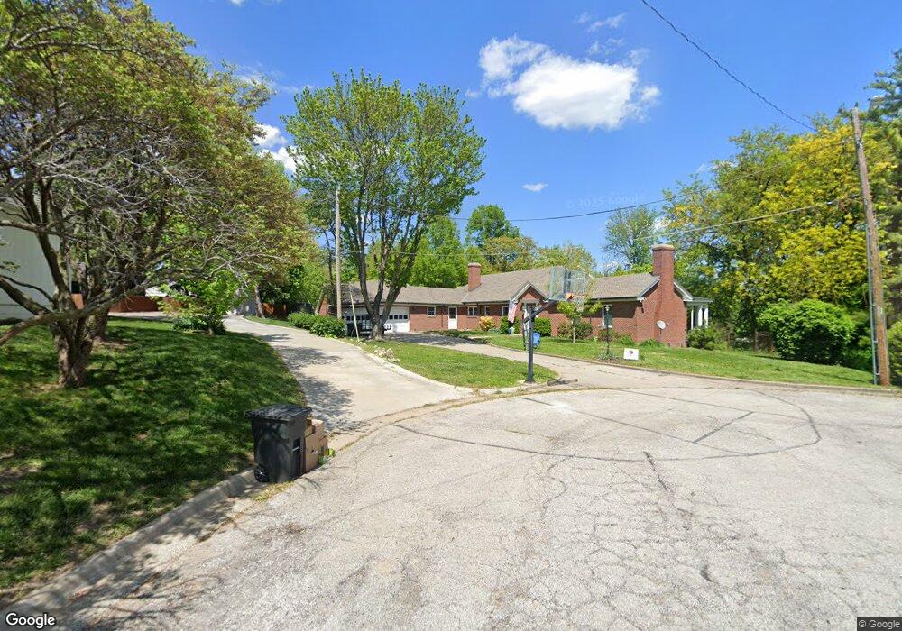
4 Hill Pine Dr Saint Joseph, MO 64505
Lovers Lane NeighborhoodEstimated Value: $223,000 - $454,000
Studio
--
Bath
2,004
Sq Ft
$174/Sq Ft
Est. Value
About This Home
This home is located at 4 Hill Pine Dr, Saint Joseph, MO 64505 and is currently estimated at $348,058, approximately $173 per square foot. 4 Hill Pine Dr is a home located in Buchanan County with nearby schools including Field Elementary School, Bode Middle School, and Central High School.
Ownership History
Date
Name
Owned For
Owner Type
Purchase Details
Closed on
Feb 21, 2012
Sold by
Gv Federal National Mortgage Assn and Pr Millsap & Singer Llc
Bought by
Garvey Michael J and Garvey Taira D
Current Estimated Value
Home Financials for this Owner
Home Financials are based on the most recent Mortgage that was taken out on this home.
Original Mortgage
$218,523
Outstanding Balance
$149,454
Interest Rate
3.93%
Mortgage Type
New Conventional
Estimated Equity
$198,604
Purchase Details
Closed on
May 2, 2011
Sold by
Osteen Quintin
Bought by
Gv Federal National Mortgage Assn
Create a Home Valuation Report for This Property
The Home Valuation Report is an in-depth analysis detailing your home's value as well as a comparison with similar homes in the area
Home Values in the Area
Average Home Value in this Area
Purchase History
| Date | Buyer | Sale Price | Title Company |
|---|---|---|---|
| Garvey Michael J | -- | First American Title | |
| Gv Federal National Mortgage Assn | $194,328 | None Available |
Source: Public Records
Mortgage History
| Date | Status | Borrower | Loan Amount |
|---|---|---|---|
| Open | Garvey Michael J | $218,523 |
Source: Public Records
Tax History
| Year | Tax Paid | Tax Assessment Tax Assessment Total Assessment is a certain percentage of the fair market value that is determined by local assessors to be the total taxable value of land and additions on the property. | Land | Improvement |
|---|---|---|---|---|
| 2025 | $2,889 | $40,430 | $4,750 | $35,680 |
| 2024 | $2,666 | $37,320 | $4,750 | $32,570 |
| 2023 | $2,666 | $37,320 | $4,750 | $32,570 |
| 2022 | $2,460 | $37,320 | $4,750 | $32,570 |
| 2021 | $2,471 | $37,320 | $4,750 | $32,570 |
| 2020 | $2,456 | $37,320 | $4,750 | $32,570 |
| 2019 | $2,372 | $37,320 | $4,750 | $32,570 |
| 2018 | $2,141 | $37,320 | $4,750 | $32,570 |
| 2017 | $2,121 | $37,320 | $0 | $0 |
| 2015 | $2,068 | $37,320 | $0 | $0 |
| 2014 | $2,068 | $37,320 | $0 | $0 |
Source: Public Records
Map
Nearby Homes
- 2511 Kent St
- 2324 Goff Ave
- 2011 Lovers Ln
- 3309 Westwood Dr
- 1805 6th Ave
- 1717 6th Ave
- 3413 W Colony Square
- 0 Moss and Eugene Field Ave
- 1511 6th Ave
- 1525 4th Ave
- 2204 Ashland Ave
- 2610 Parallel Ave
- 2110 Ashland Ave
- 2611 Parallel Ave
- 2502 Flintstone Dr
- 1302 Randolph St
- 1920 N 29th St
- 3131 Saint Joseph Ave
- 3133 Saint Joseph Ave
- 2634 Lucille Ave
- 3033 Goff Ave
- 3 Hill Pine Dr
- 2318 Lovers Ln
- 2316 Lovers Ln
- 2312 Lovers Ln
- 2212 Lovers Ln
- 2227 Lovers Ln
- 2223 Lovers Ln
- 2321 Lovers Ln
- 2221 Lovers Ln
- 2327 Lovers Ln
- 2215 Lovers Ln
- 1 Lindenwood Ln
- 2409 N Circle Dr
- 2206 Lovers Ln
- 2530 N 26th St
- 2405 N Circle Dr
- 2 Lindenwood Ln
- 2502 Gene Field Rd
- 2501 Gene Field Rd
Your Personal Tour Guide
Ask me questions while you tour the home.