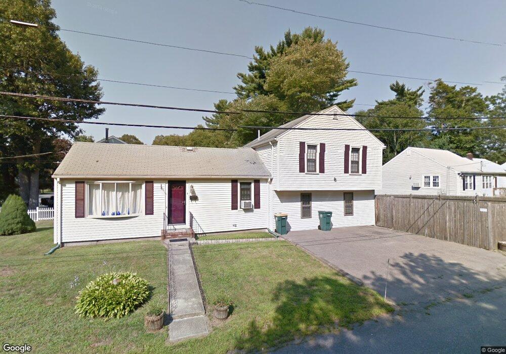
4 Jamieson St Abington, MA 02351
Estimated Value: $557,000 - $613,000
3
Beds
3
Baths
1,622
Sq Ft
$361/Sq Ft
Est. Value
About This Home
This home is located at 4 Jamieson St, Abington, MA 02351 and is currently estimated at $585,379, approximately $360 per square foot. 4 Jamieson St is a home located in Plymouth County with nearby schools including Woodsdale School, Beaver Brook Elementary School, and Abington Middle School.
Ownership History
Date
Name
Owned For
Owner Type
Purchase Details
Closed on
May 1, 2003
Sold by
Jamieson Richard P and Jamieson Jennifer A
Bought by
Tirrell Katherine M and Littlewood Kevin S
Current Estimated Value
Home Financials for this Owner
Home Financials are based on the most recent Mortgage that was taken out on this home.
Original Mortgage
$237,916
Outstanding Balance
$103,629
Interest Rate
5.82%
Mortgage Type
Purchase Money Mortgage
Estimated Equity
$481,750
Purchase Details
Closed on
May 30, 1997
Sold by
Wentzell Jacqueline V
Bought by
Jamieson Richard P and Jamieson Jennifer A
Create a Home Valuation Report for This Property
The Home Valuation Report is an in-depth analysis detailing your home's value as well as a comparison with similar homes in the area
Home Values in the Area
Average Home Value in this Area
Purchase History
| Date | Buyer | Sale Price | Title Company |
|---|---|---|---|
| Tirrell Katherine M | $272,000 | -- | |
| Jamieson Richard P | $110,000 | -- |
Source: Public Records
Mortgage History
| Date | Status | Borrower | Loan Amount |
|---|---|---|---|
| Open | Jamieson Richard P | $12,000 | |
| Open | Jamieson Richard P | $237,916 |
Source: Public Records
Tax History Compared to Growth
Tax History
| Year | Tax Paid | Tax Assessment Tax Assessment Total Assessment is a certain percentage of the fair market value that is determined by local assessors to be the total taxable value of land and additions on the property. | Land | Improvement |
|---|---|---|---|---|
| 2025 | $6,215 | $475,900 | $215,600 | $260,300 |
| 2024 | $5,926 | $442,900 | $196,000 | $246,900 |
| 2023 | $5,302 | $373,100 | $170,400 | $202,700 |
| 2022 | $5,211 | $342,400 | $149,100 | $193,300 |
| 2021 | $261 | $295,100 | $135,200 | $159,900 |
| 2020 | $5,364 | $315,500 | $140,800 | $174,700 |
| 2019 | $5,191 | $298,500 | $134,100 | $164,400 |
| 2018 | $4,966 | $278,700 | $134,100 | $144,600 |
| 2017 | $4,958 | $270,200 | $134,100 | $136,100 |
| 2016 | $4,612 | $257,200 | $127,700 | $129,500 |
| 2015 | $4,027 | $236,900 | $127,700 | $109,200 |
Source: Public Records
Map
Nearby Homes
- 14 Jamieson St
- 56 Ekstrom Cir
- 44 Old Forge Rd
- 8 Kingswood Dr Unit D5
- 74 Checkerberry Rd
- 221 Chestnut St
- 57 Sheri Ln
- 840 Hancock St
- 278 Sycamore St
- 6 Robert Post Rd
- 451 Lincoln St
- 1077 Bedford St
- 32 Warren St
- 23 Loganberry Dr
- 90 Warren St
- 40 Wales St
- 10 Mccue Cir
- 27 Swan Ave
- 169 Pond St
- 1353 Washington St