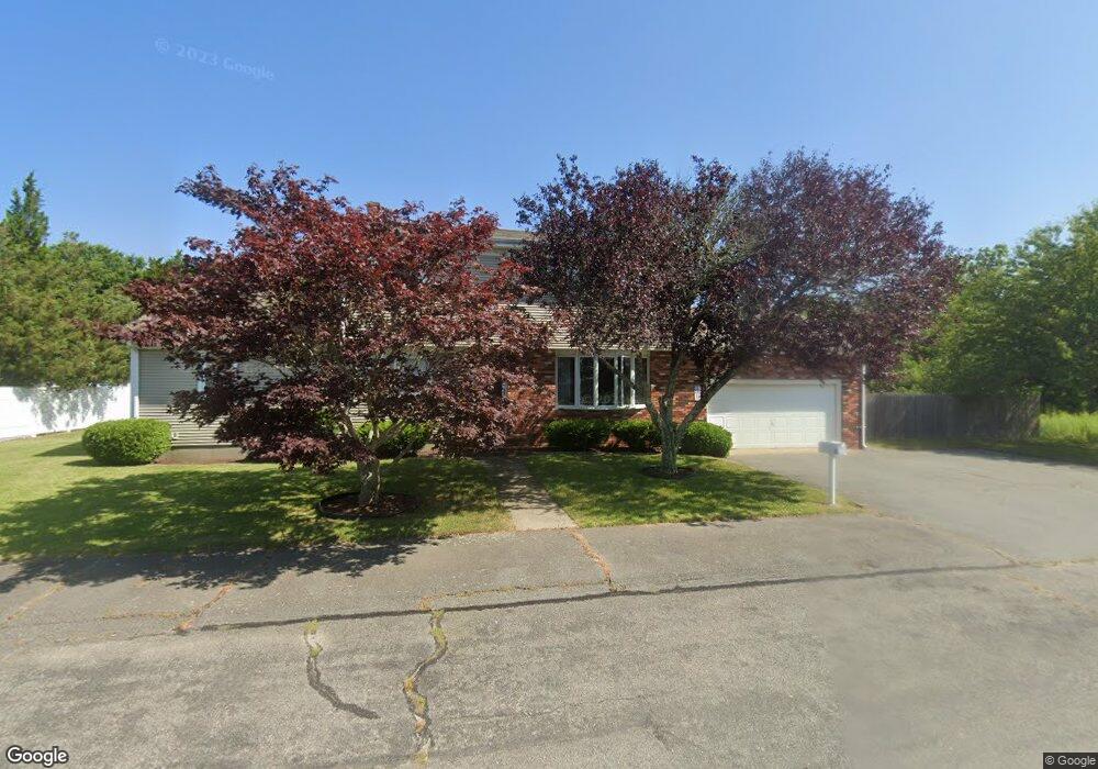
4 Jason Terrace Fairhaven, MA 02719
Oxford NeighborhoodEstimated Value: $520,000 - $616,000
4
Beds
2
Baths
1,976
Sq Ft
$286/Sq Ft
Est. Value
About This Home
This home is located at 4 Jason Terrace, Fairhaven, MA 02719 and is currently estimated at $564,920, approximately $285 per square foot. 4 Jason Terrace is a home located in Bristol County with nearby schools including Fairhaven High School, City On A Hill Charter Public School New Bedford, and St. Joseph School.
Ownership History
Date
Name
Owned For
Owner Type
Purchase Details
Closed on
Sep 4, 2013
Sold by
Lewis Beverly A
Bought by
Robert A Lewis Irt and Lewis Robert A
Current Estimated Value
Purchase Details
Closed on
Jun 10, 2013
Sold by
Lewis Beverly A and Lewis Ernest
Bought by
Lewis Beverly A
Purchase Details
Closed on
Nov 7, 1978
Bought by
Beverl Irt
Create a Home Valuation Report for This Property
The Home Valuation Report is an in-depth analysis detailing your home's value as well as a comparison with similar homes in the area
Home Values in the Area
Average Home Value in this Area
Purchase History
| Date | Buyer | Sale Price | Title Company |
|---|---|---|---|
| Robert A Lewis Irt | -- | -- | |
| Lewis Beverly A | -- | -- | |
| Beverl Irt | -- | -- |
Source: Public Records
Mortgage History
| Date | Status | Borrower | Loan Amount |
|---|---|---|---|
| Previous Owner | Beverl Irt | $25,000 |
Source: Public Records
Tax History Compared to Growth
Tax History
| Year | Tax Paid | Tax Assessment Tax Assessment Total Assessment is a certain percentage of the fair market value that is determined by local assessors to be the total taxable value of land and additions on the property. | Land | Improvement |
|---|---|---|---|---|
| 2025 | $41 | $440,300 | $174,200 | $266,100 |
| 2024 | $3,938 | $426,600 | $174,200 | $252,400 |
| 2023 | $3,777 | $379,600 | $152,600 | $227,000 |
| 2022 | $3,683 | $360,400 | $141,800 | $218,600 |
| 2021 | $3,709 | $328,500 | $128,300 | $200,200 |
| 2020 | $3,565 | $322,300 | $128,300 | $194,000 |
| 2019 | $3,390 | $290,500 | $106,400 | $184,100 |
| 2018 | $2,841 | $276,800 | $101,300 | $175,500 |
| 2017 | $3,309 | $274,800 | $101,300 | $173,500 |
| 2016 | $3,347 | $274,800 | $101,300 | $173,500 |
| 2015 | $3,268 | $269,000 | $101,300 | $167,700 |
Source: Public Records
Map
Nearby Homes
- 3 Harbor Mist Dr
- 22 John St
- 450 Bridge St
- 40 Highland Ave
- 280 Bridge St Lot1
- 77 Adams St
- 15 Bayview Ave
- 133 Pleasant St
- 70 Hathaway St
- 5 Laura Ln
- 11 Lawton St
- 190 Sconticut Neck Rd
- 16 Ash St
- 2 Washburn Ave
- 58 Washington St
- 17 Turner Ave
- 121 Green St
- 0 Nulands Neck Unit 73286360
- 230 Green St
- 77 Main St
- 7 Lincoln Dr
- 3 Jason Terrace
- 3 Lincoln Dr
- 12 Lincoln Dr
- 1 Ritas Way
- 8 Lincoln Dr
- 6 Lincoln Dr
- 0 & 12 Lincoln Dr
- 200 Huttleston Ave
- 7 Shirley St
- 4 Lincoln Dr
- 0 Jason Terrace
- 240242 Huttleston Ave
- 0 Huttleston Ave
- 2 Lincoln Dr
- 196 Huttleston Ave
- 6 Shirley St
- 736 Sconitcut Rd Unit B
- 736 Sconitcut Rd Unit C
- 736 Sconticut Rd Unit A