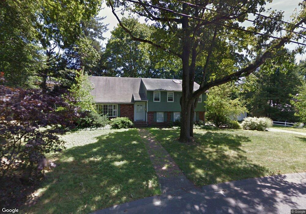
4 Juniper Place Lexington, MA 02420
Munroe Hill NeighborhoodEstimated Value: $3,246,828 - $4,030,000
6
Beds
7
Baths
4,777
Sq Ft
$771/Sq Ft
Est. Value
About This Home
This home is located at 4 Juniper Place, Lexington, MA 02420 and is currently estimated at $3,681,707, approximately $770 per square foot. 4 Juniper Place is a home located in Middlesex County with nearby schools including Fiske Elementary School, William Diamond Middle School, and Lexington High School.
Ownership History
Date
Name
Owned For
Owner Type
Purchase Details
Closed on
Mar 28, 2019
Sold by
Isaac Madathil and Isaac Achamma
Bought by
Isaac Thomas and Kim Somi
Current Estimated Value
Purchase Details
Closed on
May 6, 2016
Sold by
Walsh Robert M and Walsh Carrie G
Bought by
Isaac Thomas and Kim Somi
Home Financials for this Owner
Home Financials are based on the most recent Mortgage that was taken out on this home.
Original Mortgage
$1,758,400
Interest Rate
3.71%
Mortgage Type
Unknown
Purchase Details
Closed on
Jun 25, 2014
Sold by
Caouette Barry S
Bought by
Walsh Robert M and Walsh Carrie G
Home Financials for this Owner
Home Financials are based on the most recent Mortgage that was taken out on this home.
Original Mortgage
$1,300,000
Interest Rate
3%
Mortgage Type
Purchase Money Mortgage
Purchase Details
Closed on
Jun 21, 2012
Sold by
Mcgirr Virginia M
Bought by
Caouette Barry S
Create a Home Valuation Report for This Property
The Home Valuation Report is an in-depth analysis detailing your home's value as well as a comparison with similar homes in the area
Home Values in the Area
Average Home Value in this Area
Purchase History
| Date | Buyer | Sale Price | Title Company |
|---|---|---|---|
| Isaac Thomas | -- | -- | |
| Isaac Thomas | $2,198,000 | -- | |
| Walsh Robert M | $2,175,000 | -- | |
| Caouette Barry S | $840,000 | -- |
Source: Public Records
Mortgage History
| Date | Status | Borrower | Loan Amount |
|---|---|---|---|
| Previous Owner | Isaac Thomas | $1,758,400 | |
| Previous Owner | Walsh Robert M | $1,300,000 |
Source: Public Records
Tax History
| Year | Tax Paid | Tax Assessment Tax Assessment Total Assessment is a certain percentage of the fair market value that is determined by local assessors to be the total taxable value of land and additions on the property. | Land | Improvement |
|---|---|---|---|---|
| 2025 | $35,308 | $2,887,000 | $1,073,000 | $1,814,000 |
| 2024 | $34,214 | $2,793,000 | $1,022,000 | $1,771,000 |
| 2023 | $32,162 | $2,474,000 | $929,000 | $1,545,000 |
| 2022 | $31,091 | $2,253,000 | $845,000 | $1,408,000 |
| 2021 | $31,687 | $2,202,000 | $804,000 | $1,398,000 |
| 2020 | $29,449 | $2,096,000 | $804,000 | $1,292,000 |
| 2019 | $28,805 | $2,040,000 | $766,000 | $1,274,000 |
| 2018 | $9,324 | $1,882,000 | $709,000 | $1,173,000 |
| 2017 | $32,182 | $2,221,000 | $676,000 | $1,545,000 |
| 2016 | $32,091 | $2,198,000 | $621,000 | $1,577,000 |
| 2015 | $26,139 | $1,759,000 | $564,000 | $1,195,000 |
| 2014 | $25,436 | $1,640,000 | $505,000 | $1,135,000 |
Source: Public Records
Map
Nearby Homes
- 58 Hancock St
- 72 Meriam St
- 36 Adams St
- 32 Edgewood Rd Unit 3
- 32 Edgewood Rd Unit 1
- 57 Colony Rd
- 16 Meriam St
- 93 Bedford St Unit 201
- 93 Bedford St Unit 308
- 93 Bedford St Unit 108
- 1 Revere St
- 18 Victory Garden Way
- 197 Grant St
- 17 Hamilton Rd
- 1894 Massachusetts Ave
- 1900 Massachusetts Ave
- 18 Hill St
- 32 Forest St
- 9 Hillside Terrace
- 25 Flintlock Rd
Your Personal Tour Guide
Ask me questions while you tour the home.