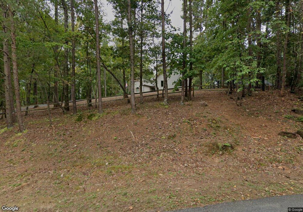
4 Laurel Trail S Dawsonville, GA 30534
Dawson County NeighborhoodEstimated Value: $974,000 - $1,616,387
2
Beds
4
Baths
2,149
Sq Ft
$535/Sq Ft
Est. Value
About This Home
This home is located at 4 Laurel Trail S, Dawsonville, GA 30534 and is currently estimated at $1,150,347, approximately $535 per square foot. 4 Laurel Trail S is a home located in Dawson County with nearby schools including Kilough Elementary School, Dawson County Junior High School, and Dawson County Middle School.
Ownership History
Date
Name
Owned For
Owner Type
Purchase Details
Closed on
Mar 6, 2020
Sold by
Slabaugh Dave and Slabaugh Janet
Bought by
Lostpoint Llc
Current Estimated Value
Purchase Details
Closed on
Apr 25, 2005
Sold by
Byste Inc
Bought by
Slabaugh Dave and Slabaugh Janet
Purchase Details
Closed on
Aug 15, 2002
Sold by
Byste Incorporated
Bought by
Stephens Russell
Purchase Details
Closed on
Oct 9, 2000
Sold by
Byste Inc
Bought by
Stephens Russell
Purchase Details
Closed on
Jan 26, 1981
Bought by
Byste Inc
Create a Home Valuation Report for This Property
The Home Valuation Report is an in-depth analysis detailing your home's value as well as a comparison with similar homes in the area
Home Values in the Area
Average Home Value in this Area
Purchase History
| Date | Buyer | Sale Price | Title Company |
|---|---|---|---|
| Lostpoint Llc | -- | None Available | |
| Slabaugh Dave | $238,000 | -- | |
| Byste Inc | -- | -- | |
| Stephens Russell | -- | -- | |
| Stephens Russell | -- | -- | |
| Byste Inc | $97,900 | -- |
Source: Public Records
Tax History Compared to Growth
Tax History
| Year | Tax Paid | Tax Assessment Tax Assessment Total Assessment is a certain percentage of the fair market value that is determined by local assessors to be the total taxable value of land and additions on the property. | Land | Improvement |
|---|---|---|---|---|
| 2024 | $8,366 | $513,568 | $176,680 | $336,888 |
| 2023 | $8,352 | $537,088 | $201,160 | $335,928 |
| 2022 | $8,480 | $395,868 | $134,120 | $261,748 |
| 2021 | $3,815 | $168,640 | $111,760 | $56,880 |
| 2020 | $3,962 | $167,440 | $111,760 | $55,680 |
| 2019 | $3,804 | $159,400 | $111,760 | $47,640 |
| 2018 | $3,812 | $159,400 | $111,760 | $47,640 |
| 2017 | $3,156 | $131,961 | $88,000 | $43,961 |
| 2016 | $2,861 | $119,645 | $77,000 | $42,645 |
| 2015 | $2,851 | $115,484 | $77,000 | $38,484 |
| 2014 | $2,872 | $112,679 | $77,000 | $35,679 |
| 2013 | -- | $93,054 | $61,600 | $31,454 |
Source: Public Records
Map
Nearby Homes
- 233 Holly Dr
- 194 Waterfront Park Ln
- 1070 Dogwood Way
- 5766 Ridgewater Cir
- 5779 Ridgewater Cir
- 5775 Ridgewater Cir
- 5728 Ridgewater Dr
- 5739 Ridgewater Cir
- 5608 Azelia Dr
- 162 River Sound Ln
- 35 E Harbor Dr
- Leyland Plan at East Harbor II at Chestatee
- Manchester Plan at East Harbor II at Chestatee
- Scarlet Plan at East Harbor II at Chestatee
- 25 River Sound Cir
- 239 E Harbor Dr
- 648 Dogwood Way
- 1619 Price Rd
- 803 Night Fire Dr
- 148 Holly Dr
- 130 Holly Dr
- 28 Laurel Trail S
- N N Laurel Trail
- 38 Laurel Trail S
- 33 Laurel Trail S
- 10 Laurel Trail N
- 10 Laurel Trail N Unit 46
- 206 Holly Dr
- 120 Holly Dr
- 39 Laurel Trail S
- 30 Laurel Trail N
- 73 Waterfront Park Ct
- 44 Laurel Trail S
- 50 Laurel Trail S
- 98 Holly Dr
- 230 Holly Dr
- 230 Holly Dr
- 44 Holly Dr
- 44 Laurel Trail N