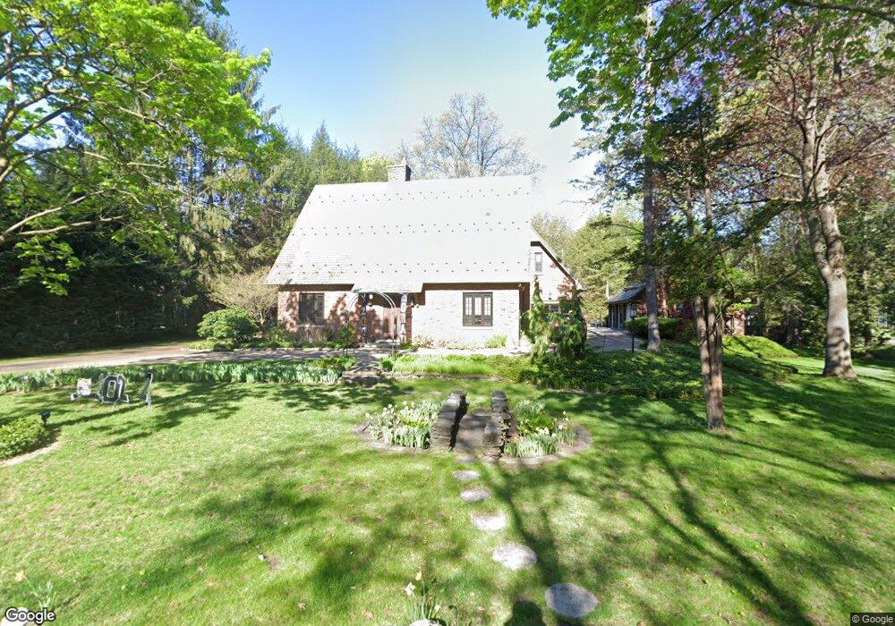
4 Locust Ln Albany, NY 12211
Estimated Value: $686,000 - $781,800
3
Beds
2
Baths
3,560
Sq Ft
$207/Sq Ft
Est. Value
About This Home
This home is located at 4 Locust Ln, Albany, NY 12211 and is currently estimated at $736,600, approximately $206 per square foot. 4 Locust Ln is a home located in Albany County with nearby schools including Loudonville Elementary School, Shaker Junior High School, and Shaker High School.
Ownership History
Date
Name
Owned For
Owner Type
Purchase Details
Closed on
Oct 18, 2005
Sold by
Pogge Norst
Bought by
Masson Patrick
Current Estimated Value
Home Financials for this Owner
Home Financials are based on the most recent Mortgage that was taken out on this home.
Original Mortgage
$76,000
Interest Rate
5.65%
Mortgage Type
Balloon
Create a Home Valuation Report for This Property
The Home Valuation Report is an in-depth analysis detailing your home's value as well as a comparison with similar homes in the area
Home Values in the Area
Average Home Value in this Area
Purchase History
| Date | Buyer | Sale Price | Title Company |
|---|---|---|---|
| Masson Patrick | $460,000 | Joseph Rotello |
Source: Public Records
Mortgage History
| Date | Status | Borrower | Loan Amount |
|---|---|---|---|
| Closed | Masson Patrick | $76,000 | |
| Open | Masson Patrick | $359,650 |
Source: Public Records
Tax History
| Year | Tax Paid | Tax Assessment Tax Assessment Total Assessment is a certain percentage of the fair market value that is determined by local assessors to be the total taxable value of land and additions on the property. | Land | Improvement |
|---|---|---|---|---|
| 2025 | $11,532 | $281,000 | $70,300 | $210,700 |
| 2024 | $11,532 | $281,000 | $70,300 | $210,700 |
| 2023 | $11,274 | $281,000 | $70,300 | $210,700 |
| 2022 | $11,076 | $281,000 | $70,300 | $210,700 |
| 2021 | $11,026 | $281,000 | $70,300 | $210,700 |
| 2020 | $10,838 | $281,000 | $70,300 | $210,700 |
| 2019 | $5,701 | $281,000 | $70,300 | $210,700 |
| 2018 | $10,700 | $281,000 | $70,300 | $210,700 |
| 2017 | $0 | $256,000 | $64,000 | $192,000 |
| 2016 | $8,952 | $256,000 | $64,000 | $192,000 |
| 2015 | -- | $256,000 | $64,000 | $192,000 |
| 2014 | -- | $256,000 | $64,000 | $192,000 |
Source: Public Records
Map
Nearby Homes
Your Personal Tour Guide
Ask me questions while you tour the home.