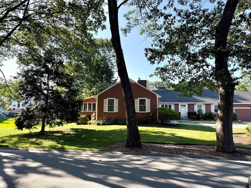
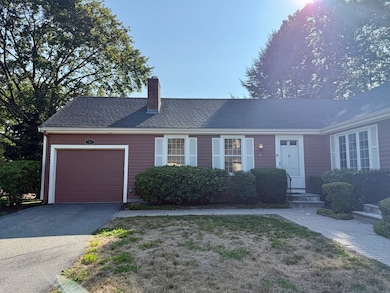
4 Lois Ln Lexington, MA 02420
Munroe Hill NeighborhoodHighlights
- Landscaped Professionally
- Property is near public transit and schools
- Main Floor Primary Bedroom
- Fiske Elementary School Rated A
- Wood Flooring
- Jogging Path
About This Home
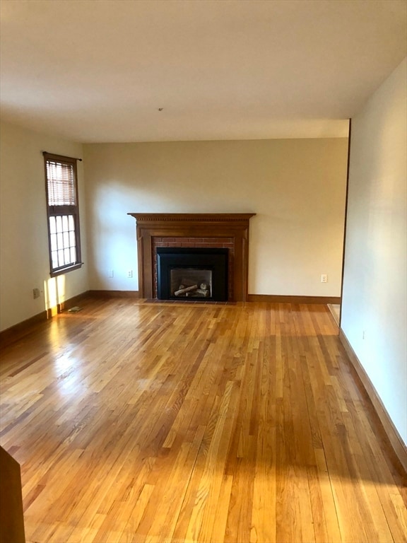
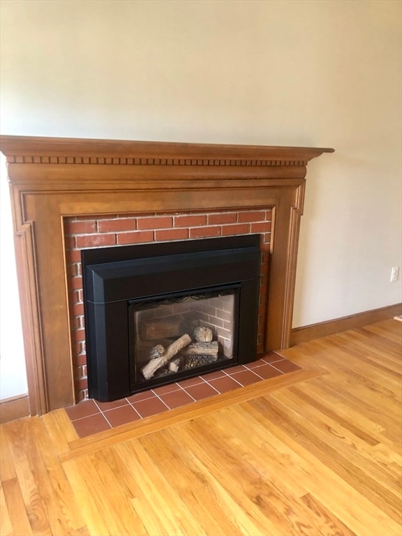
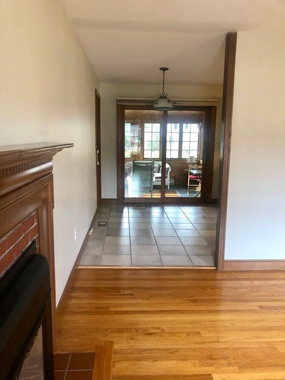
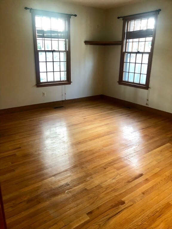
Beautiful. 2 bedroom, 1 bath townhouse offering comfortable ONE LEVEL LIVING for rent! Full basement, warm oak flooring throughout, convenient access to private backyard for entertaining or child play area, attached garage, heated family/sunroom with cathedral ceilings, central air conditioning and inviting gas fireplaced living room. Landscaping and snow removal are nicely maintained by the association, garage is attached and you'll have the full basement for storage! Moment to the Minuteman Bile Path, Lexington Center, groceries, Starbucks, Beth Israel Lahey Health health building, spa, hair salon, and restaurants. Move in January 1st or 15th!
Condo Details
Home Type
- Condominium
Year Built
- Built in 1975
Lot Details
- Landscaped Professionally
- Sprinkler System
- Garden
Parking
- 2 Car Parking Spaces
Home Design
- Entry on the 1st floor
Interior Spaces
- 1,085 Sq Ft Home
- Ceiling Fan
- Recessed Lighting
- Light Fixtures
- Window Screens
- Sliding Doors
- Living Room with Fireplace
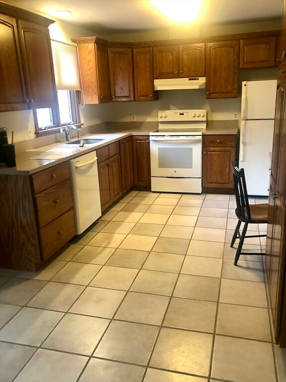
Kitchen
- Range
- Microwave
- Dishwasher
- Disposal
Flooring
- Wood
- Ceramic Tile
Bedrooms and Bathrooms
- 2 Bedrooms
- Primary Bedroom on Main
- 1 Full Bathroom
Laundry
- Laundry on main level
- Dryer
- Washer
Location
- Property is near public transit and schools
Utilities
- Cooling Available
- Internet Available
Listing and Financial Details
- Security Deposit $2,000
- Property Available on 1/1/26
- Rent includes trash collection, snow removal, gardener
- 12 Month Lease Term
- Assessor Parcel Number M:0057 L:01454,554808
Community Details
Overview
- Property has a Home Owners Association
- Near Conservation Area
Amenities
- Shops
Recreation
- Park
- Jogging Path
- Bike Trail
Pet Policy
- Call for details about the types of pets allowed
Map
Property History
| Date | Event | Price | List to Sale | Price per Sq Ft |
|---|---|---|---|---|
| 11/28/2025 11/28/25 | For Rent | $3,600 | -- | -- |
Source: MLS Property Information Network (MLS PIN)
MLS Number: 73458060
APN: LEXI-000057-000000-000145-000004
Disclaimer: Certain information contained herein is derived from information provided by parties other than Homes.com. All information provided is deemed reliable, but is not guaranteed to be accurate and should be independently verified.
![]() The property listing data and information, or the Images, set forth herein were provided to MLS Property Information Network, Inc. from third party sources, including sellers, lessors and public records, and were compiled by MLS Property Information Network, Inc. The property listing data and information, and the Images, are for the personal, non-commercial use of consumers having a good faith interest in purchasing or leasing listed properties of the type displayed to them and may not be used for any purpose other than to identify prospective properties which such consumers may have a good faith interest in purchasing or leasing. MLS Property Information Network, Inc. and its subscribers disclaim any and all representations and warranties as to the accuracy of the property listing data and information, or as to the accuracy of any of the Images, set forth herein.
The property listing data and information, or the Images, set forth herein were provided to MLS Property Information Network, Inc. from third party sources, including sellers, lessors and public records, and were compiled by MLS Property Information Network, Inc. The property listing data and information, and the Images, are for the personal, non-commercial use of consumers having a good faith interest in purchasing or leasing listed properties of the type displayed to them and may not be used for any purpose other than to identify prospective properties which such consumers may have a good faith interest in purchasing or leasing. MLS Property Information Network, Inc. and its subscribers disclaim any and all representations and warranties as to the accuracy of the property listing data and information, or as to the accuracy of any of the Images, set forth herein.
- 93 Bedford St Unit 201
- 93 Bedford St Unit 308
- 93 Bedford St Unit 108
- 93 Bedford St Unit 101
- 32 Edgewood Rd Unit 1
- 47 Ledgelawn Ave
- 30 Meriam St Unit 30
- 17 Hamilton Rd
- 1900 Massachusetts Ave
- 1894 Massachusetts Ave
- 231 Bedford St
- 36 Adams St
- 32 Forest St
- 3a Nowers Rd
- 25 Flintlock Rd
- 46 Asbury St
- 42 Winthrop Rd
- 22 Estabrook Rd
- 30 Harbell St
- 1437 Massachusetts Ave
- 27 Shirley St Unit 27
- 42 Worthen Rd Unit A1
- 186 Bedford St Unit 210
- 186 Bedford St Unit 204
- 11 Oakland St
- 1628 Massachusetts Ave Unit 1628
- 31 Captain Parker Arms Unit 12
- 162 E Emerson Rd
- 2 Effie Place
- 11 Patterson Rd
- 11 Patterson Rd Unit SF
- 162 E Emerson Rd
- 23 Thoreau Rd
- One Katahdin Dr Unit 202
- One Katahdin Dr Unit 211
- One Katahdin Dr Unit 201
- One Katahdin Dr Unit 515
- 4 Hadley Rd
- 1 Katahdin Dr
- 1 Seven Springs Ln
