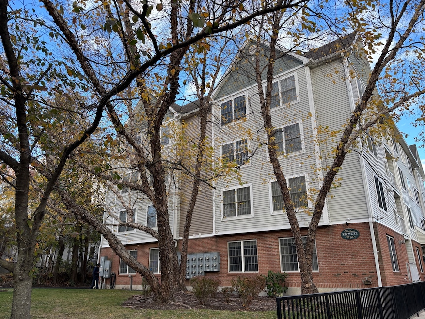
4 Lowe St Unit 201 Norwalk, CT 06854
Brookside NeighborhoodHighlights
- Beach Access
- Deck
- Laundry Room
- Brien Mcmahon High School Rated A-
- Ranch Style House
- Central Air
About This Home
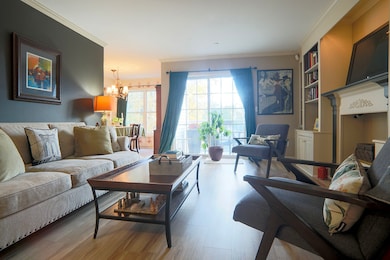
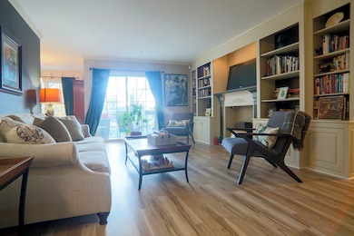
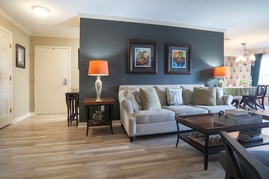
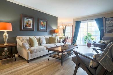
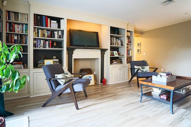
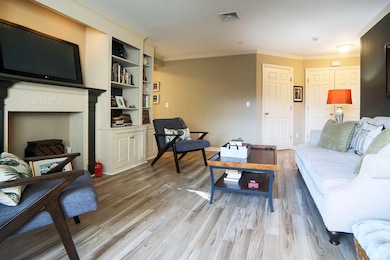
Enjoy the convenience of walking to the train, being steps from restaurants, bars and shopping and returning home to a peaceful, spacious sanctuary. This well-kept 2-bedroom, 2-bath condo in the desirable SONO area offers generous storage throughout and a private outdoor deck. The living room features built-ins and sliders that open to the deck, which also includes an exterior storage closet.Both bathrooms have linen closets.Entry has generous coat closet. A galley kitchen flows into the dining room, making everyday living and entertaining easy. The primary bedroom has its own full bath and two large closets, while the second bedroom also offers two large closets. An in-unit laundry room adds to the convenience. Building amenities include an elevator leading to the assigned, covered, gated parking garage, along with ample guest parking. The owner reports average utility costs of $125-$150 per month last year. Ideally located near Metro-North (an easy walk), I-95, the SoNo Collection Mall, and a wide range of dining and entertainment options in Historic SONO. Calf Pasture and Shady Beach are just minutes away. No pets. No exceptions.
Listing Agent
William Raveis Real Estate Brokerage Phone: (203) 247-7927 License #RES.0773072 Listed on: 11/06/2025

Home Details
Home Type
- Single Family
Est. Annual Taxes
- $5,909
Year Built
- Built in 2001
Lot Details
- Level Lot
Home Design
- Ranch Style House
- Masonry Siding
- Vinyl Siding
Interior Spaces
- 1,282 Sq Ft Home
- Elevator
Kitchen
- Gas Range
- Range Hood
- Dishwasher
Bedrooms and Bathrooms
- 2 Bedrooms
- 2 Full Bathrooms
Laundry
- Laundry Room
- Laundry on main level
- Dryer
- Washer
Parking
- 1 Car Garage
- Parking Deck
Outdoor Features
- Beach Access
- Deck
Schools
- Brien Mcmahon High School
Utilities
- Central Air
- Heating System Uses Gas
- Cable TV Available
Listing and Financial Details
- Assessor Parcel Number 2315426
Community Details
Overview
Pet Policy
- No Pets Allowed
Map
Source: SmartMLS
MLS Number: 24138376
APN: NORW-000002-000048-000058-000201
Disclaimer: Certain information contained herein is derived from information provided by parties other than Homes.com. All information provided is deemed reliable, but is not guaranteed to be accurate and should be independently verified.
![]() IDX information is provided exclusively for personal, non-commercial use, and may not be used for any purpose other than to identify prospective properties consumers may be interested in purchasing. Information is deemed reliable but not guaranteed.
IDX information is provided exclusively for personal, non-commercial use, and may not be used for any purpose other than to identify prospective properties consumers may be interested in purchasing. Information is deemed reliable but not guaranteed.
- 7 Hamilton Ave Unit 32
- 187 Flax Hill Rd Unit A4
- 187 Flax Hill Rd Unit D5
- 18 Soundview Ave
- 15 Madison St Unit F9
- 15 Madison St Unit G11
- 47 Taylor Ave
- 28 Chestnut St
- 6 W Couch St
- 20 Woodlawn Ave
- 59 Taylor Ave
- 42 S Main St Unit 202
- 52 Lexington Ave
- 9 Observatory Place Unit A
- 94 Washington St Unit 20
- 8 Crown Ave
- 134 Washington St Unit 206
- 118 Washington St Unit 304
- 10 Ann St Unit 206
- 131 Washington St Unit 204
- 218 Flax Hill Rd Unit 4
- 231 Flax Hill Rd Unit B
- 240 Flax Hill Rd
- 16 Hillside Place Unit G4
- 21 Hillside Place
- 1 Chestnut St
- 2 Oak St
- 10 Monroe St
- 2 Frances Ave Unit 2
- 107 S Main St Unit 5
- 70 S Main St Unit 3D
- 61 Washington St Unit 2E
- 2 S Main St Unit W201
- 19 Day St
- 94 Washington St Unit 18
- 22 Avenue D
- 94 Washington St
- 94 Washington St Unit 9
- 94 Washington St Unit 11
- 85 Washington St Unit 2 E