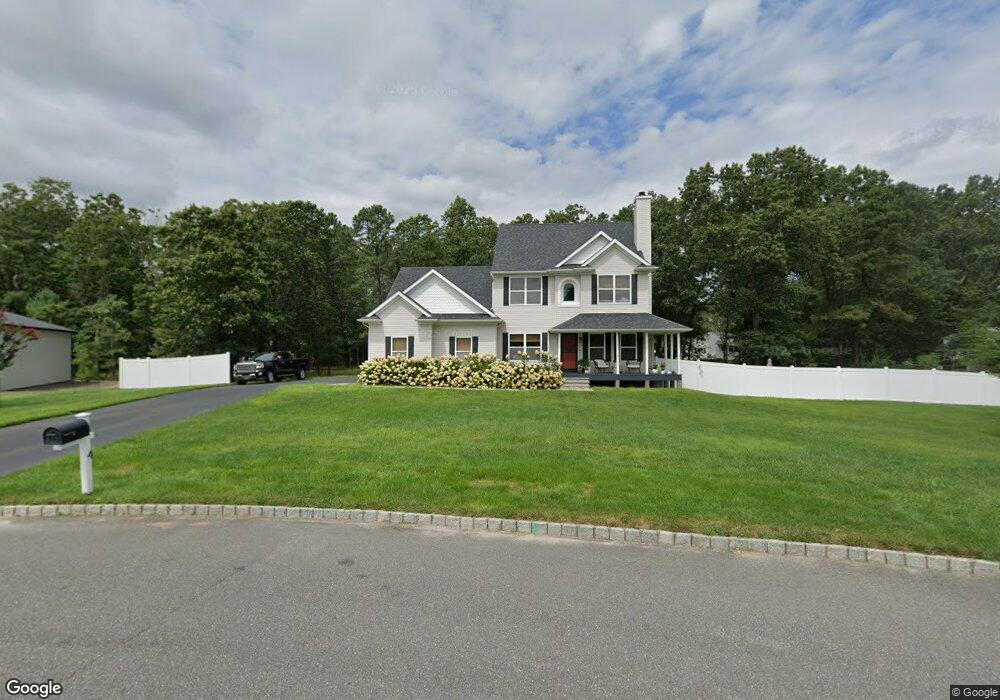
4 Mackenzie Ct Whiting, NJ 08759
Manchester Township NeighborhoodEstimated Value: $171,000 - $630,000
3
Beds
3
Baths
3,253
Sq Ft
$154/Sq Ft
Est. Value
About This Home
This home is located at 4 Mackenzie Ct, Whiting, NJ 08759 and is currently estimated at $502,180, approximately $154 per square foot. 4 Mackenzie Ct is a home located in Ocean County with nearby schools including Manchester Township High School.
Ownership History
Date
Name
Owned For
Owner Type
Purchase Details
Closed on
Jan 28, 2015
Sold by
Mdr Developers Inc
Bought by
Caruso Nicholas and Caruso Maria C
Current Estimated Value
Home Financials for this Owner
Home Financials are based on the most recent Mortgage that was taken out on this home.
Original Mortgage
$345,267
Outstanding Balance
$265,808
Interest Rate
3.9%
Mortgage Type
VA
Estimated Equity
$236,372
Purchase Details
Closed on
Sep 8, 2006
Sold by
Larrabee Edward F and Lillie Candace A
Bought by
Mdr Developers Inc
Home Financials for this Owner
Home Financials are based on the most recent Mortgage that was taken out on this home.
Original Mortgage
$4,792,500
Interest Rate
6.59%
Mortgage Type
Purchase Money Mortgage
Create a Home Valuation Report for This Property
The Home Valuation Report is an in-depth analysis detailing your home's value as well as a comparison with similar homes in the area
Home Values in the Area
Average Home Value in this Area
Purchase History
| Date | Buyer | Sale Price | Title Company |
|---|---|---|---|
| Caruso Nicholas | $338,000 | None Available | |
| Mdr Developers Inc | $787,500 | Fidelity National Title Insu |
Source: Public Records
Mortgage History
| Date | Status | Borrower | Loan Amount |
|---|---|---|---|
| Open | Caruso Nicholas | $345,267 | |
| Previous Owner | Mdr Developers Inc | $4,792,500 |
Source: Public Records
Tax History Compared to Growth
Tax History
| Year | Tax Paid | Tax Assessment Tax Assessment Total Assessment is a certain percentage of the fair market value that is determined by local assessors to be the total taxable value of land and additions on the property. | Land | Improvement |
|---|---|---|---|---|
| 2025 | $8,691 | $567,900 | $153,300 | $414,600 |
| 2024 | $8,248 | $354,000 | $77,400 | $276,600 |
| 2023 | $7,841 | $354,000 | $77,400 | $276,600 |
| 2022 | $7,841 | $354,000 | $77,400 | $276,600 |
| 2021 | $7,671 | $343,800 | $77,400 | $266,400 |
| 2020 | $7,254 | $343,800 | $77,400 | $266,400 |
| 2019 | $7,728 | $301,300 | $81,100 | $220,200 |
| 2018 | $7,698 | $301,300 | $81,100 | $220,200 |
| 2017 | $7,728 | $301,300 | $81,100 | $220,200 |
| 2016 | $7,635 | $301,300 | $81,100 | $220,200 |
| 2015 | $7,493 | $81,100 | $81,100 | $0 |
| 2014 | $1,976 | $81,100 | $81,100 | $0 |
Source: Public Records
Map
Nearby Homes
- 9 Oklahoma Way Unit A
- 19 Florida Dr Unit A
- 7 B Connecticut Dr
- 14 B Roosevelt City Rd Unit B
- 5 A Iowa Dr Unit A
- 5 Oregon Dr Unit B
- 5 Indiana Way
- 8 Hawaii Way Unit B
- 3 New Hampshire Ln Unit A
- 4 B Delaware Way Unit A
- 12 California Dr Unit B
- 6 Michigan Ave Unit A
- 4 Minnesota Ave
- 7B Rhode Island Dr
- 28 B Maryland Ave Unit A
- 7 Virginia Dr Unit B
- 4 California Dr Unit B
- 2 California Dr
- 17 Michigan Ave
- 1 Virginia Dr
- 9 Oklahoma Way
- 6 Mackenzie Ct
- 6 Mackenzie Ct
- 2 Mackenzie Ct
- 3 Mackenzie Ct
- 3 Mackenzie Ct
- 21 Mackenzie Ct
- 26 Mackenzie Ct
- 24 Mackenzie Ct
- 23 Mackenzie Ct
- 15 Mackenzie Ct
- 11 Mackenzie Ct
- 13 Mackenzie Ct
- 12 Mackenzie Ct
- 17 Mackenzie Ct
- 19 Mackenzie Ct
- 18 Mackenzie Ct
- 8 Mackenzie Ct
- 100 Route 539
- 1 Mackenzie Ct