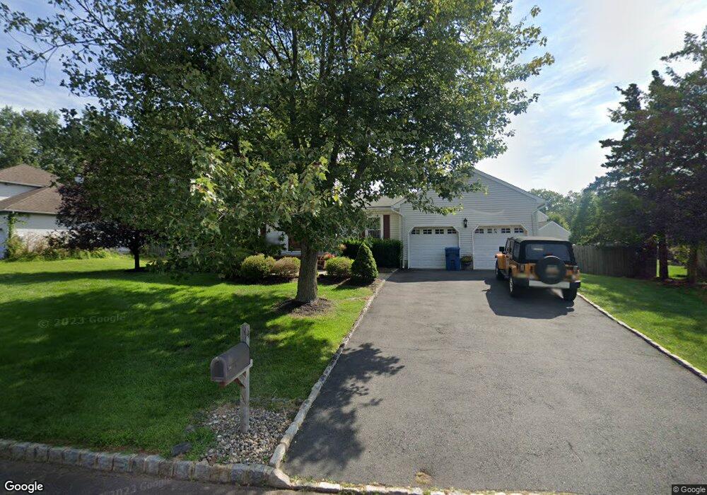
4 Marshall Rd Hillsborough, NJ 08844
Estimated Value: $670,550 - $771,000
--
Bed
--
Bath
1,798
Sq Ft
$407/Sq Ft
Est. Value
About This Home
This home is located at 4 Marshall Rd, Hillsborough, NJ 08844 and is currently estimated at $731,888, approximately $407 per square foot. 4 Marshall Rd is a home located in Somerset County with nearby schools including Hillsborough High School, Brighthorizons at Hillsborough, and Cherry Blossom Montessori School.
Ownership History
Date
Name
Owned For
Owner Type
Purchase Details
Closed on
Dec 31, 2003
Sold by
Kestel Michael
Bought by
Sowinski Anthony and Sowinski Renee
Current Estimated Value
Home Financials for this Owner
Home Financials are based on the most recent Mortgage that was taken out on this home.
Original Mortgage
$310,000
Outstanding Balance
$145,779
Interest Rate
5.98%
Estimated Equity
$586,109
Purchase Details
Closed on
Aug 16, 2002
Sold by
Donnelly Brian
Bought by
Kestel Michael and Kestel Denise
Home Financials for this Owner
Home Financials are based on the most recent Mortgage that was taken out on this home.
Original Mortgage
$296,000
Interest Rate
6.57%
Purchase Details
Closed on
May 9, 1992
Sold by
Morris Michael P and Morris Brenda B
Bought by
Donnelly Brian and Donnelly Schenk,Margaret
Purchase Details
Closed on
Jan 6, 1989
Sold by
Tafaro Stephen and Tafaro Carol
Bought by
Morris Michael and Morris Brenda
Create a Home Valuation Report for This Property
The Home Valuation Report is an in-depth analysis detailing your home's value as well as a comparison with similar homes in the area
Home Values in the Area
Average Home Value in this Area
Purchase History
| Date | Buyer | Sale Price | Title Company |
|---|---|---|---|
| Sowinski Anthony | $390,000 | -- | |
| Kestel Michael | $370,000 | -- | |
| Donnelly Brian | $190,000 | -- | |
| Morris Michael | $228,000 | -- |
Source: Public Records
Mortgage History
| Date | Status | Borrower | Loan Amount |
|---|---|---|---|
| Open | Sowinski Anthony | $310,000 | |
| Previous Owner | Kestel Michael | $296,000 |
Source: Public Records
Tax History Compared to Growth
Tax History
| Year | Tax Paid | Tax Assessment Tax Assessment Total Assessment is a certain percentage of the fair market value that is determined by local assessors to be the total taxable value of land and additions on the property. | Land | Improvement |
|---|---|---|---|---|
| 2025 | $12,800 | $649,700 | $385,200 | $264,500 |
| 2024 | $12,800 | $597,300 | $370,200 | $227,100 |
| 2023 | $11,596 | $538,600 | $310,200 | $228,400 |
| 2022 | $11,274 | $504,900 | $305,200 | $199,700 |
| 2021 | $10,561 | $449,800 | $250,200 | $199,600 |
| 2020 | $10,165 | $426,400 | $245,200 | $181,200 |
| 2019 | $10,034 | $417,400 | $235,200 | $182,200 |
| 2018 | $9,519 | $393,500 | $210,200 | $183,300 |
| 2017 | $9,426 | $390,300 | $205,200 | $185,100 |
| 2016 | $9,398 | $389,300 | $203,100 | $186,200 |
| 2015 | $8,950 | $375,400 | $188,100 | $187,300 |
| 2014 | $8,687 | $372,200 | $173,100 | $199,100 |
Source: Public Records
Map
Nearby Homes
- 912 Merritt Dr Unit D
- 902 Merritt Dr Unit E
- 911 Merritt Dr Unit B2
- 7 Monfort Dr
- 104 Devonshire Ct
- 303 Gemini Dr Unit 2B
- 710 Whitenack Ct
- 195 Beekman Ln
- 118 Bluebird Dr Unit 3
- 911 Renate Dr Unit 1
- 807 Eves Dr Unit 1B
- 3120 Revere Ct
- 790 Eves Dr
- 806 Eves Dr Unit 1B
- 107 Bluebird Dr Unit 1D
- 3204 Revere Ct
- 3011 Revere Ct
- 3014 Revere Ct
- 3007 Revere Ct
- 3320 Richmond Ct
