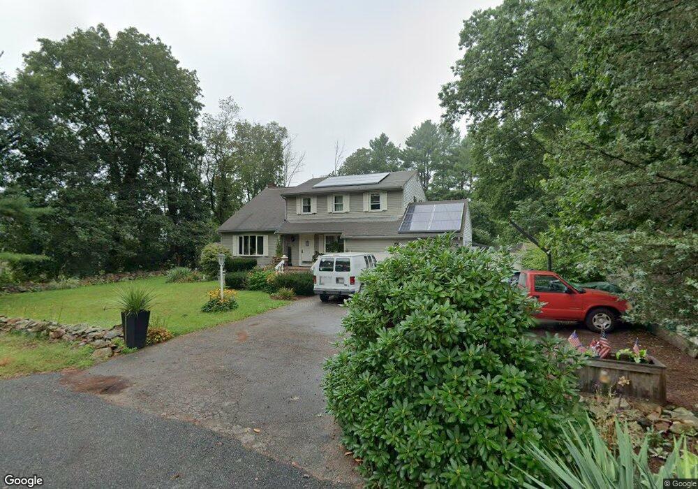
4 Massasoit St Medway, MA 02053
Estimated Value: $614,000 - $775,000
4
Beds
3
Baths
2,074
Sq Ft
$320/Sq Ft
Est. Value
About This Home
This home is located at 4 Massasoit St, Medway, MA 02053 and is currently estimated at $662,947, approximately $319 per square foot. 4 Massasoit St is a home located in Norfolk County with nearby schools including John D. McGovern Elementary School, Burke-Memorial Elementary, and Medway Middle School.
Ownership History
Date
Name
Owned For
Owner Type
Purchase Details
Closed on
Mar 31, 1993
Sold by
Bresnahan John J and Bresnaha Kathleen K
Bought by
Chesmore Thomas and Chesmore Maria
Current Estimated Value
Home Financials for this Owner
Home Financials are based on the most recent Mortgage that was taken out on this home.
Original Mortgage
$153,000
Interest Rate
7.6%
Mortgage Type
Purchase Money Mortgage
Create a Home Valuation Report for This Property
The Home Valuation Report is an in-depth analysis detailing your home's value as well as a comparison with similar homes in the area
Home Values in the Area
Average Home Value in this Area
Purchase History
| Date | Buyer | Sale Price | Title Company |
|---|---|---|---|
| Chesmore Thomas | $171,000 | -- |
Source: Public Records
Mortgage History
| Date | Status | Borrower | Loan Amount |
|---|---|---|---|
| Closed | Chesmore Thomas | $153,000 | |
| Previous Owner | Chesmore Thomas | $80,000 |
Source: Public Records
Tax History
| Year | Tax Paid | Tax Assessment Tax Assessment Total Assessment is a certain percentage of the fair market value that is determined by local assessors to be the total taxable value of land and additions on the property. | Land | Improvement |
|---|---|---|---|---|
| 2025 | $7,001 | $491,300 | $290,700 | $200,600 |
| 2024 | $7,075 | $491,300 | $290,700 | $200,600 |
| 2023 | $7,009 | $439,700 | $240,900 | $198,800 |
| 2022 | $6,973 | $411,900 | $213,900 | $198,000 |
| 2021 | $6,912 | $395,900 | $197,300 | $198,600 |
| 2020 | $6,704 | $383,100 | $182,700 | $200,400 |
| 2019 | $6,501 | $383,100 | $182,700 | $200,400 |
| 2018 | $6,356 | $359,900 | $157,800 | $202,100 |
| 2017 | $6,019 | $335,900 | $157,800 | $178,100 |
| 2016 | $5,591 | $308,700 | $139,500 | $169,200 |
| 2015 | $5,359 | $293,800 | $124,600 | $169,200 |
| 2014 | $5,526 | $293,300 | $132,900 | $160,400 |
Source: Public Records
Map
Nearby Homes
- 204 Village St
- 4 Shaw St
- 5 Richardson St
- 20 Broad St Unit 1
- 20 Broad St Unit 6
- 20 Broad St Unit A
- 20 Broad St Unit 4
- 8 Woodhaven Dr
- 33 Elm St
- 29 Elm St
- 2 Skyline Dr
- 1391 Pond St
- 8 Winthrop St
- 10 Franklin St
- 50 Main St
- 254 Daniels St
- 24 Shayne Rd Unit 110
- 33 Gorwin Dr
- 83 Oliver Pond Cir Unit 7
- 91 Oliver Pond Cir Unit 3
- 13 Waterside Run Unit 13
- 10 Charles River Rd
- 8 Charles River Rd
- 12 Waterside Unit 12
- 3 Narragansett St
- 6 Charles River Rd
- 10 Waterside Run Unit 10
- 10 Waterside Run
- 2 Massasoit St
- 8 Waterside Run Unit 8
- 6 Waterside Unit 6
- 3 Massasoit St
- 12 Charles River Rd
- 2 Waterside Run Unit 2
- 4 Waterside Run Unit 4
- 5 Charles River Rd
- 2 Kings Ln
- 2A King Phillip St Unit 2-A
- 2A King Phillip St
- 7 Massasoit St
Your Personal Tour Guide
Ask me questions while you tour the home.