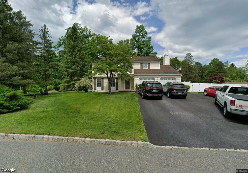
4 Michael Ct Newton, NJ 07860
Estimated Value: $501,951 - $647,000
Studio
--
Bath
2,020
Sq Ft
$291/Sq Ft
Est. Value
About This Home
This home is located at 4 Michael Ct, Newton, NJ 07860 and is currently estimated at $586,988, approximately $290 per square foot. 4 Michael Ct is a home located in Sussex County with nearby schools including Green Hills School and Tranquility Adventist School.
Ownership History
Date
Name
Owned For
Owner Type
Purchase Details
Closed on
Oct 31, 2008
Sold by
An 45 Llc
Bought by
Ciancarelli Vincent A and Ciancarelli Donna
Current Estimated Value
Purchase Details
Closed on
Feb 26, 2002
Sold by
Trause Anthony J and Trause Lorene M
Bought by
Cotter Dennis R and Cotter Tara N
Home Financials for this Owner
Home Financials are based on the most recent Mortgage that was taken out on this home.
Original Mortgage
$223,650
Interest Rate
6.85%
Mortgage Type
Stand Alone First
Create a Home Valuation Report for This Property
The Home Valuation Report is an in-depth analysis detailing your home's value as well as a comparison with similar homes in the area
Home Values in the Area
Average Home Value in this Area
Purchase History
We collect this data history from publicly available records. To have your information removed, we recommend requesting removal directly through your county’s website.
| Date | Buyer | Sale Price | Title Company |
|---|---|---|---|
| Ciancarelli Vincent A | $17,500 | None Available | |
| Cotter Dennis R | $248,500 | -- |
Source: Public Records
Mortgage History
We collect this data history from publicly available records. To have your information removed, we recommend requesting removal directly through your county’s website.
| Date | Status | Borrower | Loan Amount |
|---|---|---|---|
| Previous Owner | Cotter Dennis R | $223,650 |
Source: Public Records
Tax History
| Year | Tax Paid | Tax Assessment Tax Assessment Total Assessment is a certain percentage of the fair market value that is determined by local assessors to be the total taxable value of land and additions on the property. | Land | Improvement |
|---|---|---|---|---|
| 2025 | $10,835 | $520,500 | $137,100 | $383,400 |
| 2024 | $10,757 | $278,400 | $94,100 | $184,300 |
| 2023 | $10,757 | $278,400 | $94,100 | $184,300 |
| 2022 | $10,234 | $278,400 | $94,100 | $184,300 |
| 2021 | $10,100 | $278,400 | $94,100 | $184,300 |
| 2020 | $9,855 | $278,400 | $94,100 | $184,300 |
| 2019 | $9,647 | $278,400 | $94,100 | $184,300 |
| 2018 | $10,153 | $278,400 | $94,100 | $184,300 |
| 2017 | $9,950 | $278,400 | $94,100 | $184,300 |
| 2016 | $9,245 | $266,500 | $94,100 | $172,400 |
| 2015 | $8,914 | $266,500 | $94,100 | $172,400 |
| 2014 | $8,672 | $266,500 | $94,100 | $172,400 |
Source: Public Records
Map
Nearby Homes
- 17 Shotwell Rd
- 7 Woodfield Rd
- 37 Pequest Rd
- 14 Misty Ln
- 155 Wintermute Rd
- 83 Creek Rd
- 2 Stone Forge Rd
- 488 Ridge Rd
- 112 Kennedy Rd
- 84 Yellow Frame Rd
- 104 Creek Rd
- 26 Huntsville Rd
- 10 Old Forge Rd
- 468 Ridge Rd
- 15 Spring Hunter Ct
- 107 South St
- 1127 Dark Moon Rd
- 15 Mountainview Dr
- 96 Brighton Rd
- 10 Sunny Ln
- 2 Michael Ct
- 5 Michael Ct
- 6 Michael Ct
- 3 Michael Ct
- 15 Shotwell Rd
- 9 Michael Ct
- 115 Wolfs Corner Rd
- 111 Wolfs Corner Rd
- 8 Michael Ct
- 107 Wolfs Corner Rd
- 9 Shotwell Rd
- 105 Wolfs Corner Rd
- 12 Michael Ct
- 10 Michael Ct
- 14 Michael Ct
- 119 Wolfs Corner Rd
- 19 Shotwell Rd
- 101 Wolfs Corner Rd
- 106 Wolfs Corner Rd
- 77 Wolfs Corner Rd
Your Personal Tour Guide
Ask me questions while you tour the home.