Estimated Value: $743,871 - $840,000
4
Beds
2
Baths
1,971
Sq Ft
$402/Sq Ft
Est. Value
About This Home
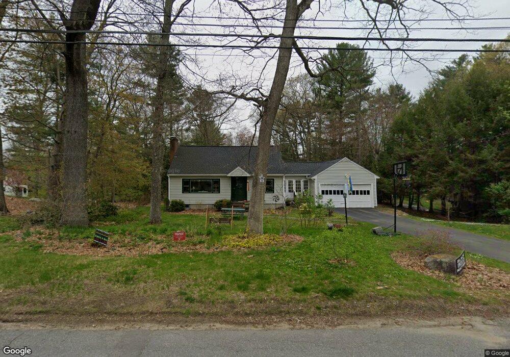
This home is located at 4 Mohegan Rd, Acton, MA 01720 and is currently estimated at $793,218, approximately $402 per square foot. 4 Mohegan Rd is a home located in Middlesex County with nearby schools including Acton-Boxborough Regional High School and Oak Meadow Montessori School.
Ownership History
Date
Name
Owned For
Owner Type
Purchase Details
Closed on
Jun 9, 2017
Sold by
Latto Douglas N and Latto Rose M
Bought by
Douglas & Rose Latto Ft
Current Estimated Value
Purchase Details
Closed on
Nov 7, 1985
Bought by
Latto Douglas N
Create a Home Valuation Report for This Property
The Home Valuation Report is an in-depth analysis detailing your home's value as well as a comparison with similar homes in the area
Home Values in the Area
Average Home Value in this Area
Purchase History
| Date | Buyer | Sale Price | Title Company |
|---|---|---|---|
| Douglas & Rose Latto Ft | -- | -- | |
| Latto Douglas N | -- | -- |
Source: Public Records
Mortgage History
| Date | Status | Borrower | Loan Amount |
|---|---|---|---|
| Previous Owner | Latto Douglas N | $100,000 | |
| Previous Owner | Latto Douglas N | $122,000 | |
| Previous Owner | Latto Douglas N | $109,000 |
Source: Public Records
Tax History
| Year | Tax Paid | Tax Assessment Tax Assessment Total Assessment is a certain percentage of the fair market value that is determined by local assessors to be the total taxable value of land and additions on the property. | Land | Improvement |
|---|---|---|---|---|
| 2025 | $10,311 | $601,200 | $313,400 | $287,800 |
| 2024 | $9,780 | $586,700 | $313,400 | $273,300 |
| 2023 | $9,804 | $558,300 | $285,000 | $273,300 |
| 2022 | $9,075 | $466,600 | $247,800 | $218,800 |
| 2021 | $8,760 | $433,000 | $229,400 | $203,600 |
| 2020 | $8,127 | $422,400 | $229,400 | $193,000 |
| 2019 | $7,804 | $402,900 | $229,400 | $173,500 |
| 2018 | $7,692 | $396,900 | $229,400 | $167,500 |
| 2017 | $7,565 | $396,900 | $229,400 | $167,500 |
| 2016 | $7,350 | $382,200 | $229,400 | $152,800 |
| 2015 | $7,268 | $381,500 | $229,400 | $152,100 |
| 2014 | $7,152 | $367,700 | $229,400 | $138,300 |
Source: Public Records
Map
Nearby Homes
- 5 Perkins Ln
- 60 Nashoba Rd
- 20 Joseph Reed Ln
- 79 Charter Rd
- 4 Littlefield Rd
- 235 Arlington St
- 18 Hayward Rd
- 246 Main St Unit 2
- 7 Kelley Rd
- 11 Braebrook
- 92 Willow St Unit 3
- 92 Willow St Unit 2
- 90 Willow St Unit 1
- 4 Omega Way
- 184 Main St Unit 3
- 33 Meadowbrook Rd
- 46 Taylor Rd
- 491 Main St
- 25 Nylander Way
- 129 Main St Unit 129
Your Personal Tour Guide
Ask me questions while you tour the home.