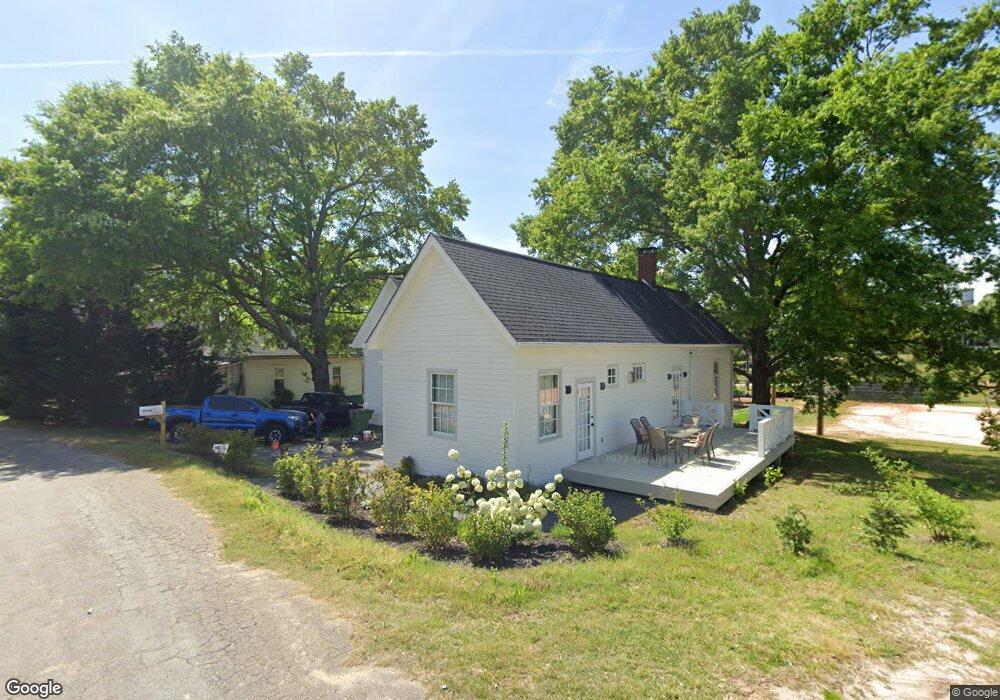
4 N Broad St Unit 4 Porterdale, GA 30014
Estimated Value: $200,000 - $266,339
2
Beds
2
Baths
1,526
Sq Ft
$162/Sq Ft
Est. Value
About This Home
This home is located at 4 N Broad St Unit 4, Porterdale, GA 30014 and is currently estimated at $246,585, approximately $161 per square foot. 4 N Broad St Unit 4 is a home located in Newton County with nearby schools including Middle Ridge Elementary School, Clements Middle School, and Newton High School.
Ownership History
Date
Name
Owned For
Owner Type
Purchase Details
Closed on
Feb 4, 2022
Sold by
Burnett Hugh
Bought by
Olivier Devon Nicole and Miller Brandon Lee
Current Estimated Value
Home Financials for this Owner
Home Financials are based on the most recent Mortgage that was taken out on this home.
Original Mortgage
$243,675
Outstanding Balance
$226,271
Interest Rate
3.55%
Mortgage Type
Cash
Estimated Equity
$20,314
Purchase Details
Closed on
May 24, 2017
Sold by
Boogery Cat Llc
Bought by
Burnett Hugh and Kelly Josephine
Purchase Details
Closed on
Feb 11, 2016
Sold by
Alexander James Lewis
Bought by
Boogery Cat Llc
Purchase Details
Closed on
Dec 13, 2012
Sold by
Norton Bill
Bought by
Alexander James Lewis
Create a Home Valuation Report for This Property
The Home Valuation Report is an in-depth analysis detailing your home's value as well as a comparison with similar homes in the area
Home Values in the Area
Average Home Value in this Area
Purchase History
| Date | Buyer | Sale Price | Title Company |
|---|---|---|---|
| Olivier Devon Nicole | $256,500 | -- | |
| Burnett Hugh | $50,000 | -- | |
| Boogery Cat Llc | $23,000 | -- | |
| Alexander James Lewis | $12,000 | -- |
Source: Public Records
Mortgage History
| Date | Status | Borrower | Loan Amount |
|---|---|---|---|
| Open | Olivier Devon Nicole | $243,675 |
Source: Public Records
Tax History Compared to Growth
Tax History
| Year | Tax Paid | Tax Assessment Tax Assessment Total Assessment is a certain percentage of the fair market value that is determined by local assessors to be the total taxable value of land and additions on the property. | Land | Improvement |
|---|---|---|---|---|
| 2024 | $3,790 | $102,640 | $10,000 | $92,640 |
| 2023 | $3,615 | $93,840 | $5,600 | $88,240 |
| 2022 | $2,968 | $78,120 | $5,600 | $72,520 |
| 2021 | $1,171 | $32,200 | $5,600 | $26,600 |
| 2020 | $580 | $21,160 | $5,600 | $15,560 |
| 2019 | $696 | $20,400 | $5,600 | $14,800 |
| 2018 | $645 | $18,800 | $5,600 | $13,200 |
| 2017 | $457 | $13,320 | $3,200 | $10,120 |
| 2016 | $452 | $13,160 | $3,200 | $9,960 |
| 2015 | $409 | $11,920 | $3,200 | $8,720 |
| 2014 | $218 | $12,840 | $0 | $0 |
Source: Public Records
Map
Nearby Homes
- 4 N Broad St
- 13 Poplar St
- 15 Poplar St
- 9 Poplar St
- 7 Poplar St
- 2800 Main St
- 19 Poplar St
- 5 Poplar St
- N N Broad St
- 0 Highway 81 Unit 8362907
- 0 Highway 81 Unit 5775647
- 0 Highway 81 Unit 6956473
- 0 Highway 81 Unit 8804130
- 0 Highway 81 Unit 7639660
- 21 Poplar St
- 3 Poplar St
- 24 Poplar St
- 22 Poplar St
- 26 Poplar St
- 20 Poplar St