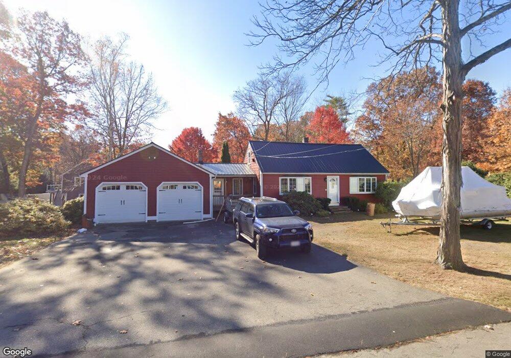
4 N Martin Rd Amesbury, MA 01913
Estimated Value: $586,000 - $651,000
4
Beds
2
Baths
1,579
Sq Ft
$392/Sq Ft
Est. Value
About This Home
This home is located at 4 N Martin Rd, Amesbury, MA 01913 and is currently estimated at $618,430, approximately $391 per square foot. 4 N Martin Rd is a home located in Essex County with nearby schools including Amesbury High School and Amesbury Seventh-Day Adventist School.
Ownership History
Date
Name
Owned For
Owner Type
Purchase Details
Closed on
Jun 6, 2024
Sold by
Mills Fred W and Mills Mary E
Bought by
Mills Irt and Boguzewski
Current Estimated Value
Purchase Details
Closed on
Mar 4, 1994
Sold by
Mills Fred W
Bought by
Bradku Rt
Create a Home Valuation Report for This Property
The Home Valuation Report is an in-depth analysis detailing your home's value as well as a comparison with similar homes in the area
Home Values in the Area
Average Home Value in this Area
Purchase History
| Date | Buyer | Sale Price | Title Company |
|---|---|---|---|
| Mills Irt | -- | None Available | |
| Mills Irt | -- | None Available | |
| Bradku Rt | $20,000 | -- | |
| Bradku Rt | $20,000 | -- |
Source: Public Records
Mortgage History
| Date | Status | Borrower | Loan Amount |
|---|---|---|---|
| Previous Owner | Bradku Rt | $137,925 |
Source: Public Records
Tax History Compared to Growth
Tax History
| Year | Tax Paid | Tax Assessment Tax Assessment Total Assessment is a certain percentage of the fair market value that is determined by local assessors to be the total taxable value of land and additions on the property. | Land | Improvement |
|---|---|---|---|---|
| 2025 | $8,091 | $528,800 | $237,600 | $291,200 |
| 2024 | $8,061 | $515,400 | $224,200 | $291,200 |
| 2023 | $7,136 | $436,700 | $194,900 | $241,800 |
| 2022 | $6,602 | $373,200 | $169,500 | $203,700 |
| 2021 | $6,033 | $330,600 | $130,900 | $199,700 |
| 2020 | $5,458 | $317,700 | $125,900 | $191,800 |
| 2019 | $5,487 | $298,700 | $125,900 | $172,800 |
| 2018 | $5,503 | $289,800 | $119,800 | $170,000 |
| 2017 | $5,341 | $267,700 | $119,800 | $147,900 |
| 2016 | $5,206 | $256,700 | $119,800 | $136,900 |
| 2015 | $5,186 | $252,500 | $119,800 | $132,700 |
| 2014 | $4,834 | $230,500 | $119,800 | $110,700 |
Source: Public Records
Map
Nearby Homes
- 13 Bailey Pond Ln Unit 13
- 47 Cutter Ln Unit 47
- 19 Cutter Ln Unit 19
- 49 W Greenwood St
- 28 Beacon St
- The Beacon Plan at The Village At Bailey's Pond
- The Essex Plan at The Village At Bailey's Pond
- The Whaler Plan at The Village At Bailey's Pond
- The Bailey Plan at The Village At Bailey's Pond
- 31 Whitter Meadows Dr Unit 31
- 60 Merrimac St Unit 907
- 60 Merrimac St Unit 604
- 5 Moncrief St Unit 5
- 4 Greenwood St
- 35 Merrimac St
- 188 Lions Mouth Rd
- 8 Riverview Heights
- 18 E Greenwood St
- 356 Main St
- 93 Friend St