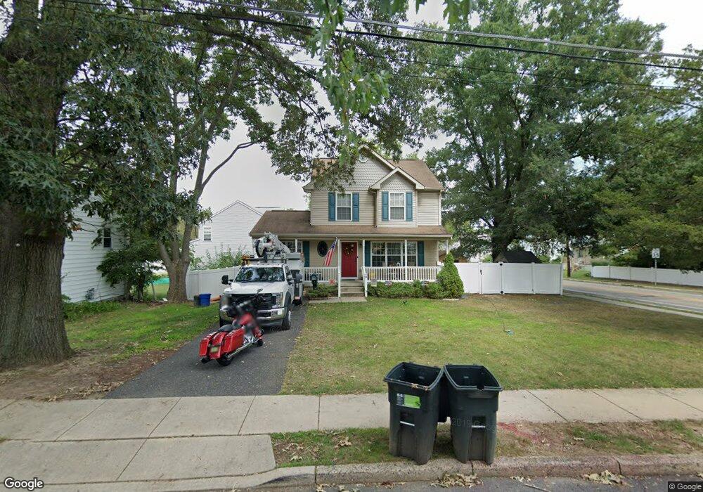
4 N Rowand Ave Runnemede, NJ 08078
Estimated Value: $385,000 - $407,509
--
Bed
--
Bath
1,776
Sq Ft
$224/Sq Ft
Est. Value
About This Home
This home is located at 4 N Rowand Ave, Runnemede, NJ 08078 and is currently estimated at $398,377, approximately $224 per square foot. 4 N Rowand Ave is a home located in Camden County with nearby schools including Mary E. Volz Elementary School, Bingham Elementary School, and Triton High School.
Ownership History
Date
Name
Owned For
Owner Type
Purchase Details
Closed on
Oct 15, 2004
Sold by
Kojeski Const Co Inc
Bought by
Kohlepp Erick M and Kohlepp Tracy E
Current Estimated Value
Home Financials for this Owner
Home Financials are based on the most recent Mortgage that was taken out on this home.
Original Mortgage
$199,500
Outstanding Balance
$98,604
Interest Rate
5.74%
Mortgage Type
Purchase Money Mortgage
Estimated Equity
$299,773
Purchase Details
Closed on
Apr 28, 2004
Sold by
Alcoa Real Estate Assocs
Bought by
Kojeski Const Co Inc
Create a Home Valuation Report for This Property
The Home Valuation Report is an in-depth analysis detailing your home's value as well as a comparison with similar homes in the area
Home Values in the Area
Average Home Value in this Area
Purchase History
| Date | Buyer | Sale Price | Title Company |
|---|---|---|---|
| Kohlepp Erick M | $210,000 | -- | |
| Kojeski Const Co Inc | $91,000 | -- |
Source: Public Records
Mortgage History
| Date | Status | Borrower | Loan Amount |
|---|---|---|---|
| Open | Kohlepp Erick M | $199,500 |
Source: Public Records
Tax History Compared to Growth
Tax History
| Year | Tax Paid | Tax Assessment Tax Assessment Total Assessment is a certain percentage of the fair market value that is determined by local assessors to be the total taxable value of land and additions on the property. | Land | Improvement |
|---|---|---|---|---|
| 2025 | $8,688 | $192,800 | $44,000 | $148,800 |
| 2024 | $8,423 | $192,800 | $44,000 | $148,800 |
| 2023 | $8,423 | $192,800 | $44,000 | $148,800 |
| 2022 | $8,155 | $192,800 | $44,000 | $148,800 |
| 2021 | $7,963 | $192,800 | $44,000 | $148,800 |
| 2020 | $7,884 | $192,800 | $44,000 | $148,800 |
| 2019 | $7,739 | $192,800 | $44,000 | $148,800 |
| 2018 | $7,591 | $192,800 | $44,000 | $148,800 |
| 2017 | $7,396 | $192,800 | $44,000 | $148,800 |
| 2016 | $7,303 | $192,800 | $44,000 | $148,800 |
| 2015 | $7,324 | $192,800 | $44,000 | $148,800 |
| 2014 | $7,230 | $192,800 | $44,000 | $148,800 |
Source: Public Records
Map
Nearby Homes
- 525 W Evesham Rd
- 924 W Evesham Rd
- 37 Whaler Ave
- 41 Whaler Ave
- 43 Whaler Ave
- 45 Whaler Ave
- 47 Whaler Dr
- 21 S Oakland Ave
- 420 Zane Ave
- 405 Melvin Ave
- 524 Hirsch Ave
- 115 W 1st Ave
- 600 Williams Ave
- 14 E Evesham Rd
- 613 Williams Terrace
- 30 12th Ave
- 516 Huntington Ave
- 206 W 5th Ave
- 1100 Central Ave
- 39 E 2nd Ave
- 421 W Clements Bridge Rd
- 0 N Rowand Ave Unit 1004666748
- 419 W Clements Bridge Rd
- 16 N Rowand Ave
- 422 W Clements Bridge Rd
- 501 W Clements Bridge Rd
- 432 W Clements Bridge Rd
- 510 W Clements Bridge Rd
- 415 W Clements Bridge Rd
- 511 W Clements Bridge Rd
- 15 N Rowand Ave
- 28 N Rowand Ave
- 408 W Clements Bridge Rd
- 408 W Clements Bridge Rd
- 514 W Clements Bridge Rd
- 24 S Rowand Ave
- 19 S Rowand Ave
- 36 N Rowand Ave
- 401 W Clements Bridge Rd
- 25 N Rowand Ave