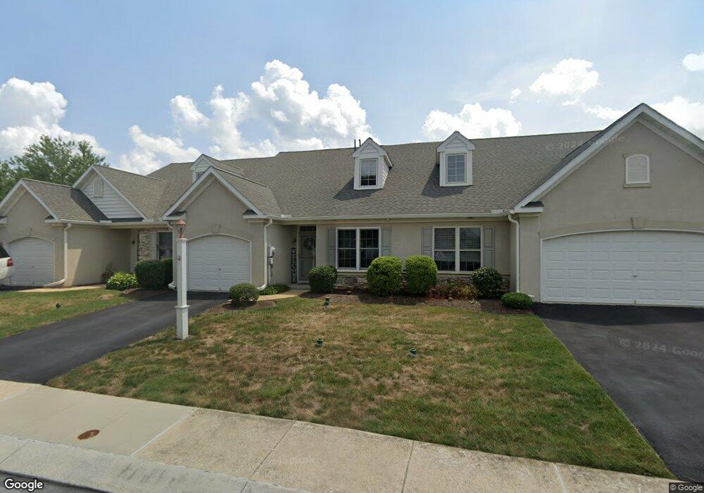
4 Oldham Ct Unit 70 Lancaster, PA 17602
Bridgeport NeighborhoodEstimated Value: $339,711 - $361,000
3
Beds
3
Baths
1,815
Sq Ft
$195/Sq Ft
Est. Value
About This Home
This home is located at 4 Oldham Ct Unit 70, Lancaster, PA 17602 and is currently estimated at $353,928, approximately $195 per square foot. 4 Oldham Ct Unit 70 is a home located in Lancaster County with nearby schools including Lampeter Elementary School, Hans Herr Elementary School, and Martin Meylin Middle School.
Ownership History
Date
Name
Owned For
Owner Type
Purchase Details
Closed on
Jun 13, 2019
Sold by
Bryant Conor and Watson Alexis
Bought by
Sheaffer Sandra L
Current Estimated Value
Home Financials for this Owner
Home Financials are based on the most recent Mortgage that was taken out on this home.
Original Mortgage
$15,000
Outstanding Balance
$13,162
Interest Rate
4%
Mortgage Type
New Conventional
Estimated Equity
$340,766
Purchase Details
Closed on
Nov 16, 2018
Sold by
Schreibel Deborah D
Bought by
Bryant Conor and Watson Alexis
Purchase Details
Closed on
Jun 26, 2015
Sold by
Lutz Carla L
Bought by
Schreibel Robert L and Schreibel Deborah D
Home Financials for this Owner
Home Financials are based on the most recent Mortgage that was taken out on this home.
Original Mortgage
$100,000
Interest Rate
3.84%
Mortgage Type
New Conventional
Create a Home Valuation Report for This Property
The Home Valuation Report is an in-depth analysis detailing your home's value as well as a comparison with similar homes in the area
Home Values in the Area
Average Home Value in this Area
Purchase History
| Date | Buyer | Sale Price | Title Company |
|---|---|---|---|
| Sheaffer Sandra L | $220,000 | None Available | |
| Bryant Conor | $185,000 | None Available | |
| Schreibel Robert L | $180,000 | None Available |
Source: Public Records
Mortgage History
| Date | Status | Borrower | Loan Amount |
|---|---|---|---|
| Open | Sheaffer Sandra L | $15,000 | |
| Previous Owner | Schreibel Robert L | $100,000 |
Source: Public Records
Tax History
| Year | Tax Paid | Tax Assessment Tax Assessment Total Assessment is a certain percentage of the fair market value that is determined by local assessors to be the total taxable value of land and additions on the property. | Land | Improvement |
|---|---|---|---|---|
| 2025 | $4,179 | $188,900 | -- | $188,900 |
| 2024 | $4,179 | $188,900 | -- | $188,900 |
| 2023 | $4,087 | $188,900 | $0 | $188,900 |
| 2022 | $4,025 | $188,900 | $0 | $188,900 |
| 2021 | $3,930 | $188,900 | $0 | $188,900 |
| 2020 | $3,930 | $188,900 | $0 | $188,900 |
| 2019 | $3,877 | $188,900 | $0 | $188,900 |
| 2018 | $3,037 | $188,900 | $0 | $188,900 |
| 2017 | $4,142 | $164,500 | $0 | $164,500 |
| 2016 | $4,142 | $164,500 | $0 | $164,500 |
| 2015 | $812 | $164,500 | $0 | $164,500 |
| 2014 | $3,117 | $164,500 | $0 | $164,500 |
Source: Public Records
Map
Nearby Homes
- 806 Lightfoot Dr
- 257 Longfellow Dr
- 133 Conestoga Blvd
- 1829 Krystle Dr
- 38 Conestoga Dr
- 8 White Tail Path
- 32 Greenfield Rd
- 516 Conestoga Greenway Trail
- 647 S Franklin St
- 1036 E King St
- 47 Riverside Ave
- 83 Highland Dr
- 980 E Orange St
- 911 E King St
- 464 S Ann St
- 2009 Millstream Rd
- 70 Chesapeake St
- 121 S Marshall St
- 352 Dohner Dr Unit 69
- 227 S Ann St
Your Personal Tour Guide
Ask me questions while you tour the home.