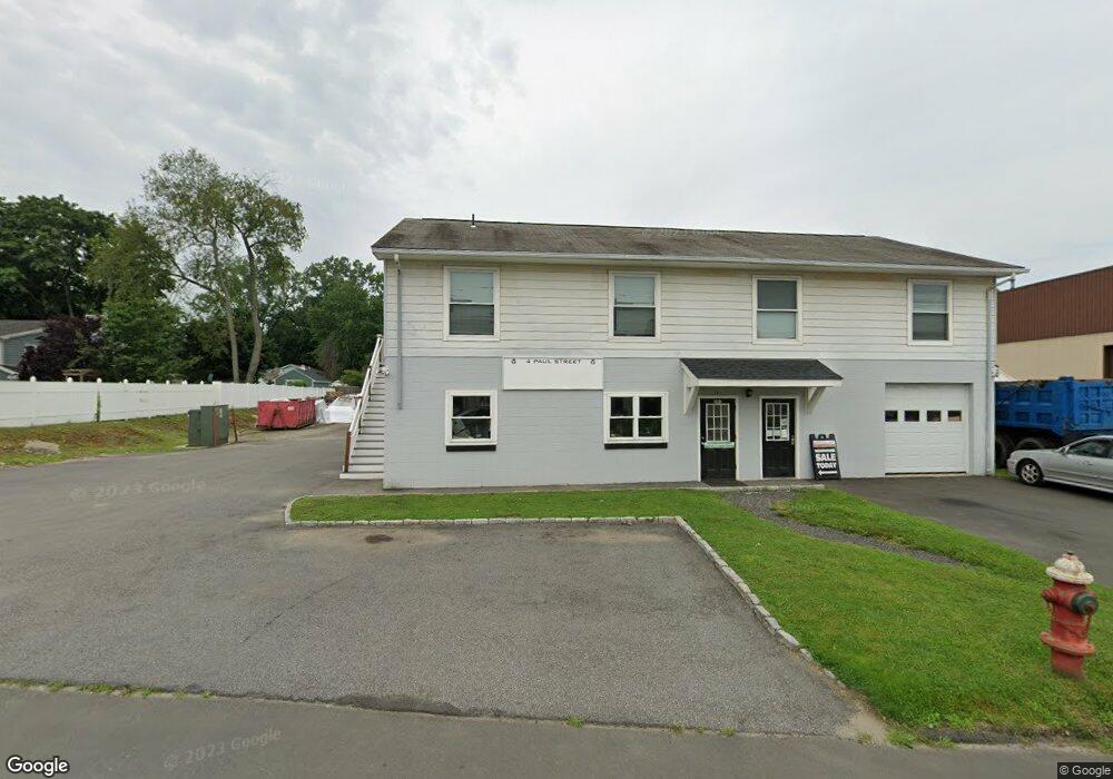
4 Paul St Bethel, CT 06801
Estimated Value: $1,091,983
--
Bed
--
Bath
11,368
Sq Ft
$96/Sq Ft
Est. Value
About This Home
This home is located at 4 Paul St, Bethel, CT 06801 and is currently estimated at $1,091,983, approximately $96 per square foot. 4 Paul St is a home located in Fairfield County with nearby schools including R.M.T. Johnson School, Bethel Middle School, and Bethel High School.
Ownership History
Date
Name
Owned For
Owner Type
Purchase Details
Closed on
Sep 10, 2021
Sold by
Codfish Hill Const Llc
Bought by
Mallory Square Llc
Current Estimated Value
Purchase Details
Closed on
Nov 6, 2020
Sold by
Codfish Hl Const Llc
Bought by
Mallory Square Llc
Purchase Details
Closed on
Aug 23, 2019
Sold by
Schulz Alain J and Schulz Patrick
Bought by
Codfish Hill Construction
Home Financials for this Owner
Home Financials are based on the most recent Mortgage that was taken out on this home.
Original Mortgage
$483,750
Interest Rate
3.7%
Mortgage Type
Purchase Money Mortgage
Purchase Details
Closed on
Sep 28, 2012
Sold by
Christine E Schulz Ret and Schulz Christine E
Bought by
Schulz Alain J and Schulz Patrick
Purchase Details
Closed on
Jan 29, 2009
Sold by
Engelman Lawrence and Schultz Christiane
Bought by
Schultz Christiane
Create a Home Valuation Report for This Property
The Home Valuation Report is an in-depth analysis detailing your home's value as well as a comparison with similar homes in the area
Home Values in the Area
Average Home Value in this Area
Purchase History
| Date | Buyer | Sale Price | Title Company |
|---|---|---|---|
| Mallory Square Llc | -- | None Available | |
| Mallory Square Llc | -- | None Available | |
| Codfish Hill Construction | $645,000 | -- | |
| Schulz Alain J | -- | -- | |
| Schultz Christiane | -- | -- |
Source: Public Records
Mortgage History
| Date | Status | Borrower | Loan Amount |
|---|---|---|---|
| Previous Owner | Codfish Hill Construction | $483,750 |
Source: Public Records
Tax History Compared to Growth
Tax History
| Year | Tax Paid | Tax Assessment Tax Assessment Total Assessment is a certain percentage of the fair market value that is determined by local assessors to be the total taxable value of land and additions on the property. | Land | Improvement |
|---|---|---|---|---|
| 2024 | $12,560 | $430,570 | $109,200 | $321,370 |
| 2023 | $12,241 | $430,570 | $109,200 | $321,370 |
| 2022 | $13,814 | $399,350 | $105,000 | $294,350 |
| 2021 | $13,682 | $399,350 | $105,000 | $294,350 |
| 2020 | $13,474 | $399,350 | $105,000 | $294,350 |
| 2019 | $13,342 | $399,350 | $105,000 | $294,350 |
| 2018 | $13,127 | $399,350 | $105,000 | $294,350 |
| 2017 | $12,058 | $366,730 | $105,000 | $261,730 |
| 2016 | $11,798 | $366,730 | $105,000 | $261,730 |
| 2015 | $11,801 | $366,730 | $105,000 | $261,730 |
| 2014 | $11,776 | $366,730 | $105,000 | $261,730 |
Source: Public Records
Map
Nearby Homes
- 18 Penny Ln Unit 18
- 6 Mansfield St
- 10 Fleetwood Ave
- 6 Paulding Terrace
- 10 South St Unit 85
- 28 Drummers Ln
- 104 Coalpit Hill Rd Unit B8
- 81 Coalpit Hill Rd Unit B
- 6 Henry St
- 10 Hunting Ridge Ln Unit 10
- 18 Hidden Brook Trail Unit 18
- 27 Crows Nest Ln Unit 7E
- 47 Liberty Ave
- 50-52 Knollwood Dr
- 15A Mountainville Rd
- 32 Hickok Ave
- 21 Oven Rock Rd
- 39 Main St Unit 2-2
- 63 Great Hill Dr Unit 63
- 32 Crows Nest Ln Unit 14