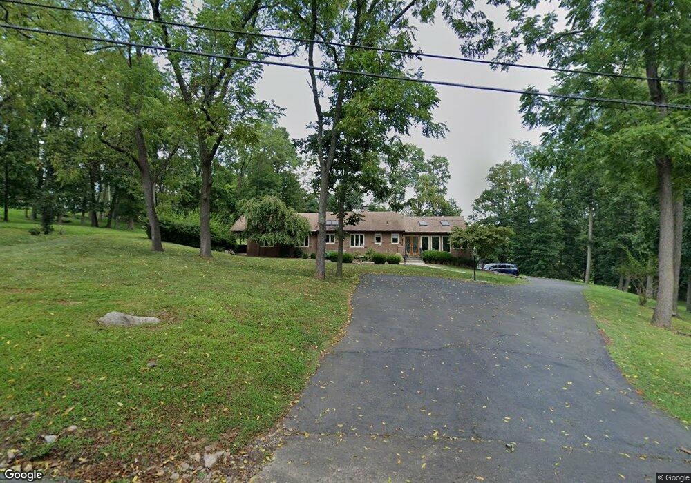
4 Poor Farm Rd Pennington, NJ 08534
Estimated Value: $702,000 - $905,000
3
Beds
3
Baths
2,768
Sq Ft
$305/Sq Ft
Est. Value
About This Home
This home is located at 4 Poor Farm Rd, Pennington, NJ 08534 and is currently estimated at $844,977, approximately $305 per square foot. 4 Poor Farm Rd is a home located in Mercer County with nearby schools including Hopewell Valley Central High School.
Ownership History
Date
Name
Owned For
Owner Type
Purchase Details
Closed on
Mar 27, 2020
Sold by
Merzena Kathryn G and Last Will And Testament Of Myr
Bought by
Guthrie William D and Gutherie Evelyn R
Current Estimated Value
Home Financials for this Owner
Home Financials are based on the most recent Mortgage that was taken out on this home.
Original Mortgage
$325,000
Interest Rate
3.5%
Mortgage Type
New Conventional
Purchase Details
Closed on
Dec 15, 2010
Sold by
Faherty Lynda A and Faherty James W
Bought by
Feucht Robert and Feucht Myra
Create a Home Valuation Report for This Property
The Home Valuation Report is an in-depth analysis detailing your home's value as well as a comparison with similar homes in the area
Home Values in the Area
Average Home Value in this Area
Purchase History
| Date | Buyer | Sale Price | Title Company |
|---|---|---|---|
| Guthrie William D | $473,000 | Foundation Title Llc | |
| Feucht Robert | $650,000 | None Available |
Source: Public Records
Mortgage History
| Date | Status | Borrower | Loan Amount |
|---|---|---|---|
| Previous Owner | Guthrie William D | $325,000 |
Source: Public Records
Tax History Compared to Growth
Tax History
| Year | Tax Paid | Tax Assessment Tax Assessment Total Assessment is a certain percentage of the fair market value that is determined by local assessors to be the total taxable value of land and additions on the property. | Land | Improvement |
|---|---|---|---|---|
| 2025 | $16,732 | $530,000 | $307,600 | $222,400 |
| 2024 | $16,197 | $530,000 | $307,600 | $222,400 |
| 2023 | $16,197 | $530,000 | $307,600 | $222,400 |
| 2022 | $15,863 | $530,000 | $307,600 | $222,400 |
| 2021 | $16,213 | $530,000 | $307,600 | $222,400 |
| 2020 | $15,571 | $530,000 | $307,600 | $222,400 |
| 2019 | $17,784 | $610,700 | $307,600 | $303,100 |
| 2018 | $17,454 | $610,700 | $307,600 | $303,100 |
| 2017 | $16,977 | $610,700 | $307,600 | $303,100 |
| 2016 | $16,049 | $610,700 | $307,600 | $303,100 |
| 2015 | $15,964 | $610,700 | $307,600 | $303,100 |
| 2014 | $15,628 | $610,700 | $307,600 | $303,100 |
Source: Public Records
Map
Nearby Homes
- 101 Harbourton Woodsville Rd
- 12 Poor Farm Rd
- 72 Poor Farm Rd
- 12 Lynnbrook Dr
- 16 New Rd
- 133 Woosamonsa Rd
- 1602 Harbourton Rocktown Rd
- 4 New Rd
- 0 Harbourton Mount Airy Rd Unit NJME2037478
- 402 Lambertville Hopewell Rd
- 402 Lambertville - Hopewell Rd
- 6 Chase Hollow Rd
- 1442 Trenton Harbourton Rd
- 304 Route 31
- 17 Woosamonsa Rd
- 309 Pennington - Harbourton Rd
- 1407 Trenton Harbourton Rd
- 9 Woodsville Rd
- 18 Woolsey Ct
- 81 Titus Mill Rd
- 71 Harbourton Woodsville Rd
- 78 Harbourton Woodsville Rd
- 68 Harbourton Woodsville Rd
- 69 Harbourton Woodsville Rd
- 8 Poor Farm Rd
- 75 Harbourton Woodsville Rd
- 63 Harbourton Woodsville Rd
- 7 Poor Farm Rd
- 73 Harbourton Woodsville Rd
- 16 Poor Farm Rd
- 11 Poor Farm Rd
- 62 Harbourton Woodsville Rd
- 20 Poor Farm Rd
- 60 Harbourton Woodsville Rd
- 24 Poor Farm Rd
- 15 Poor Farm Rd
- 3 Harbourton Ridge Dr
- 1 Harbourton Ridge Dr
- 5 Harbourton Ridge Dr
- 55 Harbourton Woodsville Rd