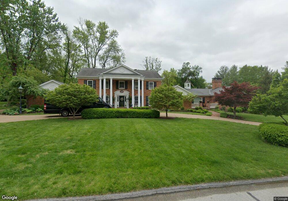
4 Portland Dr Saint Louis, MO 63131
Estimated Value: $1,911,000 - $2,702,000
5
Beds
5
Baths
5,472
Sq Ft
$416/Sq Ft
Est. Value
About This Home
This home is located at 4 Portland Dr, Saint Louis, MO 63131 and is currently estimated at $2,276,563, approximately $416 per square foot. 4 Portland Dr is a home located in St. Louis County with nearby schools including Conway Elementary, Ladue 5th Grade Center, and Ladue Middle.
Ownership History
Date
Name
Owned For
Owner Type
Purchase Details
Closed on
Sep 10, 2010
Sold by
Bader Richard S and Bader Victoria
Bought by
Twardowski Gregory J and Twardowski Mary C
Current Estimated Value
Home Financials for this Owner
Home Financials are based on the most recent Mortgage that was taken out on this home.
Original Mortgage
$990,000
Outstanding Balance
$651,401
Interest Rate
4.37%
Mortgage Type
New Conventional
Estimated Equity
$1,625,162
Create a Home Valuation Report for This Property
The Home Valuation Report is an in-depth analysis detailing your home's value as well as a comparison with similar homes in the area
Home Values in the Area
Average Home Value in this Area
Purchase History
| Date | Buyer | Sale Price | Title Company |
|---|---|---|---|
| Twardowski Gregory J | $1,350,000 | None Available |
Source: Public Records
Mortgage History
| Date | Status | Borrower | Loan Amount |
|---|---|---|---|
| Open | Twardowski Gregory J | $990,000 |
Source: Public Records
Tax History Compared to Growth
Tax History
| Year | Tax Paid | Tax Assessment Tax Assessment Total Assessment is a certain percentage of the fair market value that is determined by local assessors to be the total taxable value of land and additions on the property. | Land | Improvement |
|---|---|---|---|---|
| 2025 | $19,932 | $332,750 | $125,060 | $207,690 |
| 2024 | $19,932 | $291,720 | $115,440 | $176,280 |
| 2023 | $19,909 | $291,720 | $115,440 | $176,280 |
| 2022 | $19,364 | $272,860 | $96,200 | $176,660 |
| 2021 | $19,251 | $272,860 | $96,200 | $176,660 |
| 2020 | $16,215 | $248,870 | $95,630 | $153,240 |
| 2019 | $15,972 | $248,870 | $95,630 | $153,240 |
| 2018 | $16,678 | $239,780 | $86,070 | $153,710 |
| 2017 | $16,612 | $239,780 | $86,070 | $153,710 |
| 2016 | $16,170 | $225,640 | $76,510 | $149,130 |
| 2015 | $15,400 | $225,640 | $76,510 | $149,130 |
| 2014 | $16,896 | $240,090 | $47,180 | $192,910 |
Source: Public Records
Map
Nearby Homes
- 436 Tregaron Place
- 22 Countryside Ln
- 11255 Talamore Cir Unit 13
- 10444 Litzsinger Rd
- 108 Frontenac Forest
- 152 Frontenac Forest
- 1139 Enclave Ct
- 1131 Enclave Ct
- 10 Westfield Ln
- 11712 Westham Dr
- 26 Huntleigh Woods
- 11758 Westham Dr
- 1741 Pine Hill Dr
- 1737 Folkstone Dr
- 1728 Folkstone Dr
- 5 W Point Ln
- 10268 Ridgelynn Dr
- 723 Oak Valley Dr
- 824 Bluespring Ln
- 2409 N Ballas Rd