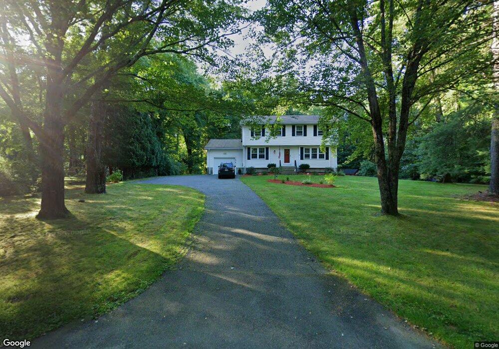
4 Sandra Cir Mendon, MA 01756
Estimated Value: $603,765 - $784,000
4
Beds
3
Baths
1,832
Sq Ft
$364/Sq Ft
Est. Value
About This Home
This home is located at 4 Sandra Cir, Mendon, MA 01756 and is currently estimated at $666,441, approximately $363 per square foot. 4 Sandra Cir is a home located in Worcester County with nearby schools including Nipmuc Regional High School and Our Lady of the Valley Regional School.
Ownership History
Date
Name
Owned For
Owner Type
Purchase Details
Closed on
Oct 14, 1997
Sold by
Cutliffe Laurence R and Cutliffe Elizabeth H
Bought by
Jacaruso James N and Jacaruso Natalie R
Current Estimated Value
Home Financials for this Owner
Home Financials are based on the most recent Mortgage that was taken out on this home.
Original Mortgage
$130,000
Interest Rate
7.52%
Mortgage Type
Purchase Money Mortgage
Purchase Details
Closed on
Jan 3, 1994
Sold by
Hall Eddy J and Hall Florence P
Bought by
Cutliffe Laurence and Cutliffe Elizabeth
Create a Home Valuation Report for This Property
The Home Valuation Report is an in-depth analysis detailing your home's value as well as a comparison with similar homes in the area
Home Values in the Area
Average Home Value in this Area
Purchase History
| Date | Buyer | Sale Price | Title Company |
|---|---|---|---|
| Jacaruso James N | $205,950 | -- | |
| Cutliffe Laurence | $167,200 | -- |
Source: Public Records
Mortgage History
| Date | Status | Borrower | Loan Amount |
|---|---|---|---|
| Open | Cutliffe Laurence | $100,000 | |
| Open | Cutliffe Laurence | $150,000 | |
| Closed | Cutliffe Laurence | $51,000 | |
| Closed | Cutliffe Laurence | $130,000 |
Source: Public Records
Tax History
| Year | Tax Paid | Tax Assessment Tax Assessment Total Assessment is a certain percentage of the fair market value that is determined by local assessors to be the total taxable value of land and additions on the property. | Land | Improvement |
|---|---|---|---|---|
| 2025 | $7,194 | $537,300 | $146,300 | $391,000 |
| 2024 | $7,129 | $520,000 | $140,600 | $379,400 |
| 2023 | $6,891 | $472,000 | $125,500 | $346,500 |
| 2022 | $6,733 | $436,900 | $122,300 | $314,600 |
| 2021 | $6,415 | $382,100 | $118,600 | $263,500 |
| 2020 | $6,082 | $363,100 | $118,600 | $244,500 |
| 2019 | $5,938 | $354,700 | $115,200 | $239,500 |
| 2018 | $5,744 | $338,700 | $115,200 | $223,500 |
| 2017 | $5,733 | $323,000 | $115,200 | $207,800 |
| 2016 | $5,687 | $329,700 | $122,300 | $207,400 |
| 2015 | $5,210 | $325,400 | $122,300 | $203,100 |
| 2014 | $4,969 | $310,200 | $118,500 | $191,700 |
Source: Public Records
Map
Nearby Homes
- 25 Dunny Cove Ln
- 13A Asylum St
- 27 Taft Ave
- 76 Pouts Ln
- 35 Pouts Ln
- 44 Pouts Ln
- 23 Uxbridge Rd
- 53 Asylum St
- 14 Kelley Rd
- 13 Kelley Rd
- 223 Mendon St
- 10 Wesley Dr
- 55 Northbridge Rd
- 183 Blackstone St
- 8 Washington St
- 26 Maple St
- 218 E Hartford Ave Unit 218
- 220 Millville Rd
- 7 Jewell Crossing
- 17 Forest Park Dr
Your Personal Tour Guide
Ask me questions while you tour the home.