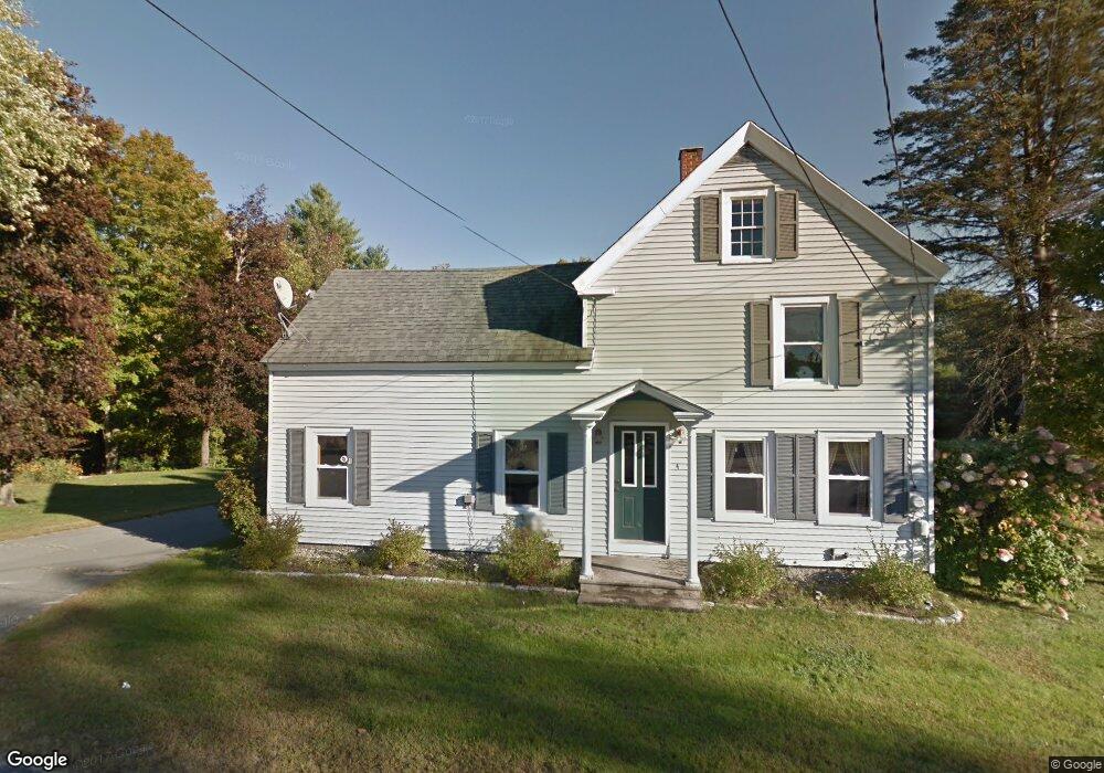
4 Short St Porter, ME 04068
Estimated Value: $269,000 - $379,000
3
Beds
2
Baths
1,800
Sq Ft
$184/Sq Ft
Est. Value
About This Home
This home is located at 4 Short St, Porter, ME 04068 and is currently estimated at $330,933, approximately $183 per square foot. 4 Short St is a home located in Oxford County.
Ownership History
Date
Name
Owned For
Owner Type
Purchase Details
Closed on
Sep 23, 2015
Sold by
Barsanti Jenilee M and Barsanti Philip R
Bought by
Schroeder Eric and Schroeder Colleen
Current Estimated Value
Home Financials for this Owner
Home Financials are based on the most recent Mortgage that was taken out on this home.
Original Mortgage
$130,000
Outstanding Balance
$101,754
Interest Rate
3.97%
Mortgage Type
Commercial
Estimated Equity
$229,179
Purchase Details
Closed on
Oct 30, 2008
Sold by
Mclucas Richard C
Bought by
Barsanti Janilee M and Barsanti Philip R
Create a Home Valuation Report for This Property
The Home Valuation Report is an in-depth analysis detailing your home's value as well as a comparison with similar homes in the area
Home Values in the Area
Average Home Value in this Area
Purchase History
| Date | Buyer | Sale Price | Title Company |
|---|---|---|---|
| Schroeder Eric | -- | -- | |
| Barsanti Janilee M | -- | -- |
Source: Public Records
Mortgage History
| Date | Status | Borrower | Loan Amount |
|---|---|---|---|
| Open | Schroeder Eric | $130,000 |
Source: Public Records
Tax History Compared to Growth
Tax History
| Year | Tax Paid | Tax Assessment Tax Assessment Total Assessment is a certain percentage of the fair market value that is determined by local assessors to be the total taxable value of land and additions on the property. | Land | Improvement |
|---|---|---|---|---|
| 2025 | $2,407 | $248,100 | $32,000 | $216,100 |
| 2024 | $2,721 | $228,676 | $44,142 | $184,534 |
| 2023 | $2,483 | $141,300 | $28,600 | $112,700 |
| 2022 | $2,345 | $141,294 | $28,589 | $112,705 |
| 2021 | $2,345 | $141,294 | $28,589 | $112,705 |
| 2020 | $2,300 | $141,294 | $28,589 | $112,705 |
| 2019 | $2,381 | $141,294 | $28,589 | $112,705 |
| 2018 | $2,381 | $141,294 | $28,589 | $112,705 |
| 2017 | $2,345 | $141,294 | $28,589 | $112,705 |
| 2016 | $2,134 | $141,294 | $28,589 | $112,705 |
| 2014 | $1,678 | $124,305 | $36,565 | $87,740 |
| 2013 | $1,678 | $124,305 | $36,565 | $87,740 |
Source: Public Records
Map
Nearby Homes
- R3-32 Ossipee Trail
- 206 Gilman Rd
- 62 Eastman Hill Rd
- 122 Ossipee Trail
- 0 S River Ln Unit 1641807
- 00 Pratt Rd
- 1108 Ossipee Trail
- 12 Main St
- 32 Summer St
- 248 Spec Pond Rd
- 35 Pine St
- 185 Huntress Bridge Rd
- 187 Huntress Bridge Rd
- 8 Pennie Ln
- 761 Pendexter Rd
- Lot #00 North Rd
- Lot# 01 North Rd
- Lot #02 North Rd
- 11 Penny Ln
- 266 S Hiram Rd
- 539 Ossipee Trail
- 543 Ossipee Trail
- 552 Ossipee Trail
- 535 Ossipee Trail
- 555 Ossipee Trail
- 0 Route 160 Rd N Unit 747704
- 0 Route 160 Rd N Unit 622337
- 0 Route 160 Rd N Unit 352479
- 0 Route 160 Rd N Unit 309151
- 0 Route 160 Rd N Unit 306232
- 0 Route 160 Rd N Unit 208078
- 0 Rte 160 Rd N Unit 208422
- 0 Route 160 Rd N Unit 943026
- 0 Rte 160 Rd N Unit 1066131
- 530 Ossipee Trail
- R7-15-0 North Rd
- 0 Route 25
- 9 North Rd
- 565 Ossipee Trail
- 561 Ossipee Trail