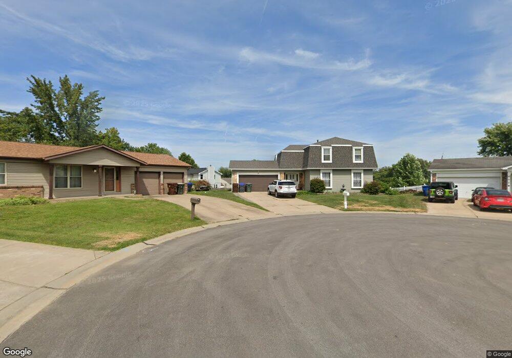
4 Spencer Path Ct Saint Peters, MO 63376
Estimated Value: $352,898 - $384,000
4
Beds
4
Baths
2,080
Sq Ft
$175/Sq Ft
Est. Value
About This Home
This home is located at 4 Spencer Path Ct, Saint Peters, MO 63376 and is currently estimated at $363,975, approximately $174 per square foot. 4 Spencer Path Ct is a home located in St. Charles County with nearby schools including Hawthorn Elementary School, Dr. Bernard J. Dubray Middle School, and Fort Zumwalt East High School.
Ownership History
Date
Name
Owned For
Owner Type
Purchase Details
Closed on
Aug 30, 2012
Sold by
Federal National Mortgage Association
Bought by
Mcadams Jared and Mcadams Laura
Current Estimated Value
Home Financials for this Owner
Home Financials are based on the most recent Mortgage that was taken out on this home.
Original Mortgage
$158,332
Outstanding Balance
$109,145
Interest Rate
3.49%
Mortgage Type
VA
Estimated Equity
$254,830
Purchase Details
Closed on
Dec 7, 2011
Sold by
Unger James H and Unger Linda L
Bought by
Federal National Mortgage Association
Create a Home Valuation Report for This Property
The Home Valuation Report is an in-depth analysis detailing your home's value as well as a comparison with similar homes in the area
Home Values in the Area
Average Home Value in this Area
Purchase History
| Date | Buyer | Sale Price | Title Company |
|---|---|---|---|
| Mcadams Jared | $158,332 | None Available | |
| Federal National Mortgage Association | $115,564 | None Available |
Source: Public Records
Mortgage History
| Date | Status | Borrower | Loan Amount |
|---|---|---|---|
| Open | Mcadams Jared | $158,332 |
Source: Public Records
Tax History
| Year | Tax Paid | Tax Assessment Tax Assessment Total Assessment is a certain percentage of the fair market value that is determined by local assessors to be the total taxable value of land and additions on the property. | Land | Improvement |
|---|---|---|---|---|
| 2025 | $3,920 | $59,741 | -- | -- |
| 2023 | $3,916 | $54,984 | $0 | $0 |
| 2022 | $3,447 | $45,317 | $0 | $0 |
| 2021 | $3,442 | $45,317 | $0 | $0 |
| 2020 | $3,041 | $38,757 | $0 | $0 |
| 2019 | $3,033 | $38,757 | $0 | $0 |
| 2018 | $2,722 | $33,378 | $0 | $0 |
| 2017 | $2,709 | $33,378 | $0 | $0 |
| 2016 | $2,446 | $30,045 | $0 | $0 |
| 2015 | $2,291 | $30,045 | $0 | $0 |
| 2014 | $2,464 | $31,729 | $0 | $0 |
Source: Public Records
Map
Nearby Homes
- 11 Lost Dutchman Dr
- 88 Spencer Trail
- 21 Lemon Tree Dr
- 57 Bartley St
- 537 Sgt Pepper Dr
- 404 Kaliedoscope Ln
- 2223 Highland Hill Dr Unit E
- 758 Delray Dr Unit H
- 796 Delray Dr Unit J
- 6 Shadow Creek Dr
- 1106 Holly Springs Trail
- 26 Vanguard Dr
- 101 Woodline Ct
- 914 Blake Ct
- 100 Gailwood Dr
- 537 Ryehill Dr
- 533 Ryehill Dr
- 33 Carriage Way W
- 1819 Oak Tree St
- 4011 Kathleen Place
- 3 Spencer Path Ct
- 5 Spencer Path Ct
- 91 Lost Dutchman Dr
- 85 Lost Dutchman Dr
- 95 Lost Dutchman Dr
- 97 Lost Dutchman Dr
- 2 Spencer Path Ct
- 83 Lost Dutchman Dr
- 6 Spencer Path Ct
- 7 Spencer Path Ct
- 81 Lost Dutchman Dr
- 12 Spencer Path Dr
- 1 Spencer Path Ct
- 8 Spencer Path Ct
- 16 Spencer Path Dr
- 88B Lost Dutchman Dr
- 88A Lost Dutchman Dr
- 86 Lost Dutchman Dr
- 4A Shining Rock Dr
- 4B Shining Rock Dr
Your Personal Tour Guide
Ask me questions while you tour the home.