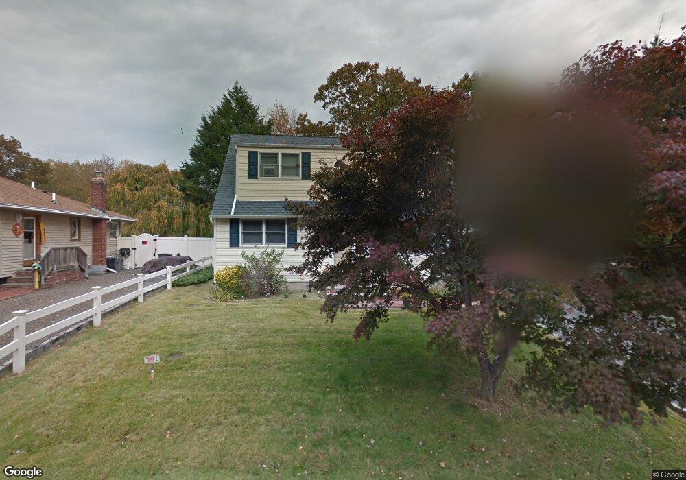
4 Stanley Ct Huntington, NY 11743
Estimated Value: $558,989 - $708,000
--
Bed
--
Bath
--
Sq Ft
5,663
Sq Ft Lot
About This Home
This home is located at 4 Stanley Ct, Huntington, NY 11743 and is currently estimated at $638,247. 4 Stanley Ct is a home located in Suffolk County with nearby schools including Silas Wood Sixth Grade Center, Henry L Stimson Middle School, and Walt Whitman High School.
Ownership History
Date
Name
Owned For
Owner Type
Purchase Details
Closed on
Jun 3, 2002
Sold by
Jean Roger and Jiha Jacques
Bought by
Jean Roger and Jean Colette G
Current Estimated Value
Home Financials for this Owner
Home Financials are based on the most recent Mortgage that was taken out on this home.
Original Mortgage
$198,400
Outstanding Balance
$81,392
Interest Rate
6.39%
Mortgage Type
FHA
Estimated Equity
$556,855
Purchase Details
Closed on
Nov 7, 1997
Sold by
Levitt Howard B and Levitt Terry D
Bought by
Jean Roger and Jiha Jacques
Create a Home Valuation Report for This Property
The Home Valuation Report is an in-depth analysis detailing your home's value as well as a comparison with similar homes in the area
Home Values in the Area
Average Home Value in this Area
Purchase History
| Date | Buyer | Sale Price | Title Company |
|---|---|---|---|
| Jean Roger | -- | First American Title Ins Co | |
| Jean Roger | $163,500 | Network Title Agency |
Source: Public Records
Mortgage History
| Date | Status | Borrower | Loan Amount |
|---|---|---|---|
| Open | Jean Roger | $198,400 |
Source: Public Records
Tax History Compared to Growth
Tax History
| Year | Tax Paid | Tax Assessment Tax Assessment Total Assessment is a certain percentage of the fair market value that is determined by local assessors to be the total taxable value of land and additions on the property. | Land | Improvement |
|---|---|---|---|---|
| 2024 | $8,958 | $2,350 | $150 | $2,200 |
| 2023 | $4,479 | $2,350 | $150 | $2,200 |
| 2022 | $8,778 | $2,350 | $150 | $2,200 |
| 2021 | $8,644 | $2,350 | $150 | $2,200 |
| 2020 | $8,442 | $2,350 | $150 | $2,200 |
| 2019 | $16,885 | $0 | $0 | $0 |
| 2018 | $7,877 | $2,350 | $150 | $2,200 |
| 2017 | $7,877 | $2,350 | $150 | $2,200 |
| 2016 | $7,737 | $2,350 | $150 | $2,200 |
| 2015 | -- | $2,350 | $150 | $2,200 |
| 2014 | -- | $2,350 | $150 | $2,200 |
Source: Public Records
Map
Nearby Homes
- 22 Robert Dr
- 61 Pleasant St
- 56 Dix Hills Rd
- 12 Glenwood Ln
- 57 Lafayette St
- 85 Dix Hills Rd
- 60 Lafayette St
- 5 Shadywood Ct
- 15 Hilton Ct
- 12 Andover Place
- 28 Sanford St
- 15 Lindsay St
- 7 Walwin Place
- 10 Printer Ct
- 5 Cooper Ave
- 230 Cook St
- 31A Nevinwood Place
- 37 Amsterdam St
- 30 Stuyvesant St
- 60 Delamere St