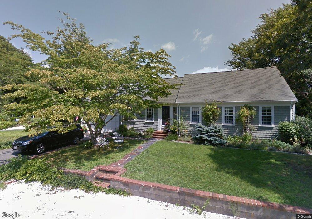
4 Stephen Ln West Dennis, MA 02670
West Dennis NeighborhoodEstimated Value: $744,000 - $827,000
3
Beds
3
Baths
2,701
Sq Ft
$289/Sq Ft
Est. Value
About This Home
This home is located at 4 Stephen Ln, West Dennis, MA 02670 and is currently estimated at $779,788, approximately $288 per square foot. 4 Stephen Ln is a home located in Barnstable County with nearby schools including Dennis-Yarmouth Regional High School.
Ownership History
Date
Name
Owned For
Owner Type
Purchase Details
Closed on
Nov 30, 2024
Sold by
Teleen Brenda T
Bought by
Brenda T Teleen T T and Brenda Teleen
Current Estimated Value
Purchase Details
Closed on
Feb 12, 1999
Sold by
Dow Mary B
Bought by
Teleen Brenda T
Home Financials for this Owner
Home Financials are based on the most recent Mortgage that was taken out on this home.
Original Mortgage
$75,000
Interest Rate
6.78%
Mortgage Type
Purchase Money Mortgage
Create a Home Valuation Report for This Property
The Home Valuation Report is an in-depth analysis detailing your home's value as well as a comparison with similar homes in the area
Home Values in the Area
Average Home Value in this Area
Purchase History
| Date | Buyer | Sale Price | Title Company |
|---|---|---|---|
| Brenda T Teleen T T | -- | None Available | |
| Brenda T Teleen T T | -- | None Available | |
| Teleen Brenda T | $165,000 | -- | |
| Teleen Brenda T | $165,000 | -- |
Source: Public Records
Mortgage History
| Date | Status | Borrower | Loan Amount |
|---|---|---|---|
| Previous Owner | Teleen Brenda T | $50,000 | |
| Previous Owner | Teleen Brenda T | $75,000 |
Source: Public Records
Tax History Compared to Growth
Tax History
| Year | Tax Paid | Tax Assessment Tax Assessment Total Assessment is a certain percentage of the fair market value that is determined by local assessors to be the total taxable value of land and additions on the property. | Land | Improvement |
|---|---|---|---|---|
| 2025 | $2,699 | $623,400 | $161,600 | $461,800 |
| 2024 | $2,649 | $603,400 | $155,400 | $448,000 |
| 2023 | $2,562 | $548,600 | $141,300 | $407,300 |
| 2022 | $2,402 | $428,900 | $127,300 | $301,600 |
| 2021 | $4,075 | $385,600 | $124,800 | $260,800 |
| 2020 | $2,261 | $370,600 | $124,800 | $245,800 |
| 2019 | $2,126 | $344,500 | $122,300 | $222,200 |
| 2018 | $3,662 | $307,800 | $95,300 | $212,500 |
| 2017 | $2,663 | $307,900 | $95,300 | $212,600 |
| 2016 | $1,919 | $293,800 | $116,500 | $177,300 |
| 2015 | $1,880 | $293,800 | $116,500 | $177,300 |
| 2014 | $1,830 | $288,200 | $116,500 | $171,700 |
Source: Public Records
Map
Nearby Homes
- 428 Main St Unit 1-11
- 467 Main St
- 401 Main St Unit 201
- 401 Main St Unit 101
- 23 Doric Ave
- 209 Main St Unit 3
- 209 Main St Unit 6
- 209 Main St Unit 1
- 209 Main St Unit 2
- 209 Main St Unit 4
- 209 Main St Unit 5
- 14 Schoolhouse Ln
- 29 Bass River Rd
- 45 Seth Ln
- 18 Turner Ln
- 178 School St
- 3 Pinefield Ln
- 40 Kelley Rd
- 61 Trotters Ln
- 15 Woodside Park Rd
- 3 Captain Donald Path
- 11 Captain Donald Path
- 11 Capt Donald Point
- 9 Captain Donald Path
- 8 Capt Donalds
- 15 Captain Donald Path
- 3 Stephen Ln
- 123 Cove Rd
- 117 Cove Rd
- 18 Captain Donald Path
- 12 Captain Donald Path
- 8 Captain Donald Path
- 114 Cove Rd
- 22 Captain Donald Path
- 112 Cove Rd
- 112 Cove Rd
- 114 Cove Rd
- 130 Cove Rd
- 30 Captain Donald Path
- 30 Capt Donalds Path