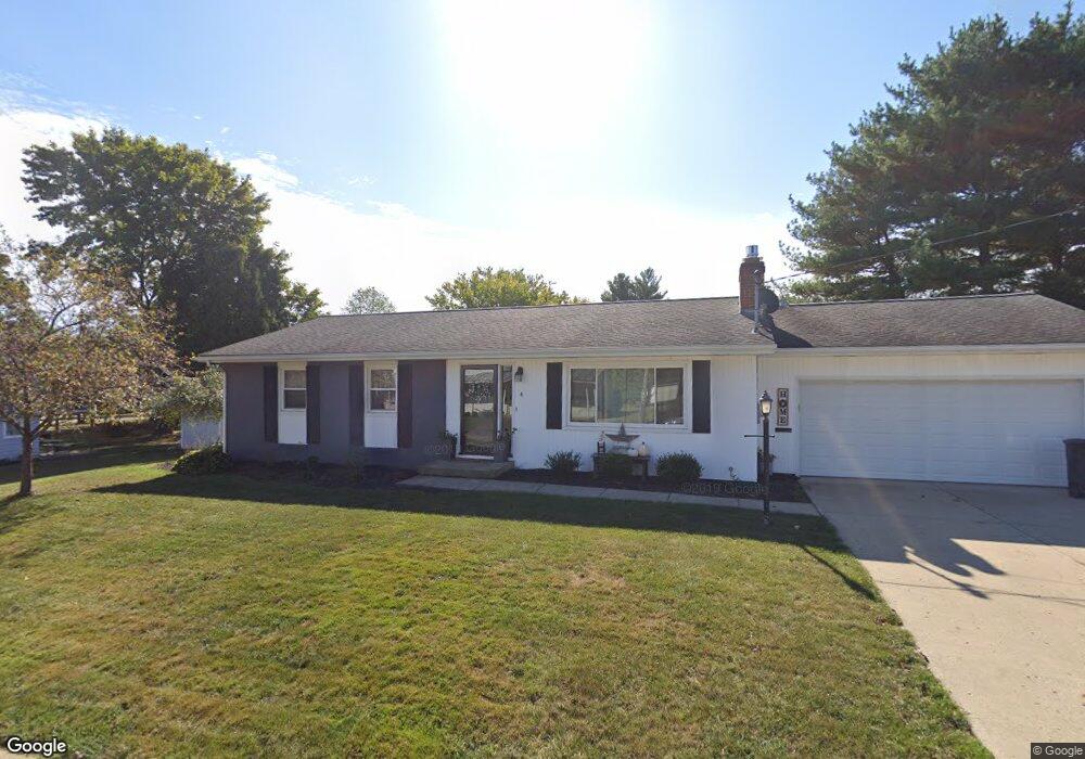
4 Swingle Ave Mount Vernon, OH 43050
Estimated Value: $227,000 - $245,762
4
Beds
3
Baths
1,260
Sq Ft
$190/Sq Ft
Est. Value
About This Home
This home is located at 4 Swingle Ave, Mount Vernon, OH 43050 and is currently estimated at $238,941, approximately $189 per square foot. 4 Swingle Ave is a home located in Knox County with nearby schools including Mount Vernon High School, St. Vincent de Paul School, and Christian Star Academy.
Ownership History
Date
Name
Owned For
Owner Type
Purchase Details
Closed on
Mar 19, 2007
Sold by
Kolsky Rebecca A
Bought by
Elder Laura Christine and Sanders Jamie S
Current Estimated Value
Home Financials for this Owner
Home Financials are based on the most recent Mortgage that was taken out on this home.
Original Mortgage
$60,000
Outstanding Balance
$7,598
Interest Rate
6.4%
Mortgage Type
New Conventional
Estimated Equity
$231,343
Purchase Details
Closed on
Nov 8, 1999
Sold by
Deminski Richard M and Deminski Mari
Bought by
Kolsky Rebecca A
Purchase Details
Closed on
Jul 25, 1995
Sold by
Deminski Richard M and Deminski Mari
Bought by
Deminski Richard M and Deminski Mari
Purchase Details
Closed on
Aug 16, 1989
Sold by
Hickman Lilliam E
Bought by
Deminski Richard M and Deminski Mari
Create a Home Valuation Report for This Property
The Home Valuation Report is an in-depth analysis detailing your home's value as well as a comparison with similar homes in the area
Home Values in the Area
Average Home Value in this Area
Purchase History
| Date | Buyer | Sale Price | Title Company |
|---|---|---|---|
| Elder Laura Christine | $95,625 | None Available | |
| Kolsky Rebecca A | $107,500 | -- | |
| Deminski Richard M | -- | -- | |
| Deminski Richard M | $58,100 | -- |
Source: Public Records
Mortgage History
| Date | Status | Borrower | Loan Amount |
|---|---|---|---|
| Open | Elder Laura Christine | $60,000 |
Source: Public Records
Tax History Compared to Growth
Tax History
| Year | Tax Paid | Tax Assessment Tax Assessment Total Assessment is a certain percentage of the fair market value that is determined by local assessors to be the total taxable value of land and additions on the property. | Land | Improvement |
|---|---|---|---|---|
| 2024 | $2,281 | $59,130 | $8,290 | $50,840 |
| 2023 | $2,281 | $59,130 | $8,290 | $50,840 |
| 2022 | $1,804 | $42,540 | $5,960 | $36,580 |
| 2021 | $1,804 | $42,540 | $5,960 | $36,580 |
| 2020 | $1,748 | $42,310 | $5,960 | $36,350 |
| 2019 | $1,650 | $37,220 | $6,440 | $30,780 |
| 2018 | $1,650 | $37,220 | $6,440 | $30,780 |
| 2017 | $1,620 | $37,220 | $6,440 | $30,780 |
| 2016 | $1,578 | $34,460 | $5,960 | $28,500 |
| 2015 | $1,509 | $34,460 | $5,960 | $28,500 |
| 2014 | $1,517 | $34,460 | $5,960 | $28,500 |
| 2013 | $1,582 | $34,210 | $5,610 | $28,600 |
Source: Public Records
Map
Nearby Homes
- 9 Rose Ave
- 6 Miller Ave
- 107 Northridge Dr
- 109 Northridge Dr
- 200 Mansfield Rd
- 12 Northview Dr
- 769 Upper Fredericktown Rd
- 800 N Sandusky St
- 10 Yoakam Dr
- 812 N Gay St
- 33 Longitude Dr
- 300 1/2 Calhoun St
- 13 Mansfield Ave
- 7 Elizabeth St
- 604 N Gay St
- 0 W Pleasant St
- 12567 Upper Fredericktown Rd
- 404 N Gay St
- 1400 N Mulberry St
- 3 Swingle Ave
- 149 Mansfield Ave
- 147 Mansfield Ave
- 1313 N Mulberry St
- 151 Mansfield Ave
- 1308 N Mulberry St
- 1402 N Mulberry St
- 1311 N Mulberry St
- 1317 N Mulberry St
- 155 Mansfield Ave
- 145 Mansfield Ave
- 1309 N Mulberry St
- 1319 N Mulberry St
- 1304 N Mulberry St
- 1404 N Mulberry St
- 1307 N Mulberry St
- 114 Rose Ave
- 110 Rose Ave