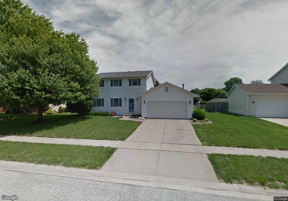
4 Taft Dr Unit 1 Rochester, IL 62563
Estimated Value: $271,194 - $370,000
--
Bed
--
Bath
--
Sq Ft
0.27
Acres
About This Home
This home is located at 4 Taft Dr Unit 1, Rochester, IL 62563 and is currently estimated at $323,299. 4 Taft Dr Unit 1 is a home located in Sangamon County with nearby schools including Rochester Elementary Ec-1 School, Rochester Elementary School, and Rochester Intermediate School.
Ownership History
Date
Name
Owned For
Owner Type
Purchase Details
Closed on
Oct 30, 2018
Sold by
Trello Tracy
Bought by
Trello Michael J
Current Estimated Value
Home Financials for this Owner
Home Financials are based on the most recent Mortgage that was taken out on this home.
Original Mortgage
$118,000
Outstanding Balance
$73,393
Interest Rate
4.25%
Mortgage Type
New Conventional
Estimated Equity
$249,906
Purchase Details
Closed on
Dec 1, 2000
Purchase Details
Closed on
Sep 20, 1999
Purchase Details
Closed on
Apr 26, 1996
Create a Home Valuation Report for This Property
The Home Valuation Report is an in-depth analysis detailing your home's value as well as a comparison with similar homes in the area
Home Values in the Area
Average Home Value in this Area
Purchase History
| Date | Buyer | Sale Price | Title Company |
|---|---|---|---|
| Trello Michael J | -- | -- | |
| -- | -- | -- | |
| -- | $142,000 | -- | |
| -- | $140,000 | -- |
Source: Public Records
Mortgage History
| Date | Status | Borrower | Loan Amount |
|---|---|---|---|
| Open | Trello Michael J | $118,000 |
Source: Public Records
Tax History Compared to Growth
Tax History
| Year | Tax Paid | Tax Assessment Tax Assessment Total Assessment is a certain percentage of the fair market value that is determined by local assessors to be the total taxable value of land and additions on the property. | Land | Improvement |
|---|---|---|---|---|
| 2024 | $5,468 | $83,182 | $14,571 | $68,611 |
| 2023 | $5,351 | $79,010 | $13,840 | $65,170 |
| 2022 | $5,138 | $74,813 | $13,105 | $61,708 |
| 2021 | $4,923 | $71,825 | $12,582 | $59,243 |
| 2020 | $4,829 | $70,904 | $12,421 | $58,483 |
| 2019 | $4,744 | $71,368 | $12,502 | $58,866 |
| 2018 | $4,699 | $70,223 | $12,301 | $57,922 |
| 2017 | $4,623 | $69,480 | $12,171 | $57,309 |
| 2016 | $4,471 | $67,208 | $11,773 | $55,435 |
| 2015 | $3,835 | $58,263 | $11,996 | $46,267 |
| 2014 | $3,806 | $57,835 | $11,908 | $45,927 |
| 2013 | $3,746 | $57,171 | $11,771 | $45,400 |
Source: Public Records
Map
Nearby Homes
- 112 Deer Creek Rd Unit 1
- 1204 W Main St
- 217 E Main St Unit 1
- 427 Spring Ridge
- 525 E Mill St Unit 1
- 3440 Woodhaven Dr Unit 1
- 5 Swannanoa Unit 1
- 27 Mishawaka Dr Unit 1
- 3149 Beaver Creek Ln
- 46 Woodland Trail
- 3810 Bristlecone Dr Unit 2
- 3491 Woodhaven Dr
- 3120 Red Bud Ln
- 66 White Birch Rd
- 3504 Hoylake Dr
- 2265 Jostes Rd
- 329-331 Harbor Point Place
- 312 Harbor Point Place
- 314 Harbor Point Place
- 9 Acadia Ct Unit 1
- 6 Taft Dr Unit 1
- 2 Taft Dr Unit 1
- 67 Taft Dr Unit 1
- 8 Taft Dr Unit 1
- 5 Taft Dr Unit 1
- 7 Taft Dr Unit 1
- 65 Taft Dr Unit 1
- 3 Taft Dr Unit 1
- 9 Taft Dr Unit 1
- 10 Taft Dr Unit 1
- 1 Taft Dr Unit 1
- 63 Taft Dr Unit 1
- 70 Taft Dr Unit 1
- 66 Taft Dr Unit 1
- 11 Taft Dr
- 68 Taft Dr Unit 1
- 14 Taft Dr Unit 1
- 72 Taft Dr Unit 1
- 13 Taft Dr Unit 1
- 64 Taft Dr Unit 1