Estimated Value: $1,859,000 - $2,124,466
4
Beds
4
Baths
3,898
Sq Ft
$503/Sq Ft
Est. Value
About This Home
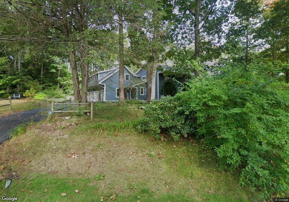
This home is located at 4 Teal Dr, Cumberland Foreside, ME 04110 and is currently estimated at $1,961,367, approximately $503 per square foot. 4 Teal Dr is a home located in Cumberland County with nearby schools including Mabel I. Wilson School, Greely Middle School 4-5, and Greely Middle School.
Ownership History
Date
Name
Owned For
Owner Type
Purchase Details
Closed on
Apr 28, 2014
Sold by
Gertrude E Kanter Lt and Kanter
Bought by
Gary L Kanter Lt and Kanter
Current Estimated Value
Purchase Details
Closed on
Mar 6, 2009
Sold by
Kanter Gary L and Kanter Trudy E
Bought by
Gertrude E Kanter Lt
Create a Home Valuation Report for This Property
The Home Valuation Report is an in-depth analysis detailing your home's value as well as a comparison with similar homes in the area
Home Values in the Area
Average Home Value in this Area
Purchase History
| Date | Buyer | Sale Price | Title Company |
|---|---|---|---|
| Gary L Kanter Lt | -- | -- | |
| Gary L Kanter Lt | -- | -- | |
| Gertrude E Kanter Lt | -- | -- | |
| Gertrude E Kanter Lt | -- | -- |
Source: Public Records
Mortgage History
| Date | Status | Borrower | Loan Amount |
|---|---|---|---|
| Open | Gertrude E Kanter Lt | $150,000 | |
| Previous Owner | Gertrude E Kanter Lt | $183,000 |
Source: Public Records
Tax History Compared to Growth
Tax History
| Year | Tax Paid | Tax Assessment Tax Assessment Total Assessment is a certain percentage of the fair market value that is determined by local assessors to be the total taxable value of land and additions on the property. | Land | Improvement |
|---|---|---|---|---|
| 2024 | $20,925 | $900,000 | $385,500 | $514,500 |
| 2023 | $19,935 | $900,000 | $385,500 | $514,500 |
| 2022 | $19,080 | $900,000 | $385,500 | $514,500 |
| 2021 | $18,495 | $900,000 | $385,500 | $514,500 |
| 2020 | $18,315 | $900,000 | $385,500 | $514,500 |
| 2019 | $17,865 | $900,000 | $385,500 | $514,500 |
| 2018 | $16,471 | $836,100 | $385,500 | $450,600 |
| 2017 | $12,502 | $665,000 | $385,500 | $279,500 |
| 2016 | $12,136 | $665,000 | $385,500 | $279,500 |
| 2015 | $12,037 | $665,000 | $385,500 | $279,500 |
| 2014 | $11,571 | $665,000 | $385,500 | $279,500 |
| 2013 | $11,305 | $665,000 | $385,500 | $279,500 |
Source: Public Records
Map
Nearby Homes
- 21 Ledge Rd
- 1 Ledge Rd
- 16 Town Landing Rd
- 6 Ebb Tide Dr
- 186 Foreside Rd
- 51 Meeting House Farms Rd
- 44 Essex Dr
- 69 Rand Rd
- 86 Pleasant St
- 51 Pleasant St
- 12 Sea Cove Rd
- 10 Casco Bay Dr
- 70 Main St
- 24 Daybreak Ln
- 99 Chets Way
- 52 Blueberry Cove Rd Unit 52
- 62 Blueberry Cove Rd Unit 62
- 48 Blueberry Cove
- 3 Cumberland St
- 30 Blueberry Cove