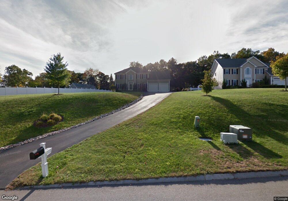
4 Thurston Ln Ashland, MA 01721
Estimated Value: $1,037,000 - $1,225,000
4
Beds
3
Baths
2,600
Sq Ft
$439/Sq Ft
Est. Value
About This Home
This home is located at 4 Thurston Ln, Ashland, MA 01721 and is currently estimated at $1,142,311, approximately $439 per square foot. 4 Thurston Ln is a home located in Middlesex County with nearby schools including William Pittaway Elementary School, David Mindess Elementary School, and Henry E. Warren Elementary School.
Create a Home Valuation Report for This Property
The Home Valuation Report is an in-depth analysis detailing your home's value as well as a comparison with similar homes in the area
Home Values in the Area
Average Home Value in this Area
Tax History
| Year | Tax Paid | Tax Assessment Tax Assessment Total Assessment is a certain percentage of the fair market value that is determined by local assessors to be the total taxable value of land and additions on the property. | Land | Improvement |
|---|---|---|---|---|
| 2025 | $13,205 | $1,034,100 | $314,300 | $719,800 |
| 2024 | $12,808 | $967,400 | $314,300 | $653,100 |
| 2023 | $11,773 | $855,000 | $299,300 | $555,700 |
| 2022 | $11,881 | $748,200 | $271,900 | $476,300 |
| 2021 | $11,540 | $713,200 | $271,900 | $441,300 |
| 2020 | $6,422 | $697,900 | $271,900 | $426,000 |
| 2019 | $11,093 | $681,400 | $271,900 | $409,500 |
| 2018 | $9,939 | $662,100 | $267,800 | $394,300 |
| 2017 | $10,880 | $651,500 | $266,600 | $384,900 |
| 2016 | $10,662 | $627,200 | $259,700 | $367,500 |
| 2015 | $10,470 | $605,200 | $246,800 | $358,400 |
| 2014 | $10,204 | $586,800 | $236,600 | $350,200 |
Source: Public Records
Map
Nearby Homes
- 9 Olive St
- 15 Haven Way
- 22 Wilbur Dr
- 20 Braeburn Ln
- 2 Braeburn Ln
- 0 Cross St
- 203 Pleasant St
- 0 Ballard Highland Marietta Unit 73391306
- 96 Pleasant St Unit 96
- 257-259 Main St
- 19 Crispwater Way Unit 178
- 66 Cedar Hill Rd
- 437 America Blvd Unit 437
- 6 Waterville Ln Unit 6
- 14 Waterville Ln Unit 14
- 30 Waterville Ln Unit 30
- 32 Waterville Ln Unit 32
- 34 Waterville Ln Unit 34
- 36 Waterville Ln Unit 36
- 38 Waterville Ln Unit 38
- 8 Thurston Ln
- 23 Frankland Rd
- 19 Frankland Rd
- 12 Thurston Ln
- 12 Thurston Ln Unit Lot 9
- 10 Thurston Ln
- 11 Thurston Ln
- 5 Thurston Ln
- 31 Frankland Rd
- 3 Thurston Ln
- 1 Thurston Ln
- 9 Thurston Ln
- 20 Frankland Rd
- 20 Frankland Rd
- 24 Frankland Rd
- 16 Thurston Ln
- 15 Thurston Ln
- 2 Thurston Ln
- 30 Frankland Rd
- 30 Frankland Rd
Your Personal Tour Guide
Ask me questions while you tour the home.