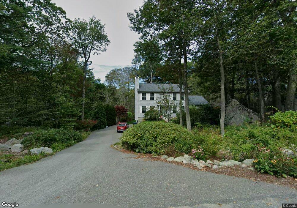
4 Tufts Ln Gloucester, MA 01930
Estimated Value: $983,067 - $1,262,000
3
Beds
3
Baths
2,376
Sq Ft
$490/Sq Ft
Est. Value
About This Home
This home is located at 4 Tufts Ln, Gloucester, MA 01930 and is currently estimated at $1,165,017, approximately $490 per square foot. 4 Tufts Ln is a home located in Essex County with nearby schools including Plum Cove School, Ralph B O'maley Middle School, and Gloucester High School.
Ownership History
Date
Name
Owned For
Owner Type
Purchase Details
Closed on
Oct 16, 1998
Sold by
Ryan Sandra M
Bought by
Curcuru Stephen
Current Estimated Value
Home Financials for this Owner
Home Financials are based on the most recent Mortgage that was taken out on this home.
Original Mortgage
$63,750
Outstanding Balance
$13,837
Interest Rate
6.8%
Mortgage Type
Purchase Money Mortgage
Estimated Equity
$1,151,180
Create a Home Valuation Report for This Property
The Home Valuation Report is an in-depth analysis detailing your home's value as well as a comparison with similar homes in the area
Purchase History
| Date | Buyer | Sale Price | Title Company |
|---|---|---|---|
| Curcuru Stephen | $85,000 | -- |
Source: Public Records
Mortgage History
| Date | Status | Borrower | Loan Amount |
|---|---|---|---|
| Open | Curcuru Stephen | $63,750 |
Source: Public Records
Tax History
| Year | Tax Paid | Tax Assessment Tax Assessment Total Assessment is a certain percentage of the fair market value that is determined by local assessors to be the total taxable value of land and additions on the property. | Land | Improvement |
|---|---|---|---|---|
| 2025 | $7,804 | $802,900 | $218,500 | $584,400 |
| 2024 | $7,711 | $792,500 | $208,100 | $584,400 |
| 2023 | $7,504 | $708,600 | $185,800 | $522,800 |
| 2022 | $7,271 | $619,900 | $161,500 | $458,400 |
| 2021 | $7,021 | $564,400 | $146,800 | $417,600 |
| 2020 | $7,007 | $568,300 | $146,800 | $421,500 |
| 2019 | $6,741 | $531,200 | $146,800 | $384,400 |
| 2018 | $6,632 | $512,900 | $146,800 | $366,100 |
| 2017 | $6,425 | $487,100 | $139,800 | $347,300 |
| 2016 | $6,286 | $461,900 | $145,800 | $316,100 |
| 2015 | $5,977 | $437,900 | $145,800 | $292,100 |
Source: Public Records
Map
Nearby Homes
- 672 Washington St
- 7 Colburn St
- 226 Atlantic St
- 2 Finch Ln
- 43 High St Unit B
- 10 Emerald St
- 167 Atlantic St
- 13 Honeysuckle Rd
- 16 Hodgkins Rd Unit 2
- 27 Hodgkins Rd
- 177 Main St
- 5 Smith St Unit R
- 1 Charte Ct
- 98 Maplewood Ave
- 1 Main St Unit R
- 1 Main St Unit C
- 1 Main St Unit D
- 16 Cleveland Place Unit 11
- 6 Monroe Ct
- 40 Sargent St