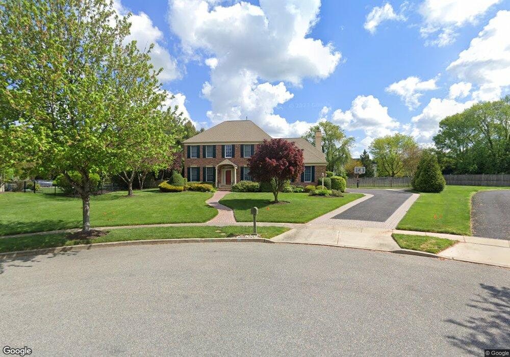
4 Tyndale Ct Moorestown, NJ 08057
Estimated Value: $1,069,320 - $1,209,000
--
Bed
--
Bath
2,976
Sq Ft
$377/Sq Ft
Est. Value
About This Home
This home is located at 4 Tyndale Ct, Moorestown, NJ 08057 and is currently estimated at $1,120,773, approximately $376 per square foot. 4 Tyndale Ct is a home located in Burlington County with nearby schools including George C. Baker Elementary School, Moorestown Upper Elementary School, and William Allen Middle School.
Ownership History
Date
Name
Owned For
Owner Type
Purchase Details
Closed on
Jun 28, 1996
Sold by
Bob Meyer Communities Inc
Bought by
Saldutti William F and Saldutti Susan A
Current Estimated Value
Purchase Details
Closed on
Jun 25, 1996
Sold by
First Union National Bank and Ravikio Edna M
Bought by
Bob Meyer Communities Inc
Create a Home Valuation Report for This Property
The Home Valuation Report is an in-depth analysis detailing your home's value as well as a comparison with similar homes in the area
Home Values in the Area
Average Home Value in this Area
Purchase History
| Date | Buyer | Sale Price | Title Company |
|---|---|---|---|
| Saldutti William F | $330,000 | Congress Title Corp | |
| Bob Meyer Communities Inc | $155,000 | Congress Title Corp | |
| Bob Meyer Communities Inc | -- | -- |
Source: Public Records
Tax History Compared to Growth
Tax History
| Year | Tax Paid | Tax Assessment Tax Assessment Total Assessment is a certain percentage of the fair market value that is determined by local assessors to be the total taxable value of land and additions on the property. | Land | Improvement |
|---|---|---|---|---|
| 2025 | $17,584 | $619,800 | $259,600 | $360,200 |
| 2024 | $17,051 | $619,800 | $259,600 | $360,200 |
| 2023 | $17,051 | $619,800 | $259,600 | $360,200 |
| 2022 | $16,877 | $619,800 | $259,600 | $360,200 |
| 2021 | $16,654 | $619,800 | $259,600 | $360,200 |
| 2020 | $16,549 | $619,800 | $259,600 | $360,200 |
| 2019 | $16,257 | $619,800 | $259,600 | $360,200 |
| 2018 | $15,817 | $619,800 | $259,600 | $360,200 |
| 2017 | $15,954 | $619,800 | $259,600 | $360,200 |
| 2016 | $15,898 | $619,800 | $259,600 | $360,200 |
| 2015 | $15,706 | $619,800 | $259,600 | $360,200 |
| 2014 | $14,912 | $619,800 | $259,600 | $360,200 |
Source: Public Records
Map
Nearby Homes
- 7 Whitetail Ct
- 628 Windsock Way
- 744 Signal Light Rd
- 693 Garwood Rd
- 415 Bridgeboro Rd
- 863 Golf View Rd
- 57 Brooks Rd
- 4327 Bridgeboro Rd
- 347 Tom Brown Rd
- 740 Garwood Rd
- 343 Tom Brown Rd
- 103 Congressional Ct
- 5 Murray Rd
- 110 Kathleen Ave
- 700 Bentley Ct
- 97 Brooks Rd
- 142 Fox Chase Dr
- 39 Bramley Rd
- 139 Patricia Ave
- 751 Garwood Rd