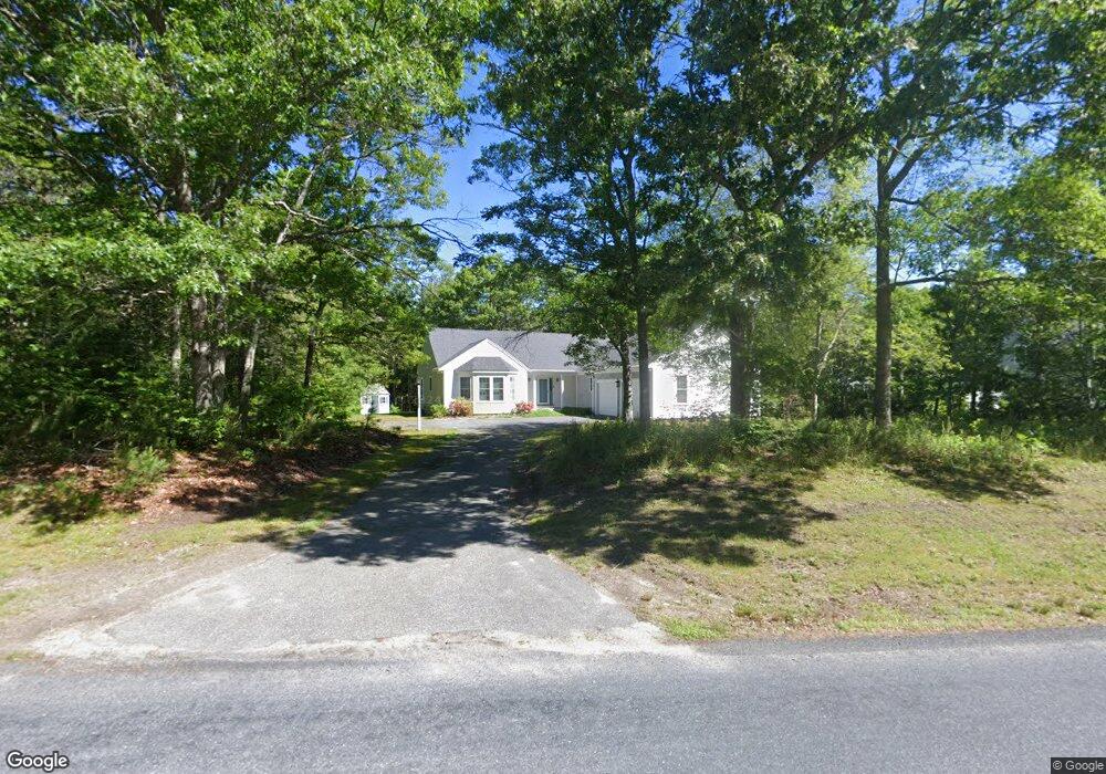
4 Vanbuskirk Way Sandwich, MA 02563
Estimated Value: $626,000 - $877,000
3
Beds
3
Baths
1,789
Sq Ft
$414/Sq Ft
Est. Value
About This Home
This home is located at 4 Vanbuskirk Way, Sandwich, MA 02563 and is currently estimated at $740,229, approximately $413 per square foot. 4 Vanbuskirk Way is a home located in Barnstable County with nearby schools including Sandwich Middle High School and Sandwich Montessori School.
Ownership History
Date
Name
Owned For
Owner Type
Purchase Details
Closed on
Feb 2, 2011
Sold by
Macmillan Joseph P and Macmillan Mary V
Bought by
Macmillan Mary
Current Estimated Value
Purchase Details
Closed on
May 28, 1992
Sold by
Vanbuskirk James E and Vanbuskirk Clarence
Bought by
Macmillan Joseph P and Macmillan Mary
Create a Home Valuation Report for This Property
The Home Valuation Report is an in-depth analysis detailing your home's value as well as a comparison with similar homes in the area
Purchase History
| Date | Buyer | Sale Price | Title Company |
|---|---|---|---|
| Macmillan Mary | -- | -- | |
| Macmillan Joseph P | $35,000 | -- |
Source: Public Records
Mortgage History
| Date | Status | Borrower | Loan Amount |
|---|---|---|---|
| Open | Macmillan Joseph P | $93,000 | |
| Previous Owner | Macmillan Joseph P | $7,000 | |
| Previous Owner | Macmillan Joseph P | $82,000 | |
| Previous Owner | Macmillan Joseph P | $84,500 |
Source: Public Records
Tax History
| Year | Tax Paid | Tax Assessment Tax Assessment Total Assessment is a certain percentage of the fair market value that is determined by local assessors to be the total taxable value of land and additions on the property. | Land | Improvement |
|---|---|---|---|---|
| 2025 | $7,331 | $693,600 | $188,200 | $505,400 |
| 2024 | $6,965 | $644,900 | $168,000 | $476,900 |
| 2023 | $6,638 | $577,200 | $152,800 | $424,400 |
| 2022 | $6,302 | $478,900 | $136,400 | $342,500 |
| 2021 | $6,066 | $440,500 | $135,800 | $304,700 |
| 2020 | $6,076 | $424,600 | $135,600 | $289,000 |
| 2019 | $5,768 | $402,800 | $133,100 | $269,700 |
| 2018 | $5,324 | $372,600 | $121,400 | $251,200 |
| 2017 | $5,255 | $352,000 | $117,500 | $234,500 |
| 2016 | $4,992 | $345,000 | $113,600 | $231,400 |
| 2015 | $4,731 | $319,200 | $92,500 | $226,700 |
Source: Public Records
Map
Nearby Homes
- 28 Spinnaker St
- 58 Southpoint Dr Unit J
- 113 Farmersville Rd
- 33 Easterly Dr
- 185 Cotuit Rd Unit JP1
- 185 Cotuit Rd Unit C5 Aspen
- 9 Viking Ln
- 93 Deerfield Rd
- 46 Kensington Dr
- 36 Moon Compass Ln
- 86 Greenville Dr
- 2 Open Space Dr
- 10 Wintergreen Ln
- 24 East Rd
- 7 Hunter's Trail
- 17 Kensington Dr
- 48 Holly Ridge Dr
- 24 Widow Coombs Walk
- 82 Old Fields Rd
- 5 Bluestone Terrace
- 6 Vanbuskirk Way
- 34 Spinnaker St
- 1 Fox Bottom Cir
- 32 Spinnaker St
- 30 Spinnaker St
- 34-R Spinnaker St
- 5 Vanbuskirk Way
- 2 Vanbuskirk Way
- 163 Farmersville Rd
- 3 Vanbuskirk Way
- 8 Vanbuskirk Way
- 36 Spinnaker St
- 3 Fox Bottom Cir
- 165 Farmersville Rd
- 26 Spinnaker St
- 2A Vanbuskirk Way
- 4 Fox Bottom Cir
- 31 Nantucket Trail
- 167 Farmersville Rd
- 42 Nauset St
Your Personal Tour Guide
Ask me questions while you tour the home.