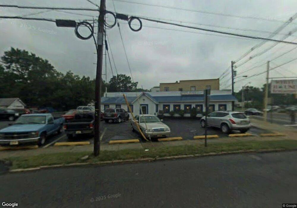
4 W Camden Ave Moorestown, NJ 08057
--
Bed
--
Bath
6,000
Sq Ft
0.76
Acres
About This Home
This home is located at 4 W Camden Ave, Moorestown, NJ 08057. 4 W Camden Ave is a home located in Burlington County with nearby schools including Mary E. Roberts Elementary School, Moorestown Upper Elementary School, and William Allen Middle School.
Ownership History
Date
Name
Owned For
Owner Type
Purchase Details
Closed on
Apr 12, 2004
Sold by
Pasamihalis Stavros and Pasamihalis Theodore
Bought by
4 West Camden Avenue Llc
Purchase Details
Closed on
Apr 14, 1994
Sold by
Filmary Co Inc
Bought by
Pasamihalis Stavoros and Pasamihalis Theodore Pasamihalis
Home Financials for this Owner
Home Financials are based on the most recent Mortgage that was taken out on this home.
Original Mortgage
$225,000
Interest Rate
7.93%
Mortgage Type
Commercial
Create a Home Valuation Report for This Property
The Home Valuation Report is an in-depth analysis detailing your home's value as well as a comparison with similar homes in the area
Home Values in the Area
Average Home Value in this Area
Purchase History
| Date | Buyer | Sale Price | Title Company |
|---|---|---|---|
| 4 West Camden Avenue Llc | $900,000 | National Title Agency | |
| Pasamihalis Stavoros | $85,000 | -- |
Source: Public Records
Mortgage History
| Date | Status | Borrower | Loan Amount |
|---|---|---|---|
| Previous Owner | Pasamihalis Stavoros | $225,000 |
Source: Public Records
Tax History Compared to Growth
Tax History
| Year | Tax Paid | Tax Assessment Tax Assessment Total Assessment is a certain percentage of the fair market value that is determined by local assessors to be the total taxable value of land and additions on the property. | Land | Improvement |
|---|---|---|---|---|
| 2025 | $10,230 | $357,800 | $111,600 | $246,200 |
| 2024 | $9,922 | $357,800 | $111,600 | $246,200 |
| 2023 | $9,922 | $357,800 | $111,600 | $246,200 |
| 2022 | $9,872 | $357,800 | $111,600 | $246,200 |
| 2021 | $9,746 | $357,800 | $111,600 | $246,200 |
| 2020 | $9,682 | $357,800 | $111,600 | $246,200 |
| 2019 | $9,507 | $357,800 | $111,600 | $246,200 |
| 2018 | $9,228 | $357,800 | $111,600 | $246,200 |
| 2017 | $9,288 | $357,800 | $111,600 | $246,200 |
| 2016 | $9,246 | $357,800 | $111,600 | $246,200 |
| 2015 | $9,124 | $357,800 | $111,600 | $246,200 |
| 2014 | $8,677 | $357,800 | $111,600 | $246,200 |
Source: Public Records
Map
Nearby Homes
- 14 Vincent Way
- 21 N Lenola Rd
- 99 Grant Ave
- 206 E Camden Ave
- 149 Chalkboard Ct
- 114 Grant Ave
- 801 E Camden Ave
- 709 Manor Terrace
- 519 N Lincoln Ave
- 124 E Wilson Ave
- 403 S Lenola Rd
- 31 S Boulevard Ave
- 106 Pine St
- 115 E Kings Hwy Unit 386
- 115 E Kings Hwy Unit 410
- 115 E Kings Hwy Unit 444
- 115 E Kings Hwy Unit 443
- 202 S Cedar Ave
- 21 Foxwood Dr Unit 21
- 15 S Pine Ave
- 8 W Camden Ave
- 10 S Lenola Rd
- 12 S Lenola Rd
- 13 S Garfield Ave
- 101 S Garfield Ave
- 14 S Lenola Rd
- 103 S Garfield Ave
- 115 S Garfield Ave
- 16 S Lenola Rd
- 11 S Lenola Rd
- 20 E Camden Ave
- 18 E Camden Ave
- 121 S Garfield Ave
- 106 W Camden Ave Unit 3
- 106 W Camden Ave
- 18 S Lenola Rd
- 22 E Camden Ave
- 14 S Garfield Ave
- 7 N Lenola Rd
- 9 N Lenola Rd