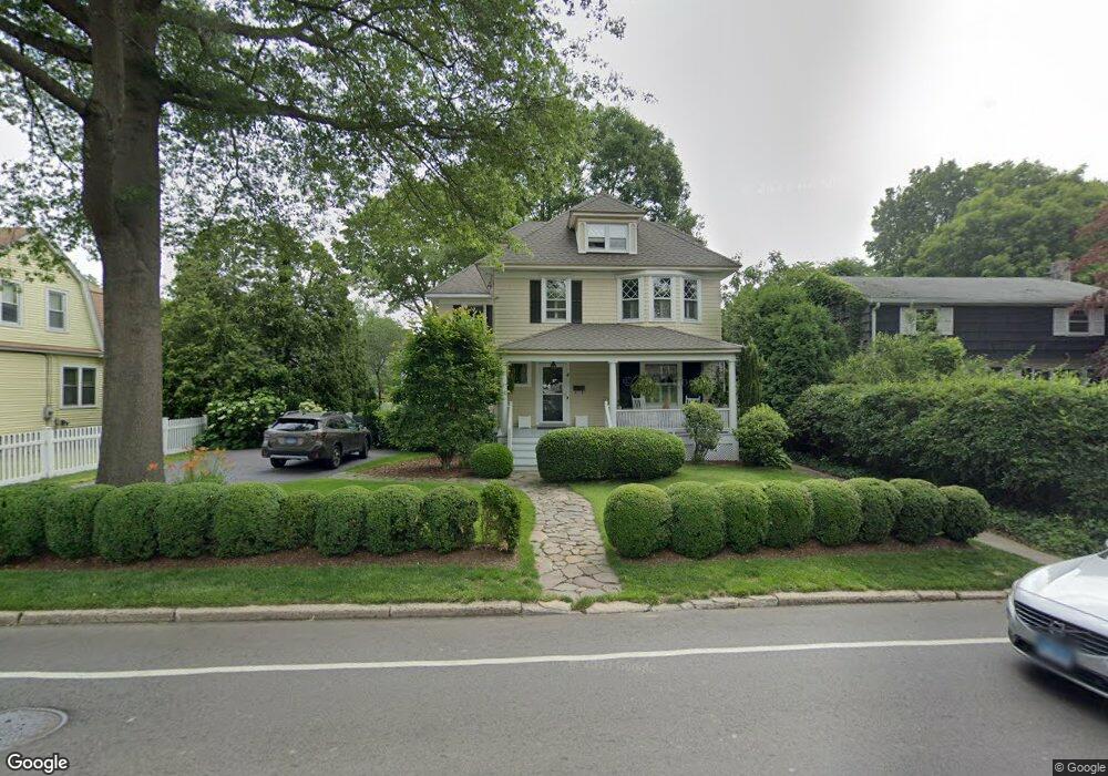
4 W Rocks Rd Norwalk, CT 06851
Woods Pond NeighborhoodEstimated Value: $853,243 - $916,000
4
Beds
3
Baths
2,347
Sq Ft
$378/Sq Ft
Est. Value
About This Home
This home is located at 4 W Rocks Rd, Norwalk, CT 06851 and is currently estimated at $887,561, approximately $378 per square foot. 4 W Rocks Rd is a home located in Fairfield County with nearby schools including Tracey School, West Rocks Middle School, and Norwalk High School.
Ownership History
Date
Name
Owned For
Owner Type
Purchase Details
Closed on
Nov 9, 2007
Sold by
Gmac Global Relocati S
Bought by
Blank William A and Blank Susan M
Current Estimated Value
Purchase Details
Closed on
Feb 8, 2006
Sold by
Valiante Chester and Valiante Linda K
Bought by
Oringer Mitchell J and Oringer Susan R
Purchase Details
Closed on
Mar 5, 1996
Sold by
Donofree Eleanor
Bought by
Donofree Dennis and Donofree Richard
Create a Home Valuation Report for This Property
The Home Valuation Report is an in-depth analysis detailing your home's value as well as a comparison with similar homes in the area
Home Values in the Area
Average Home Value in this Area
Purchase History
| Date | Buyer | Sale Price | Title Company |
|---|---|---|---|
| Blank William A | $655,000 | -- | |
| Blank William A | $655,000 | -- | |
| Oringer Mitchell J | $499,000 | -- | |
| Oringer Mitchell J | $499,000 | -- | |
| Donofree Dennis | $157,600 | -- | |
| Donofree Dennis | $157,600 | -- |
Source: Public Records
Mortgage History
| Date | Status | Borrower | Loan Amount |
|---|---|---|---|
| Open | Donofree Dennis | $295,000 | |
| Closed | Donofree Dennis | $300,000 |
Source: Public Records
Tax History Compared to Growth
Tax History
| Year | Tax Paid | Tax Assessment Tax Assessment Total Assessment is a certain percentage of the fair market value that is determined by local assessors to be the total taxable value of land and additions on the property. | Land | Improvement |
|---|---|---|---|---|
| 2025 | $11,688 | $489,020 | $153,150 | $335,870 |
| 2024 | $11,514 | $489,020 | $153,150 | $335,870 |
| 2023 | $10,296 | $410,420 | $122,840 | $287,580 |
| 2022 | $10,074 | $410,420 | $122,840 | $287,580 |
| 2021 | $9,838 | $410,420 | $122,840 | $287,580 |
| 2020 | $9,832 | $410,420 | $122,840 | $287,580 |
| 2019 | $9,569 | $410,420 | $122,840 | $287,580 |
| 2018 | $9,867 | $370,881 | $122,436 | $248,445 |
| 2017 | $9,525 | $370,880 | $122,430 | $248,450 |
| 2016 | $9,435 | $370,881 | $122,436 | $248,445 |
| 2015 | $10,455 | $412,090 | $136,040 | $276,050 |
| 2014 | $10,319 | $412,090 | $136,040 | $276,050 |
Source: Public Records
Map
Nearby Homes
- 14 E Rocks Rd
- 24 Sawmill Rd
- 4 Union Ave Unit 26
- 133 Main St Unit 5
- 12 Merrill Rd
- 1 Blue Mountain Ridge
- 31 High St Unit 4-2B
- 15 Dry Hill Rd
- 33 Center Ave
- 9 Park St Unit 217
- 46 Sunrise Hill Rd
- 34 Sunrise Hill Rd
- 15 Delaware Ave
- 44 Ambler Dr
- 22 Fair St
- 71 Saddle Rd
- 28 Aiken St
- 48 Fair St
- 25 Grand St Unit 204
- 49 Barbara Dr
- 2 W Rocks Rd
- 2 W Rocks Rd
- 6 W Rocks Rd
- 4 Glendenning St
- 1 Cannon St
- 3 Cannon St
- 6 Glendenning St
- 5 Cannon St
- 1 W Rocks Rd
- 3 W Rocks Rd
- 3 W Rocks Rd Unit 6851
- 10 Glendenning St
- 10 Glendenning St Unit LEFT
- 10 Glendenning St Unit Right
- 7 Cannon St
- 5 W Rocks Rd
- 8 W Rocks Rd
- 12 Glendenning St
- 1 Glendenning St
- 9 Cannon St